
This one has a plethora of satellite communications for "intelligence work".
RAF Menwith Hill.
Geodesic domes, like huge bubbles waiting to float away.

The Dalesborough Outdoor Center used to be an infectious diseases hospital.
We got off to a good start by mixing up left and right to end up in the wrong field.
Not to worry. It was the overflow area and was not so close to the road.


The initial plan was to walk to Gaping Gill then return.


No clues before we got there. The sign said the office was unoccupied as the guide was in the cave and the next trip was at 12.
No prices etc. So we carried on.


The river falls into the hole in the ground.
Underground is a cavern that's big enough to hold York Minster.
There's two ways in. One is to be winched down this hole. The other is a long crawl along a narrow passage.
We'll stay above ground.

Just as well winching is only available when one of the caving clubs provides it at Easter and other holidays.

This is the view of Pen-y-Ghent on the other side of Ribblesdale.

Just like China!
What are mountains coming to?

Easy if we say it quickly.
Thanks to Tim and Angela for lending us the map.

These days the theory is its an earlier burial and ceremonial site.
Either way, the remnants of walls along the edges aren't natural.

Total distance about 26 miles. It can be run in just over 2 hours.
But not by us!


Even more recent is me.
Yes, it was cold despite the sun and the snow melting.
We kept moving and had lunch further down.

Well known in railway circles. The line was due for closure a few years ago but has been restored and now carries hordes of tourists.
The line was one of the more difficult to build in England's railway era. The last navvy built rail line in the country.

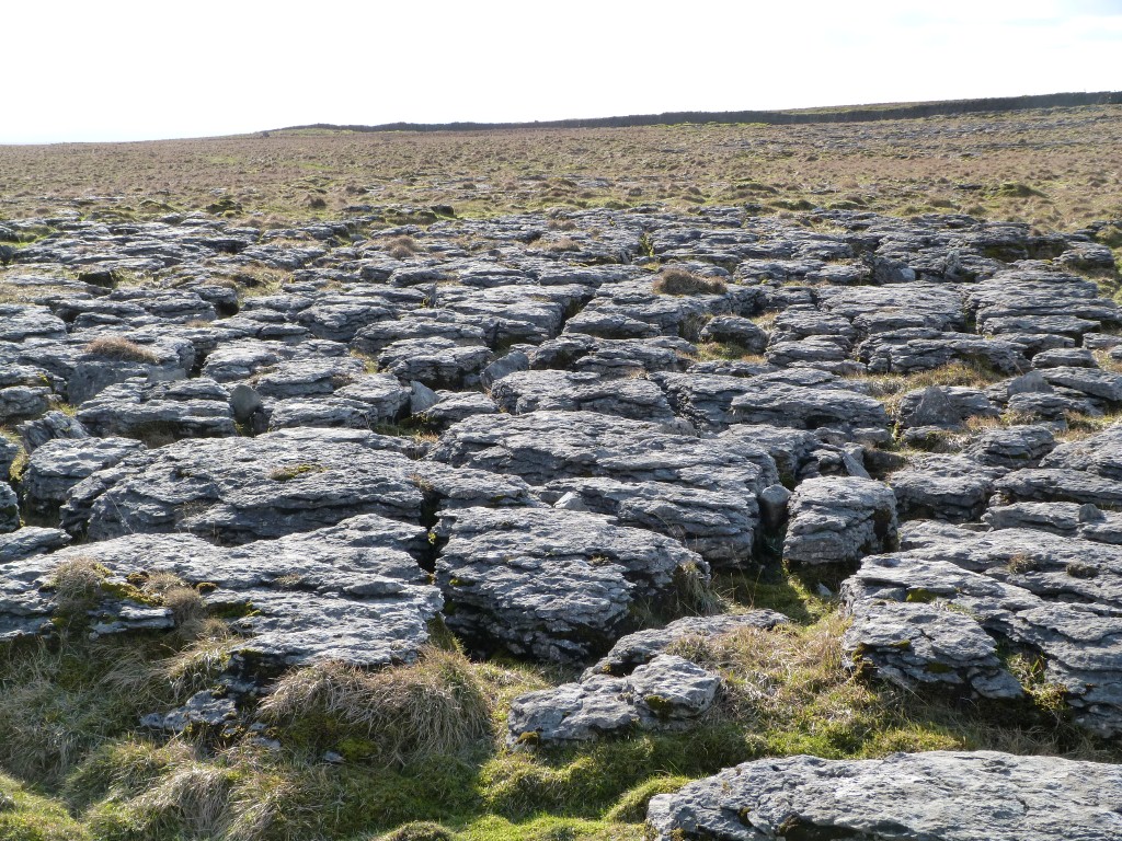
Pavement areas everywhere.
There are clynts (the cracks) and grykes (the sticky up bits).

Ribblesdale is between us and the mountain.
About 25 years since I was last on top of it.

The landscape was formed by glacial action followed by water erosion. This rock was carried by glacier and left when the glacier melted.
Its reputedly (silurian) sandstone in the middle of the limestone.

A bit too far for us to walk today we'll have to do with the few we can see.

Ribblesdale is the next valley away.
Another hour and we'll be home for a cup of tea.