| |
|
|
| Kimberley - Purnululu (Bungles) - Helicopter Fun |
 |
August 16 - 17 2018 |
| |
|
|
 |
|
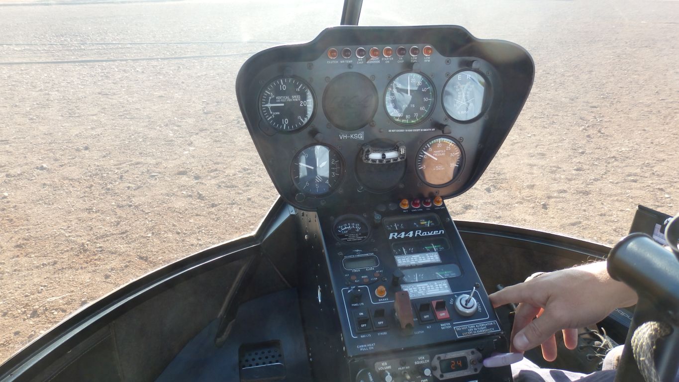
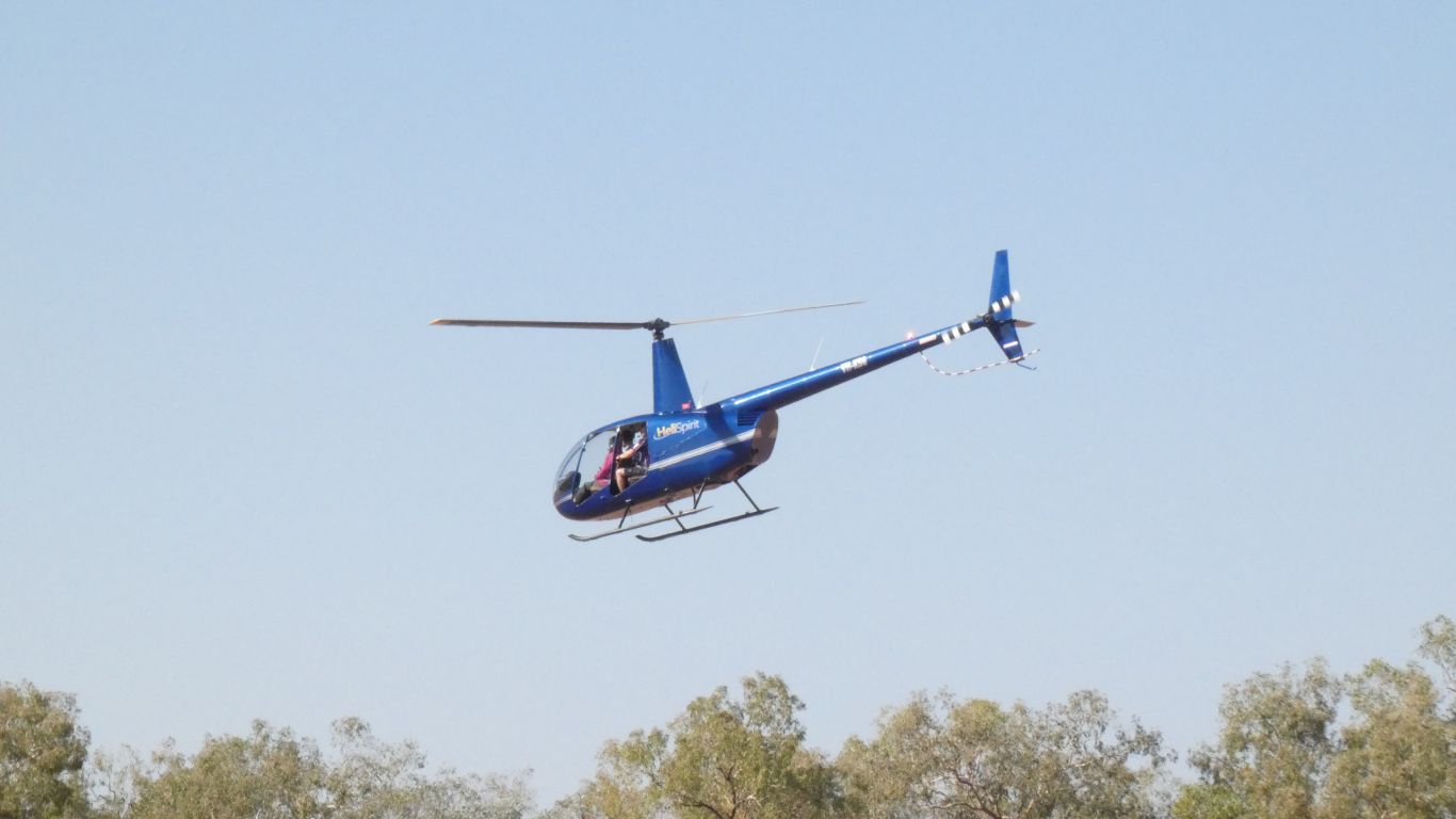
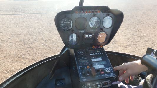
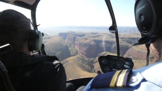
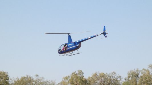
The inside of a Robinson R44 Raven 4 seat helicopter. It
can cruise at 200 km/hr. We will have a look at the Bungles from the air at
a leisurely 150 km/hr.
We've arrived early with down jackets and jeans to combat a potentially
cold trip. The doors have been removed for better sight seeing. |
| | | |
 |
|
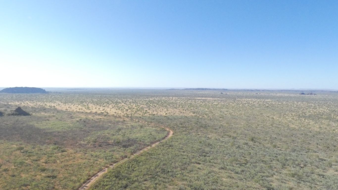
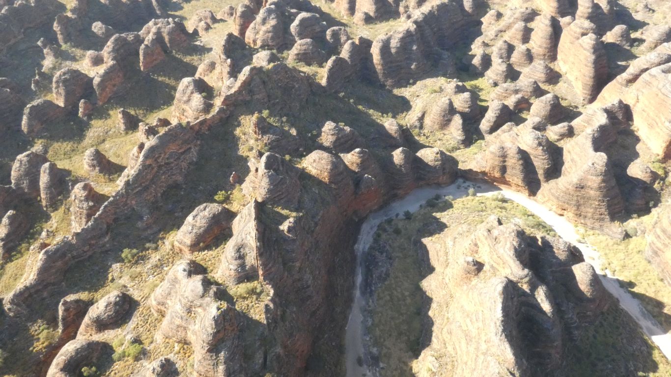
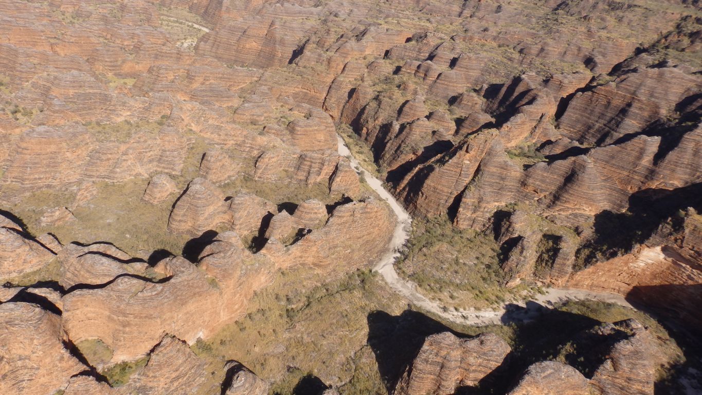
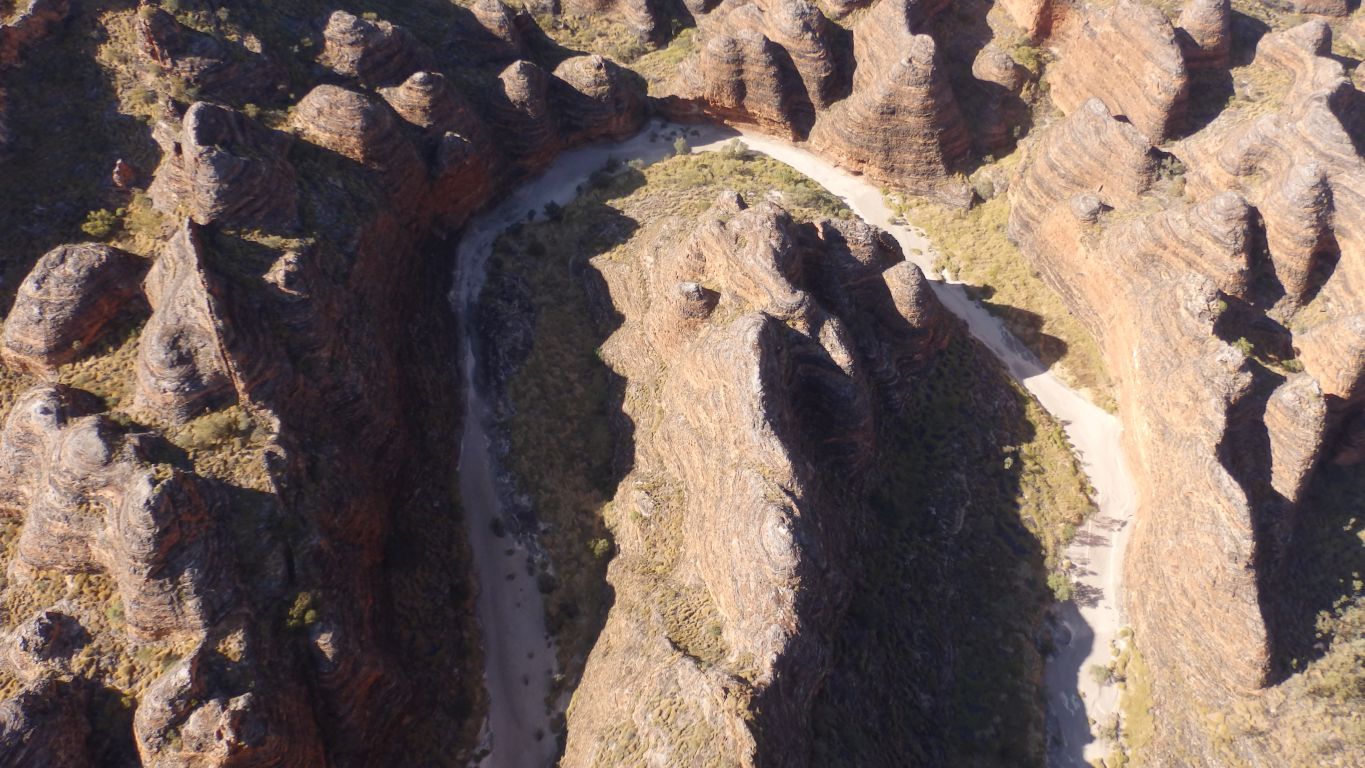
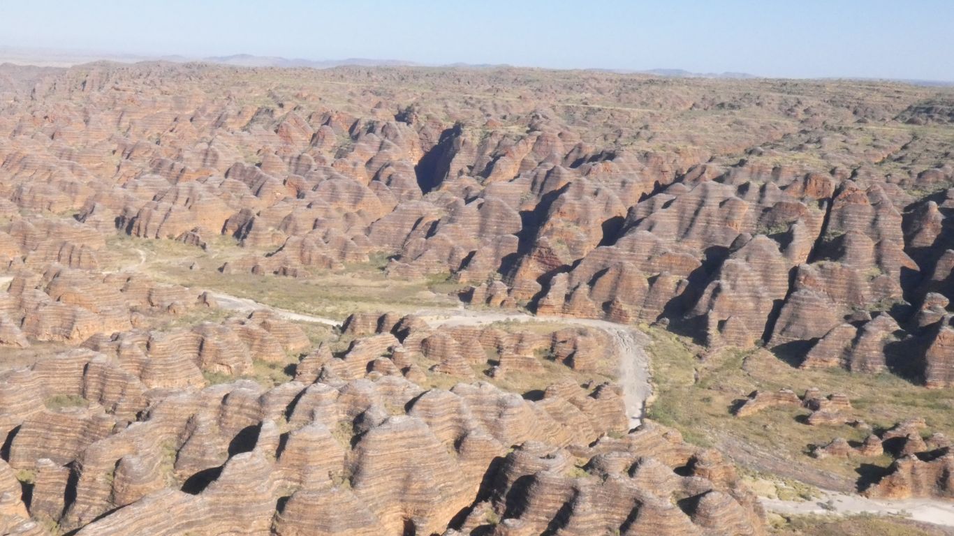
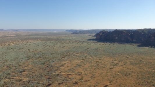
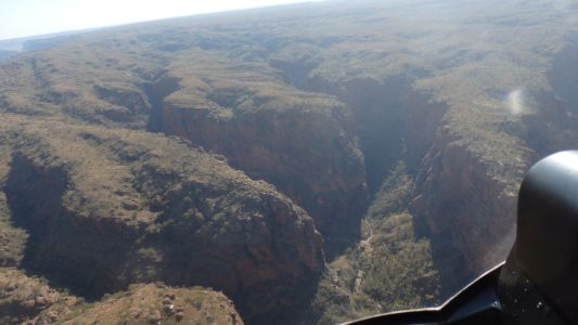
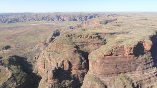
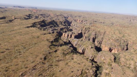
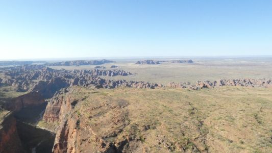
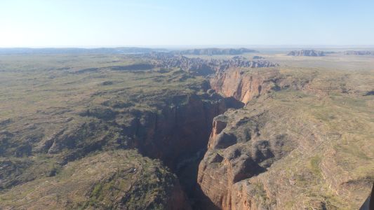
07:45 am. The sun has risen in the east. We are flying
roughly north east. Looking east, this is the road to the car park for the
beginning of Piccaninny Gorge (and Cathedral Gorge) track as it winds around
the south west tip of the Bungles. |
| | | |
 |
|
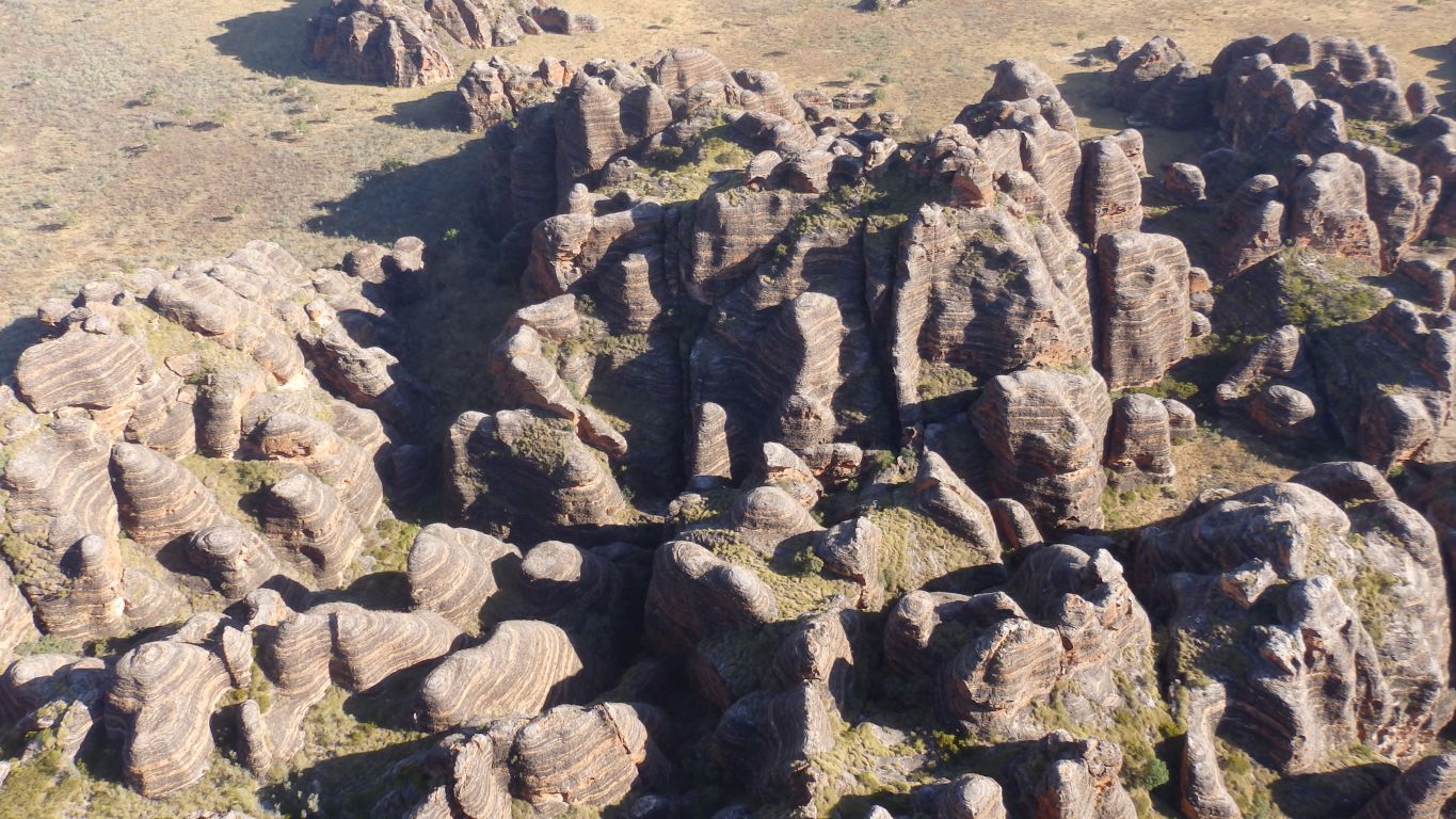
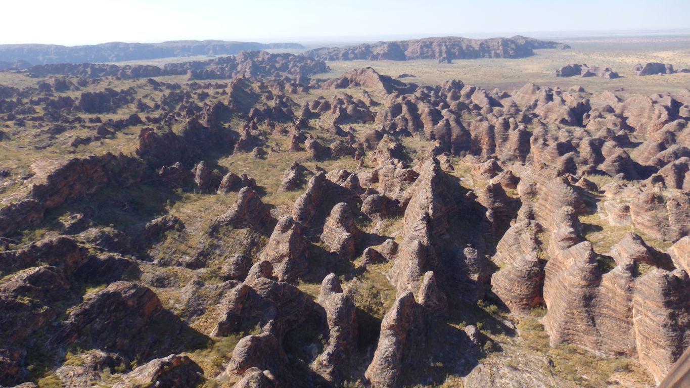
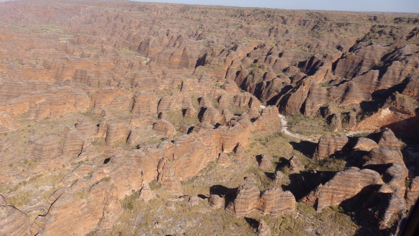
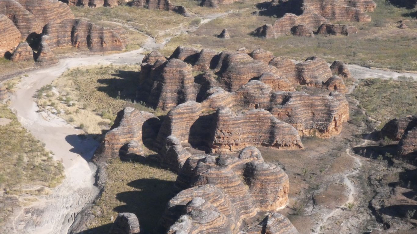
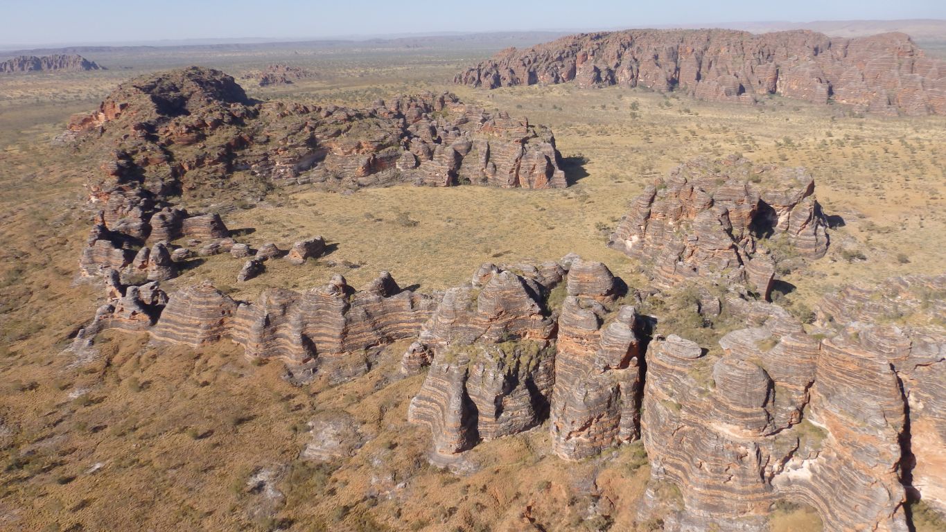
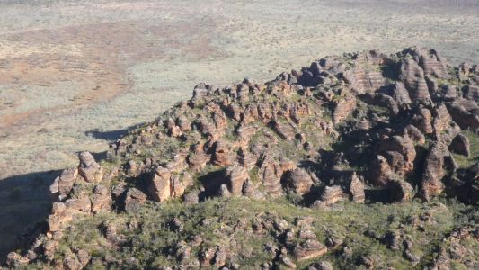
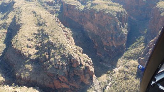
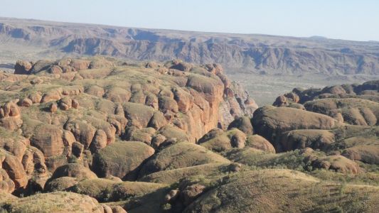
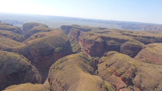
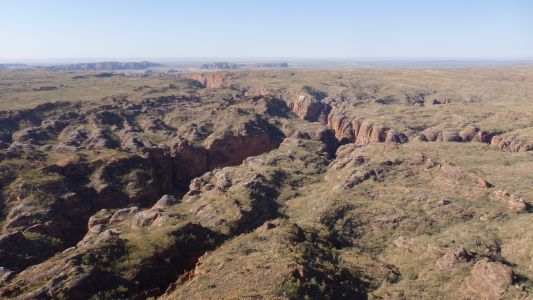
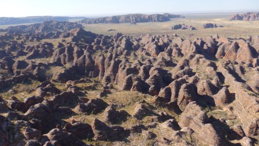
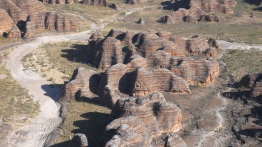
As we cross the south west corner a bit to the east we
encounter domes. The shadows from the early morning sun are just as we
wished. |
| | | |
 |
|
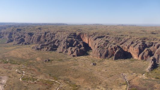
We can also look northwards along the western edge. The
northern campsite is somewhere around the far corner. |
| | | |
 |
|
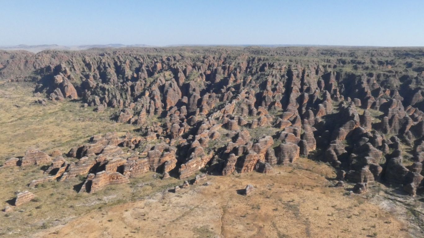
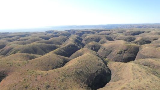
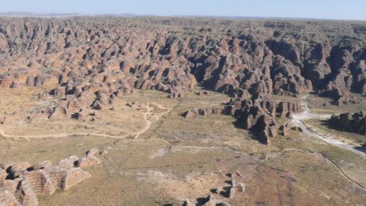
We are moving fast, there's a commentary from our pilot, we
are trying to avoid being disorientated by the helicopter, taking pics, and
registering where we are. We have 30 minutes.
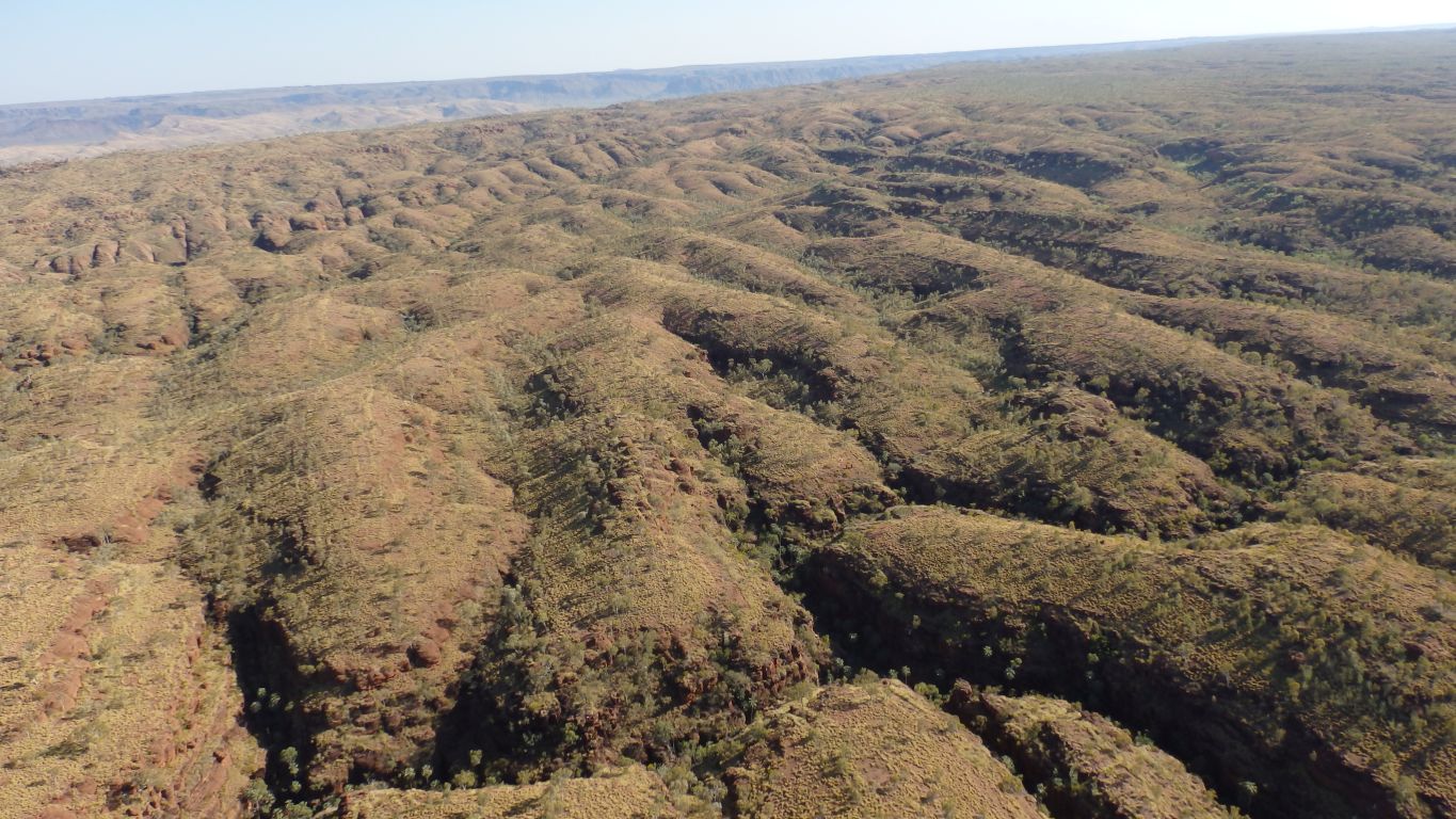
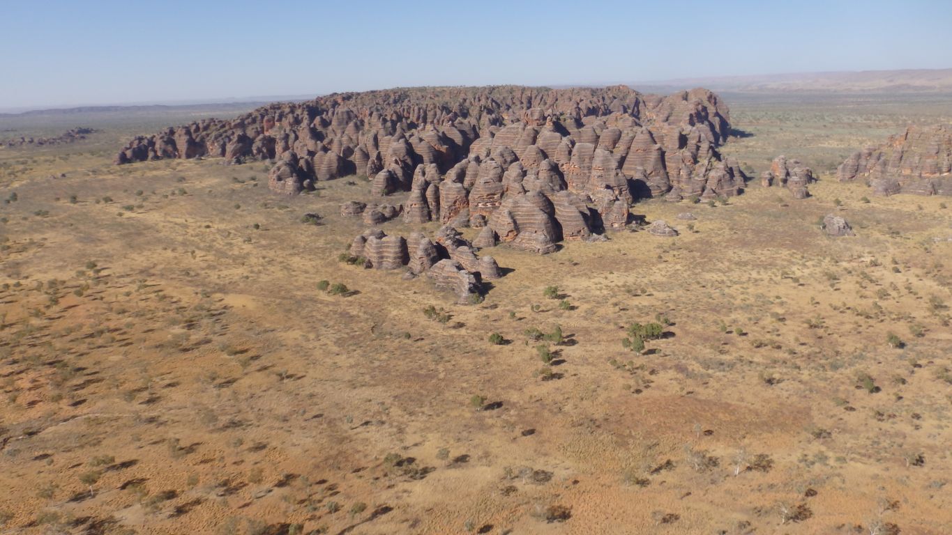
While we are thinking about all of that we pass over more domes than we
could possibly ever count. |
| | | |
 |
|
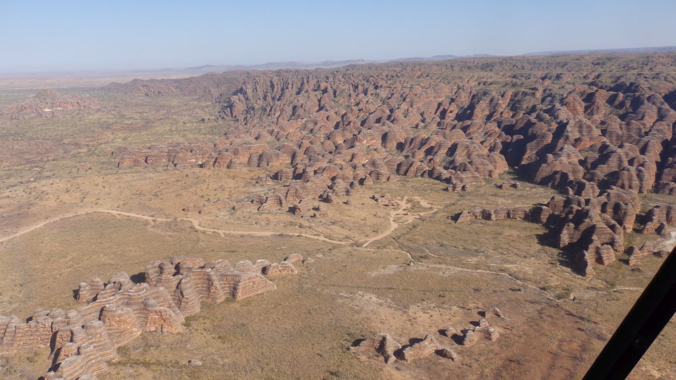
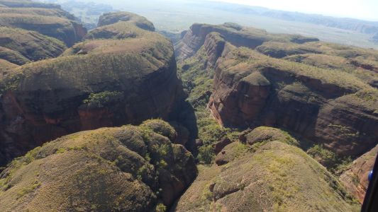
A bit hazy to begin with. We cut across the south west
corner to the western edge then turn right to follow "Y Gorge". It runs
roughly west to east. This is looking north across the entrance to the
gorge, before the turn. |
| | | |
 |
|
We both have cameras. And of course I forgot to synchronise
the times. This is looking north across the entrance to Y Gorge.
We realise that the helicopter tour has names for more gorges than are
named on maps or by the parks pamphlets. |
| | | |
 |
|
A hazy look into the gorge. |
| | | |
 |
|
And 6 seconds later we have moved around 200m. But still
looking into the gorge. |
| | | |
 |
|
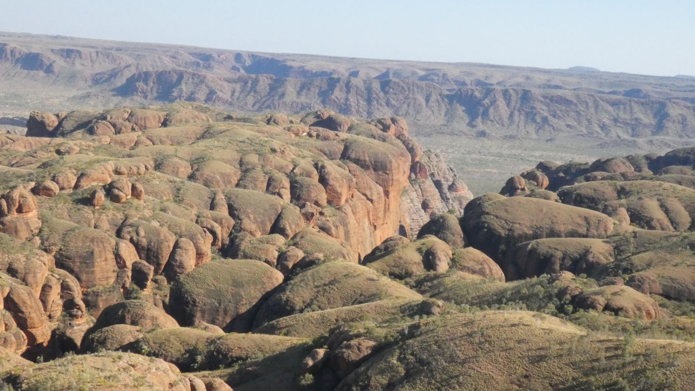
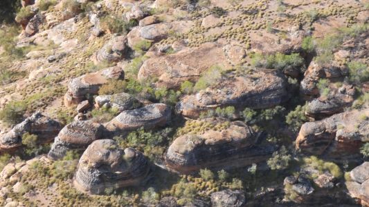
Meanwhile. The other camera is admiring the rock
formations to our east.
The bedding planes are horizontal. When the rock that covered the
sandstone eroded the reduction in pressure caused faults within the
sandstone. Containing roughly square blocks.
I know the fissures as grykes. Water slowly erodes the faults.
Which leaves clints. The domes. |
| | | |
 |
|
Deeper formations to the north. |
| | | |
 |
|
We zig-zag along Y Gorge. |
| | | |
 |
|
While seeing creek beds in the grykes. |
| | | |
 |
|
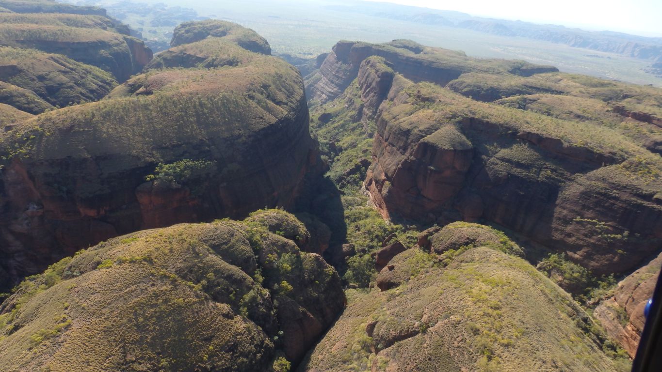
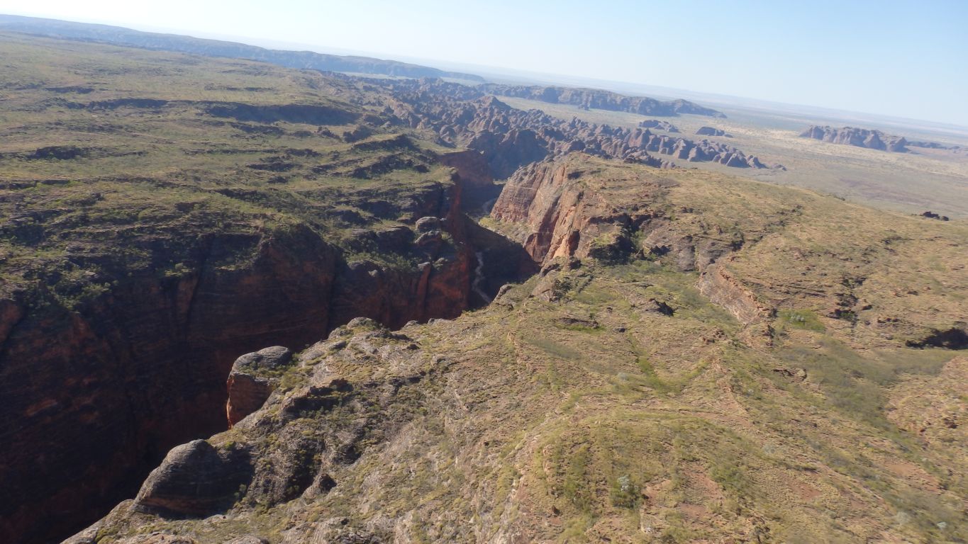
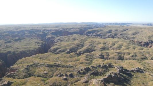
We crossed the end of Piccaninni Gorge approximately above
where we stopped. But its hard to take a pic through the floor of the
helicopter.
This is looking north north east to a gorge along the north east edge of
the masif.
One of the inaccessible gorges. |
| | | |
 |
|
And looking south east from the northern edge. |
| | | |
 |
|
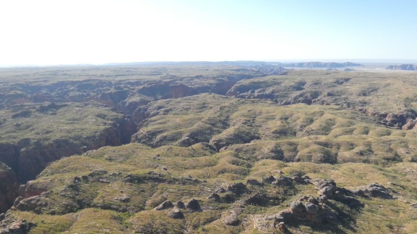
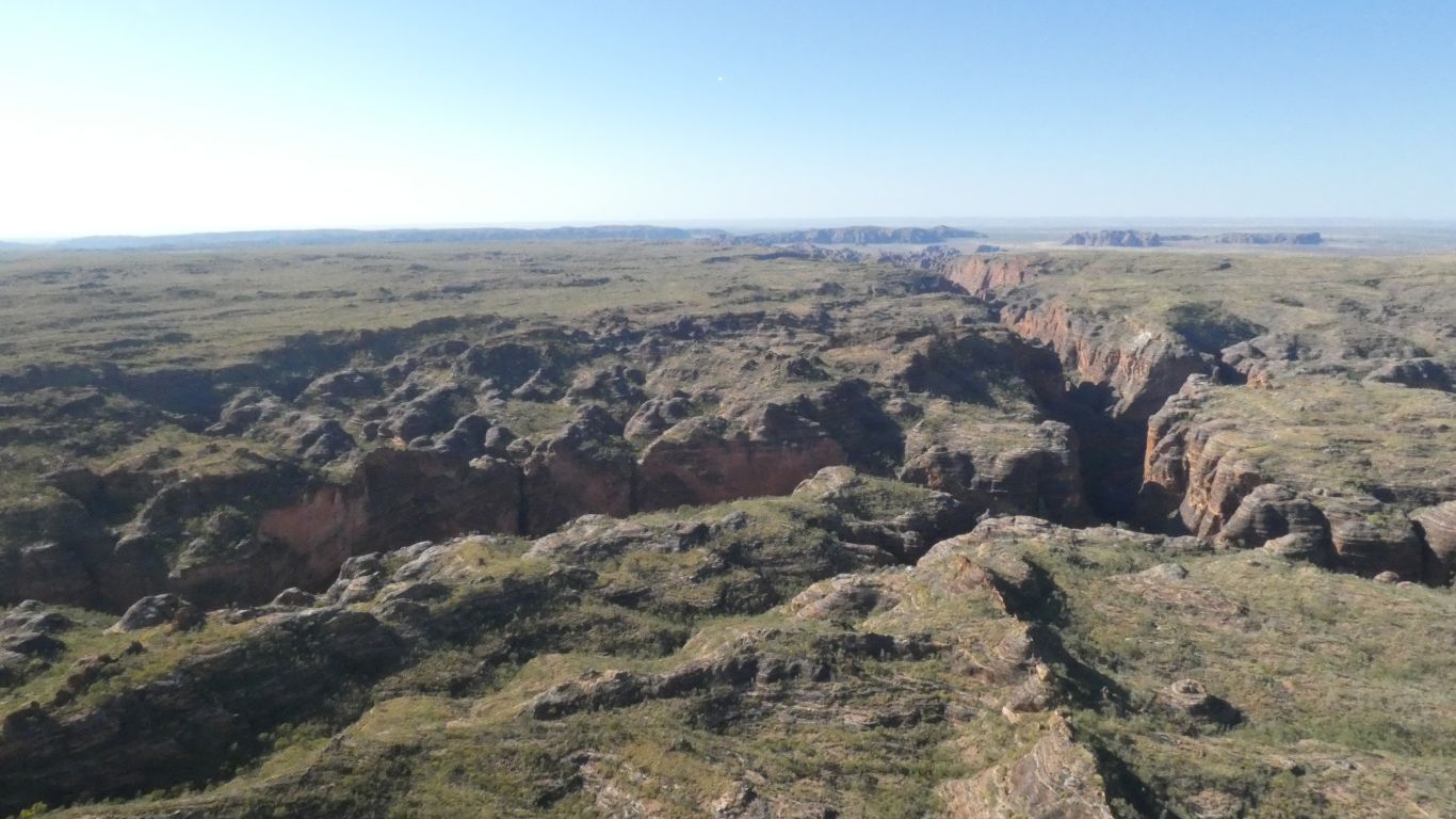
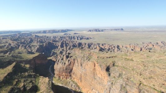
The two cameras produce very different results. There's a
large bite out of the north east part of the masif.
Several gorges leading off that bite are sacred burial sites. |
| | | |
 |
|
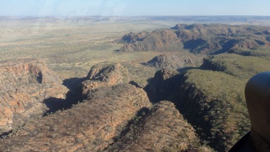
We are in safe hands. No aerobatics. Just a steady plod at
about 150 km/hr at an altitude of about 700 m. |
| | | |
 |
|
The bite becomes more obvious. |
| | | |
 |
|
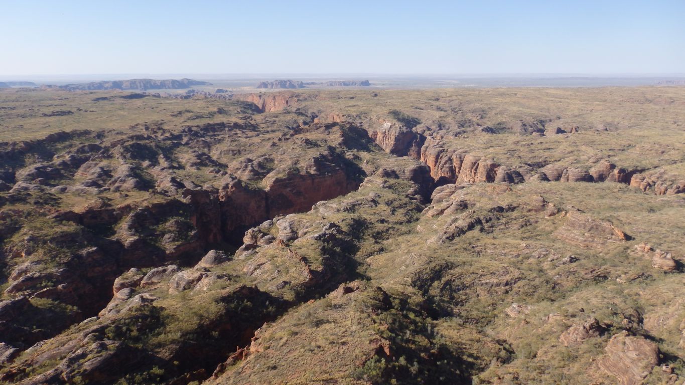
We approach it gently zig-zagging along one of the gorges. |
| | | |
 |
|
A little further along. |
| | | |
 |
|
Then we are over the bite. Looking west.
The sun is now to our left as we are turn south east. |
| | | |
 |
|
Somewhere out there is the Piccaninny Formation. The
remnants of a meteorite impact.
The impact probably occurred before the covering rock was eroded. A bit
like the dinosaurs at James Price Point leaving their trace in underlying
rock.
So we see more of a dome than a crater. And more of a plateau with the
absence of the karst domes. |
| | | |
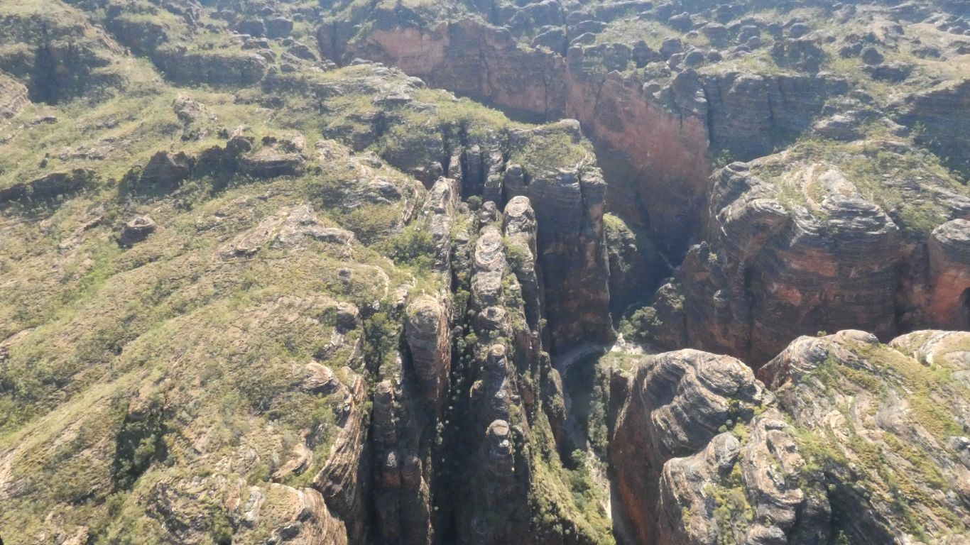
 |
|
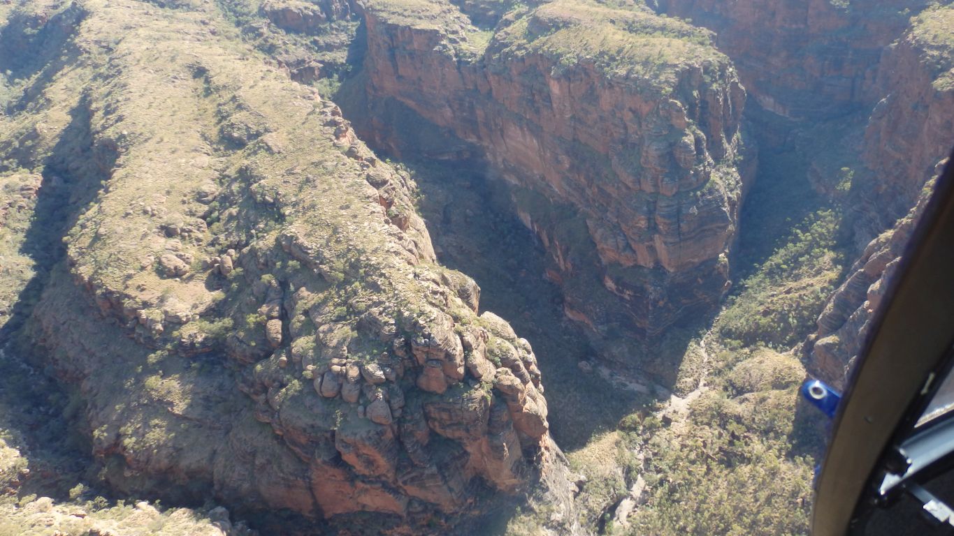
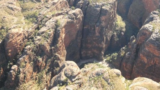
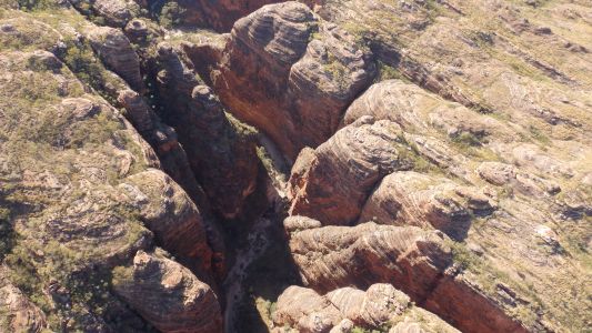
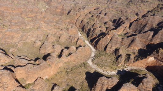
At last. Piccaninni Gorge, looking downstream (south
east).
|
| | | |
 |
|
Side Gorge 5 is to our left. |
| | | |
 |
|
We walked up the gorge to our right. |
| | | |
 |
|
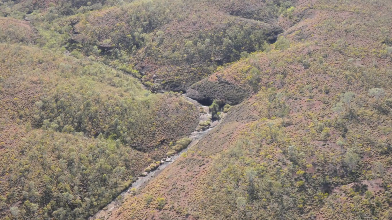
As we zig zag along the gorge we can see the creek bed
where we walked. |
| | | |
 |
|
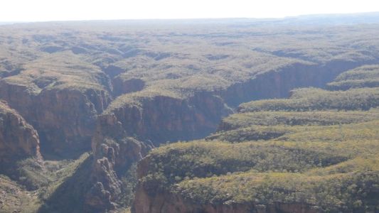
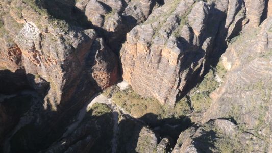
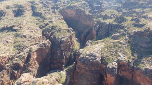
The cliffs are 200 m high. |
| | | |
 |
|
Its difficult to imagine the forces that worked to create
this landscape. |
| | | |
 |
|
No wonder we had trouble knowing where we were when
walking! |
| | | |
 |
|
Still following the gorge south east we think we've reached
the elbow as the creek exits the gorge and takes a sharp right turn to flow
along the southern edge of the range. |
| | | |
 |
|
A few seconds later, although we are generally headed south
east we zig and zag across the gorge. |
| | | |
 |
|
Still searching for the creek bed. The pamphlet for the
walk warned us not to wave to passing helicopters lest our wave is mistaken
for a request for help.
We suspect the chances of being seen are fairly remote. |
| | | |
 |
|
Not yet at the elbow. Our flight path is out to the left
of the gorge and a long loop with the elbow on our right.
Not there yet. |
| | | |
 |
|
But getting closer. |
| | | |
 |
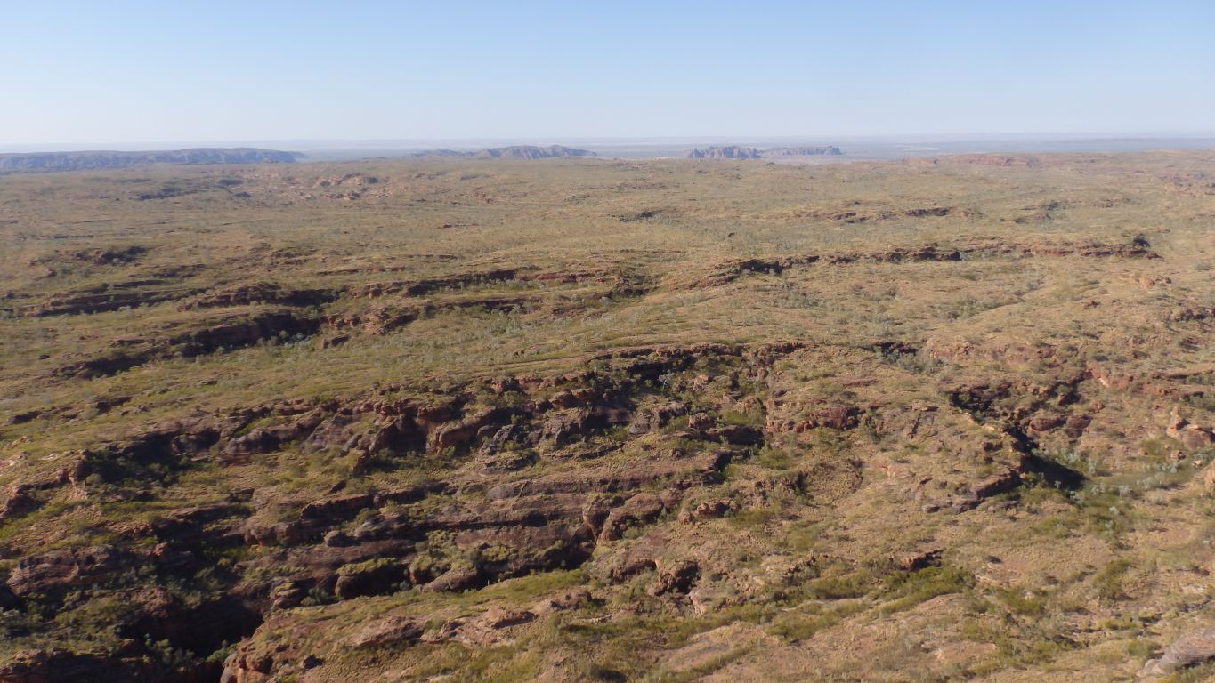
|
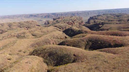
We were a bit disoriented. Along the southern edge of the
range there is more erosion. More domes than further north. |
| | | |
 |
|
A loop in the creek (after the elbow). |
| | | |
 |
|
We think the sun is just right as we head south west, to
home. |
| | | |
 |
|
More or less following Piccaninny Creek with more zigs and
zags. |
| | | |
 |
|
The white of the sand (the colour of the rock under its
veneer) is very clear. |
| | | |
 |
|
The creek is slower so carries fewer rocks and more sand.
The meanderings slow it further. |
| | | |
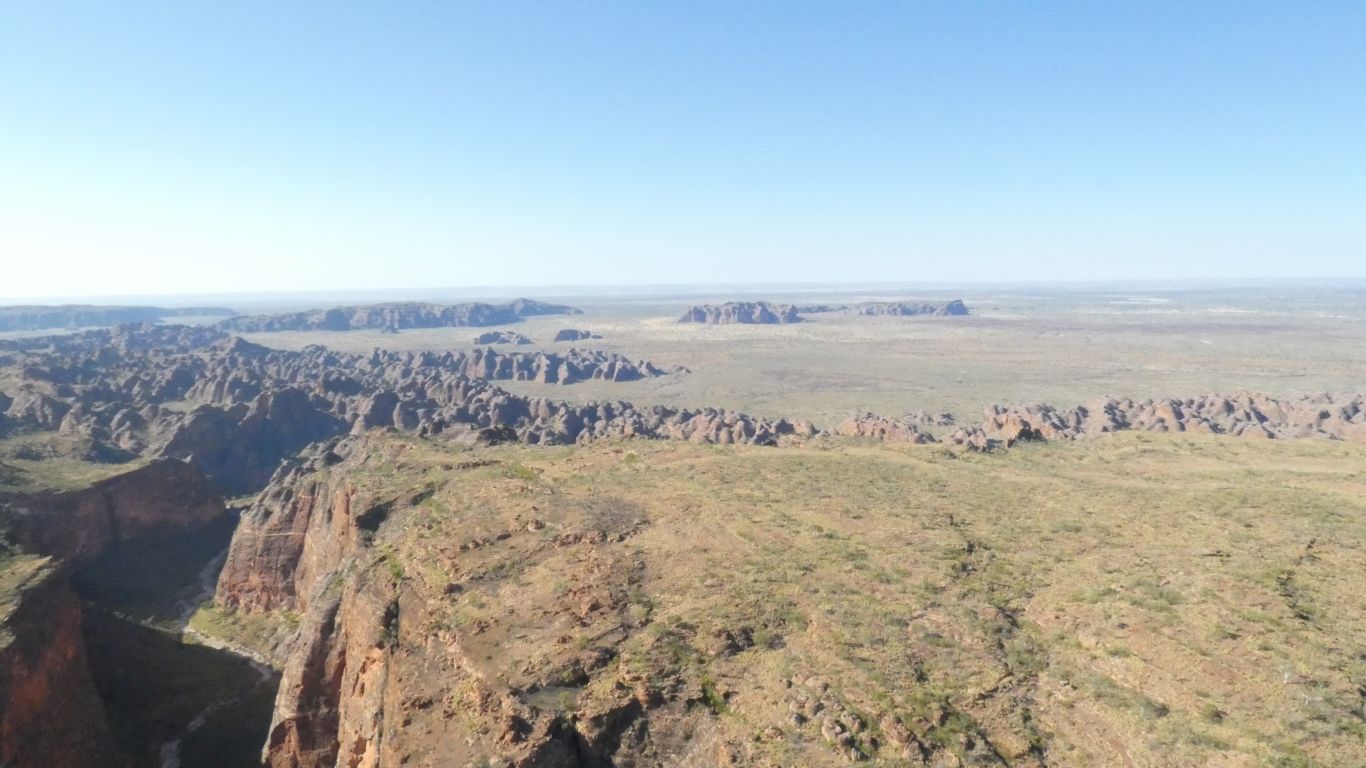
 |
|
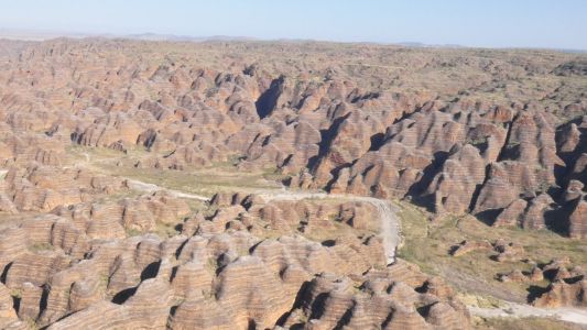
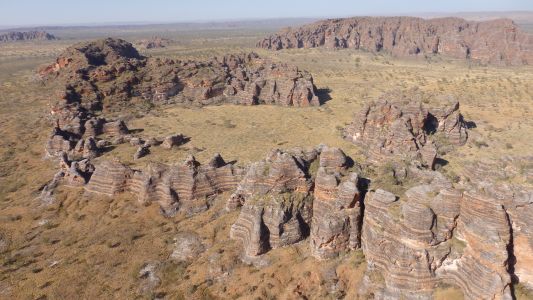
The domes are most extensive in the south west corner of
the range. The creek is widening. |
| | | |
 |
|
Then leaves the range. |
| | | |
 |
|
Looking north the car park for the walk is visible! As is
the creek as it turns south. |
| | | |
 |
|
What a fascinating place. |
| | | |
 |
|
The other camera operator thought so too. |
| | | |
 |
|
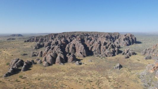
This "island", a little south of the main range, is about
the size of Uluru. |
| | | |
 |
|
There's even a horseshoe. Useful for holding cattle with
minimal fencing required. |
| | | |
 |
|
A last look at that island with the other camera. |
| | | |
 |
|
After landing we watched the next party take off. Then
headed out of the park. Towards Halls Creek and Wolfe Creek. |
| | | |
 |
|
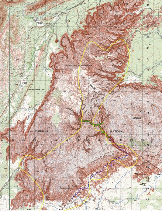
The flight path of the helicopter (and us) is in yellow.
Clockwise ..... |
| | | |
|
Kimberley / Red Centre - Wolfe Creek and Tanami Road |
|
August 18 - 21 2018 |
| | | |