| |
|
|
| Daintree to Archer Point |
 |
June 2 2019 |
| |
|
|
 |
|
I am now about to travel further north in Queensland than
ever previously. Not really a great day in the annals of exploration, I'm
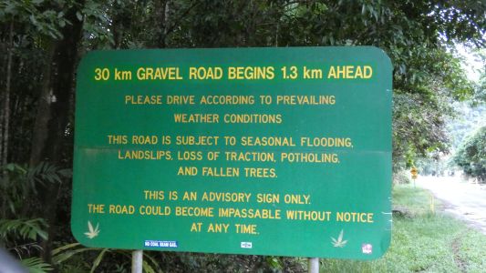
not the first. The Bloomfield Track was opened in 1968. |
| | | |
 |
|
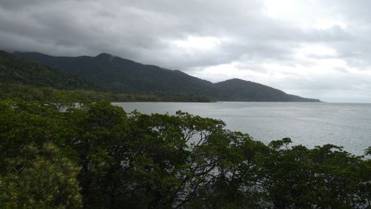
We stopped at "Cape Tribulation". While we couldn't see the
cape, to our south, we could look north. There are a couple of steep ranges
between us and Bloomfield. |
| | | |
 |
|
Cape Tribulation is "just around the corner". |
| | | |
 |
|
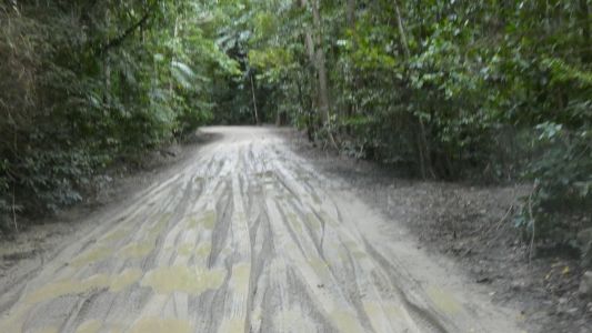
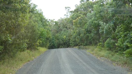
Despite the rain we had the track is mostly dry. Even this
short patch is very thin mud on a solid track. |
| | | |
 |
|
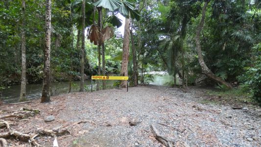
We met a vehicle coming south at Tachalbalga Creek. Just a
couple of steep downhill bits which are a bit greasy and easy to lock up
wheels. The creek is clear, and very accessible. Despite the crocodile
warnings we decide to fill the water tanks. Uneventfully.
Pleased we chose this creek, lots of fast flowing clear water. Few
opportunities after this. |
| | | |
 |
|
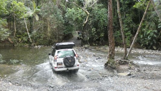
The crossing is not difficult. |
| | | |
 |
|
We weren't quite prepared for 22% gradient to climb over
the Donovan Range. |
| | | |
 |
|
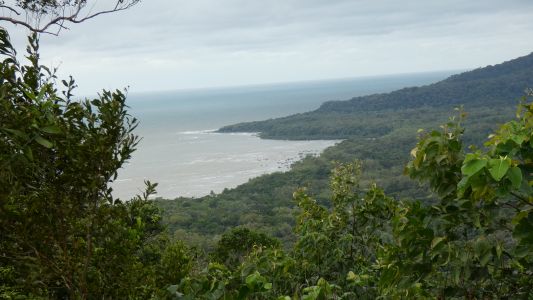
Though we were pleased to catch a glimpse of the coast. |
| | | |
 |
|
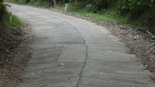
Phew. Concrete, with nice grooves cast into it. |
| | | |
 |
|
After a bit of down, another bit of up. We missed a pic of
the "33%" sign. More concrete fortunately. 2nd gear low range was not low
enough. We had to stop halfway up and select 1st gear low range. The brakes
held, the handbrake held, the hill start was faultless. This is not the
top on the way up, its the beginning of the way down.
We are uncertain of the gradient. In 2nd gear low range on more concrete
we felt in control. The exhaust retarder reduces the risk of locking up
wheels while descending. Look, no brakes! |
| | | |
 |
|
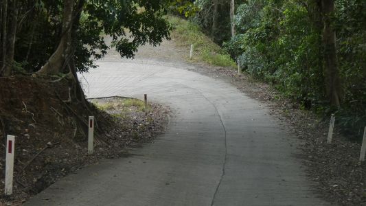
Some hairpins have a flat area for the corner itself. Some
continue the gradient through the corner. This is the latter. I kept to the
right then turned as sharply as I could - I don't like the truck being on a
sideways lean. More uneventful. |
| | | |
 |
|
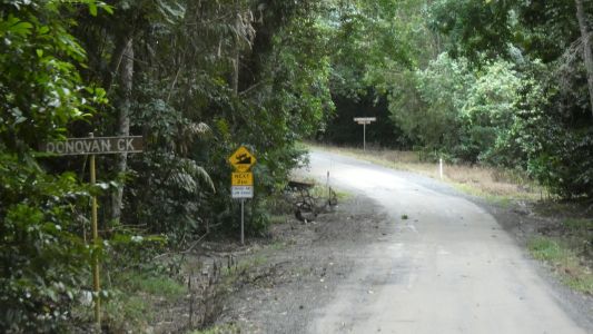
Then down to a tributary of the Bloomfield River. |
| | | |
 |
|
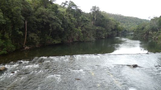
East, a bit inland, to cross the Bloomfield River at Wujal
Wujal. A very substantial bridge. Hence the name Bloomfield Track. In 1978
our 2wd 2-speed automatic was not the desirable vehicle for traversing 33%
gradients in wet rain forest. In retrospect I'm happy we didn't attempt it
then. |
| | | |
 |
|
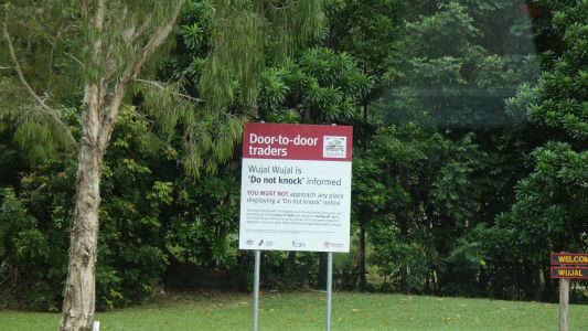
We didn't stop in Wujal Wujal but noticed this sign. How
sad that people in communities need protection from predatory businesses
willing to sell to people who neither need their products nor can afford
them. Its near the sign about no alcohol. We don't have any, but also find
those signs sad. Sad that its necessary to ban alcohol completely |
| | | |
 |
|
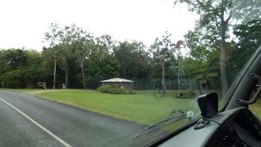
West towards the coast again. Through Ayton. Which has a
caravan park and some Esplanade land sales. It also has this tank built
from river/beach stones and a windmill. |
| | | |
 |
|
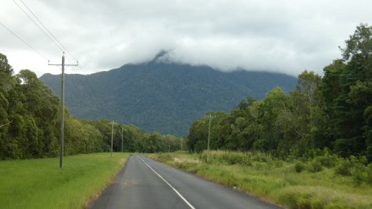
The black mountains of the Black Trevethan Range.. The
road passes to their left.
I recall a similar hill behind Thornton Beach in 1978 but haven't seen it
this trip. It was inaccessible to us. |
| | | |
 |
|
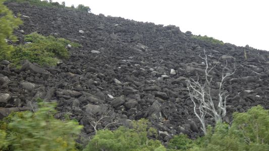
Granite. Broken boulders with lots of crevices. And stories
of people lost in the maze. Worse than crossing a scree slope. |
| | | |
 |
|
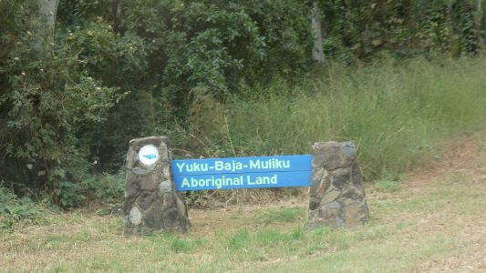
Archer Point has a campsite operated by Yuku-Baja-Muliku on
their land. |
| | | |
 |
|
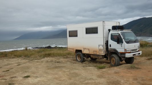
It also has a lighthouse, with a track to it. With 4G
mobile reception. This is looking south as we descend. We'll camp on the
small spit. Overlooking the imaginatively named Rocky Island. |
| | | |
 |
|
Windswept. No other word for it. Strong winds from the
south east. We line the truck up as best we can, while using a few holes to
make ourselves relatively level. Too windy to try the pole with modem
atop. |
| | | |
 |
|
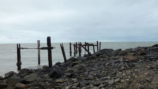
The disused wharf. It would have been a substantial
structure. Steel as well as wood. |
| | | |
 |
|
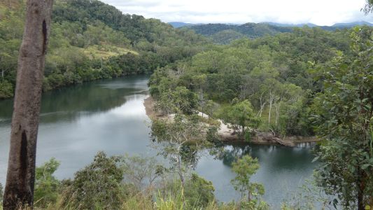
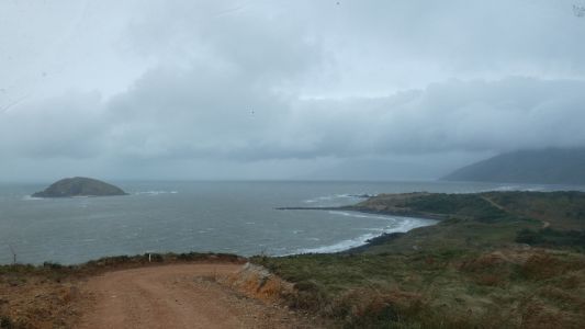
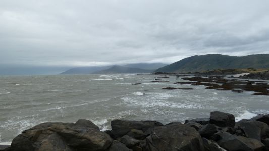
Looking south. We think Cowie Point in the distance. About
15km. Cape Tribulation is probably just visible beyond that on a good day,
just a little bit. About 50km. The Bloomfield River enters beyond the
first big headland. |
| | | |
 |
|
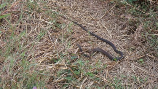
Walking back from the wharf we encounter our first snake
for the trip. No idea what sort of snake. We just try to avoid them. This
one slithered away when it realised we were there. |
| | | |
 |
|
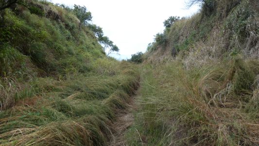
This is probably associated with the wharf. A cutting which
probably had a tram track through it. The track runs for a couple of hundred
metres, past a dam, or could have been a quarry, and disappearing into
impenetrable (to us) bush. We can imagine rock of some sort being wheeled
to a place above the wharf and being unloaded into hoppers for collection by
ship. Then again, we could be totally wrong. |
| | | |
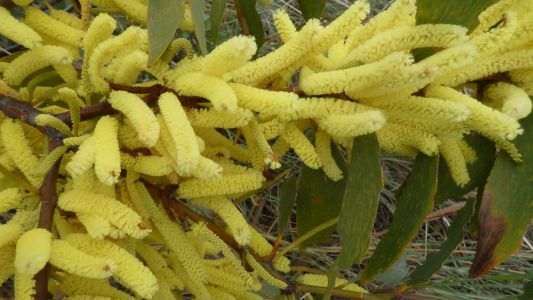 |
|
Whatever it is its pretty. |
| | | |
| Archer Point |
|
June 3 - 5 2019 |
| | | |


