| |
|
|
| Captain Billy Landing |
 |
July 2 - 3 2019 |
| |
|
|
 |
|
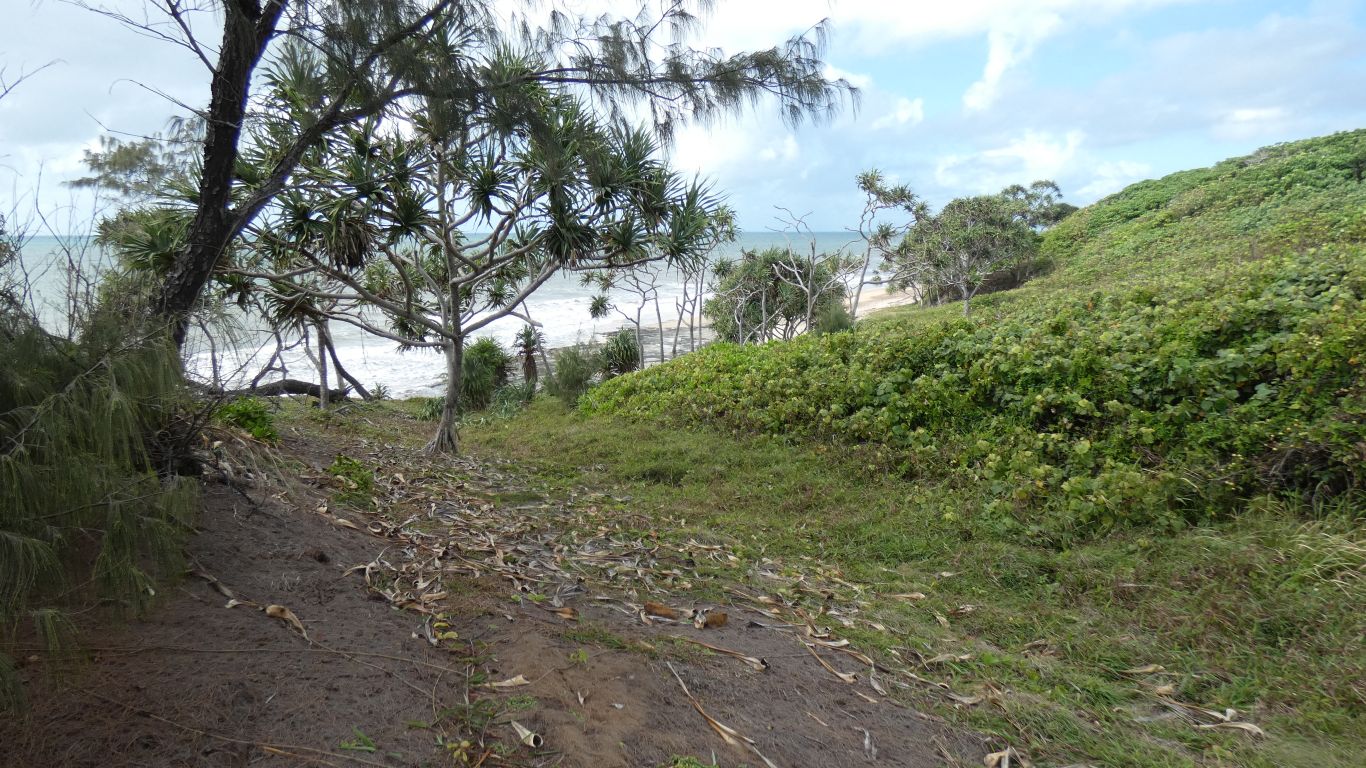
Having whetted our appetite yesterday by walking just
around the headland to the south we thought we would walk further south
today. The tide was of course an hour later, we had to wait until after
lunch for it to go out sufficiently. So a gentle stroll north in the
morning, while the bread is baking. |
| | | |
 |
|
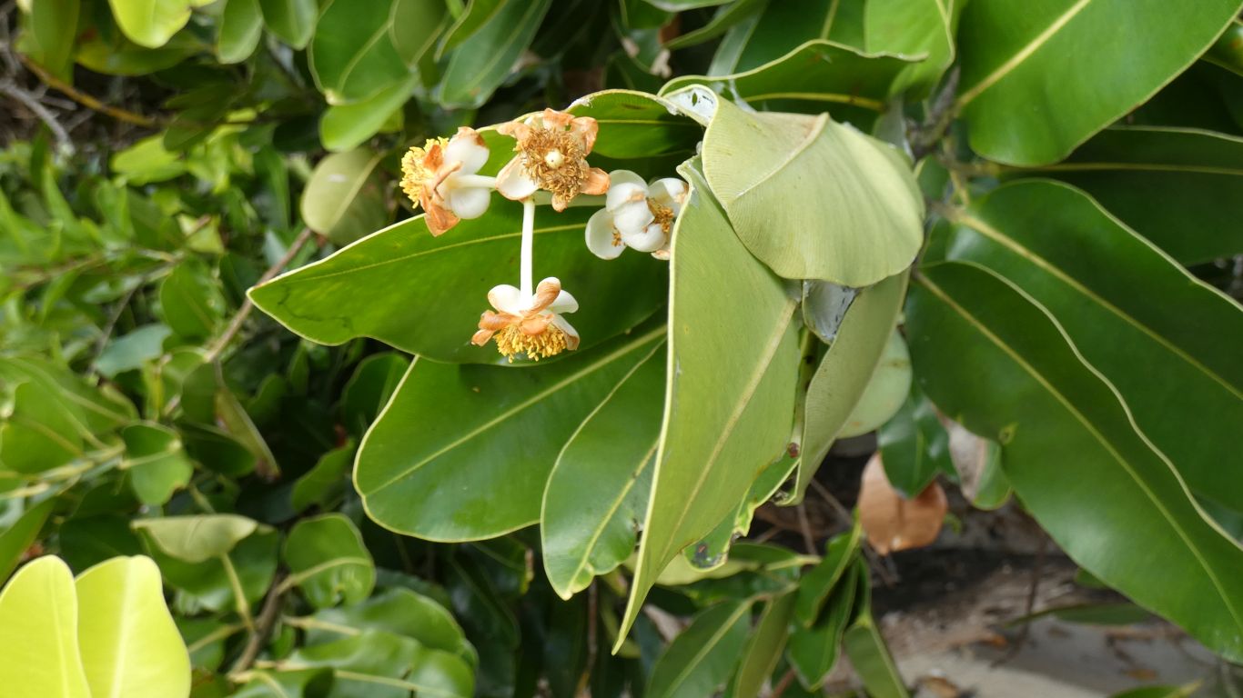
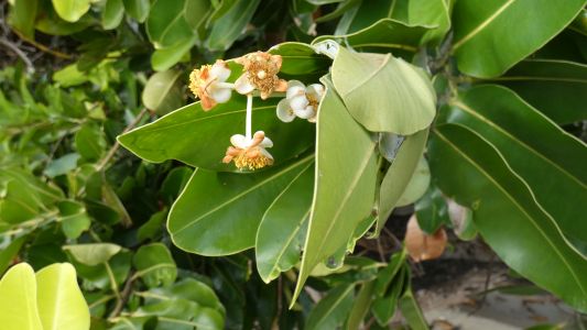
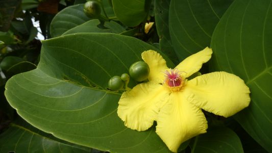
We have no idea what it is. A large bush/tree - when does a
bush become a tree? |
| | | |
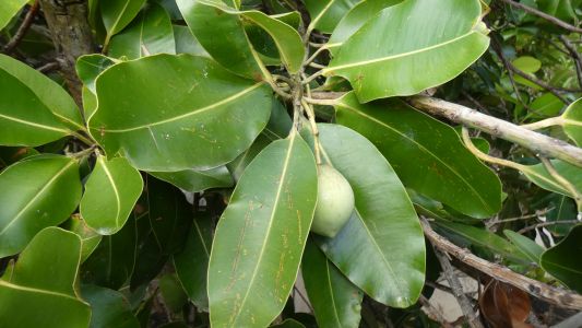 |
|
With both interesting looking flowers and fruit. |
| | | |
 |
|
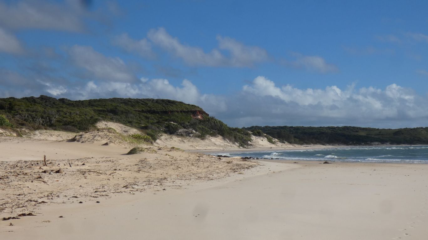
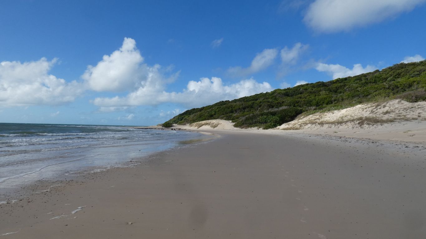
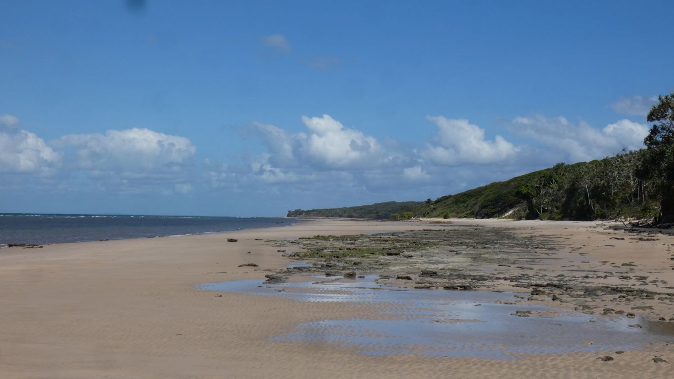
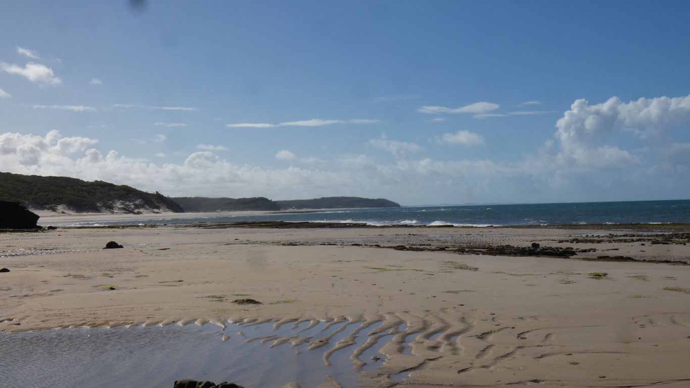
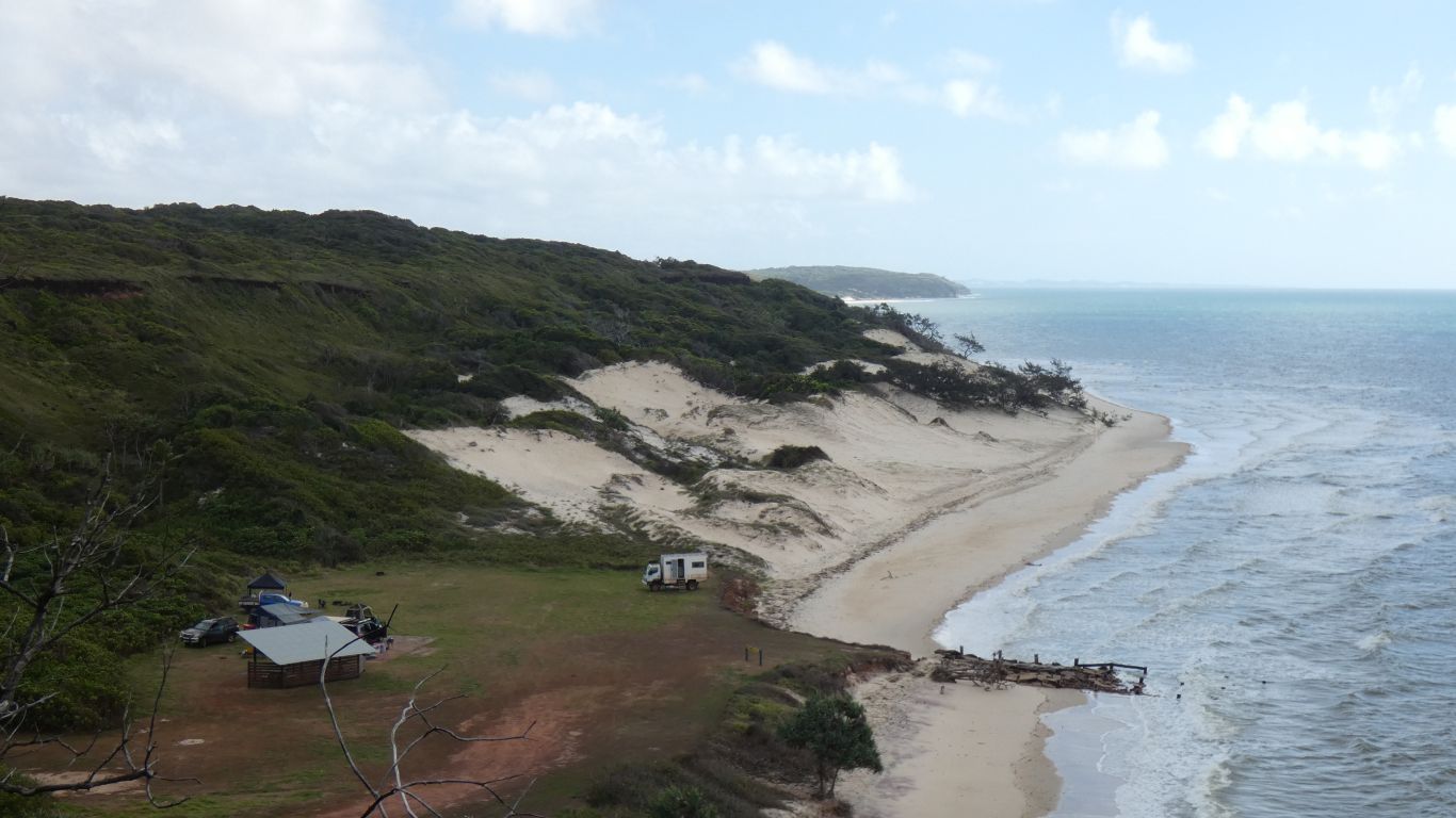
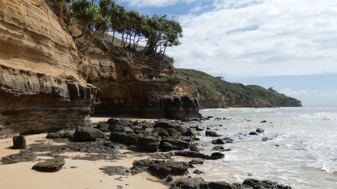
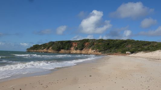
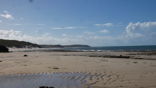
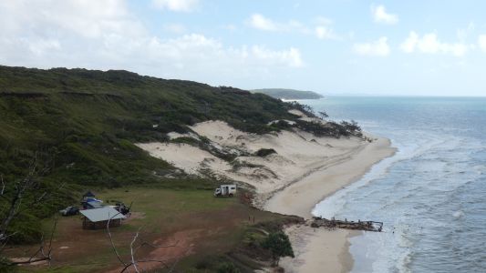
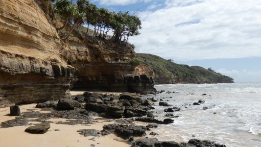
The coast is a series of small sandy headlands, in between the
big rocky headlands, with beach throughout. Though high tide is the foot of
the dunes and makes the big headlands impassable. We wonder why we don't see evidence of camping from years gone
by. And how far its possible to walk (or drive even) along the beach. We
look back every so often to see how far we've come. Not far, the landing is
just around that corner. |
| | | |
 |
|
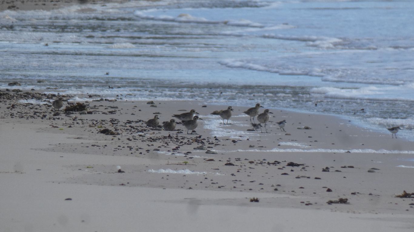
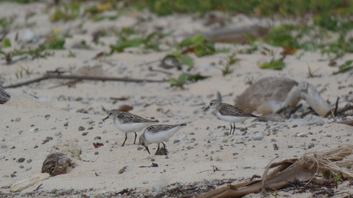
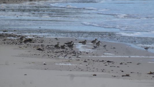
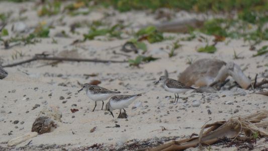
A small flock of sandpipers (sharp tailed we think) with
some red-capped dotterels seeking safety in numbers. As we approach the
sandpipers fly off and land further along the beach. The dotterels seem to
prefer walking (with those little legs working really fast), though
occasionally flying. It seems a pity to disturb them, it doesn't seem to
matter how far up the beach we walk to find a way around them. |
| | | |
 |
|
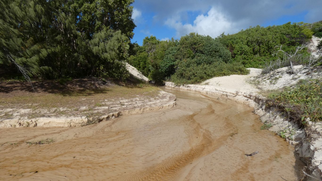
The creeks have evidence of crocodiles in the lagoons
behind the dunes. They are also red tinged from the upper layers of rock. |
| | | |
 |
|
We didn't walk far. The campsite almost emptied out. To
fill again in the afternoon. |
| | | |
 |
|
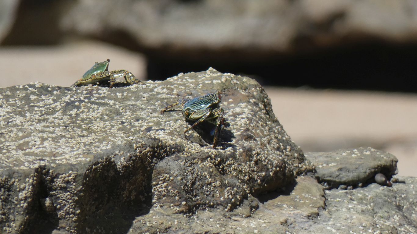
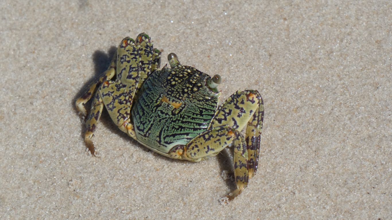
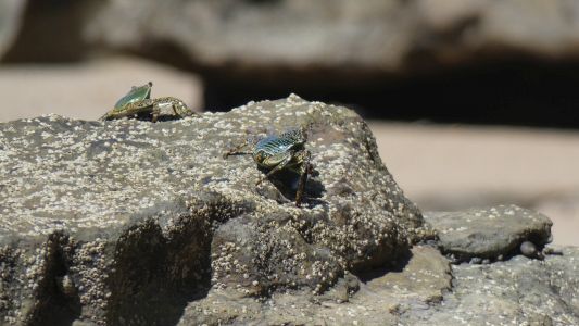
After lunch we carried water in our pack and headed south.
The crabs see us coming and rush to hide. They look black, but on closer
inspection are green with beautiful patterns.
These two were a bit slow. So well camouflaged are they I didn't see the
second one until I looked at the pic. |
| | | |
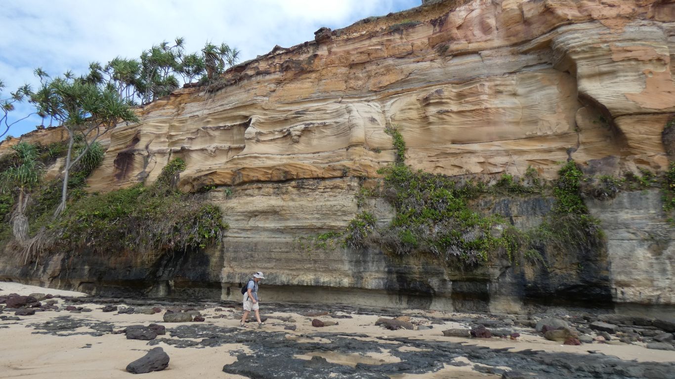
 |
|
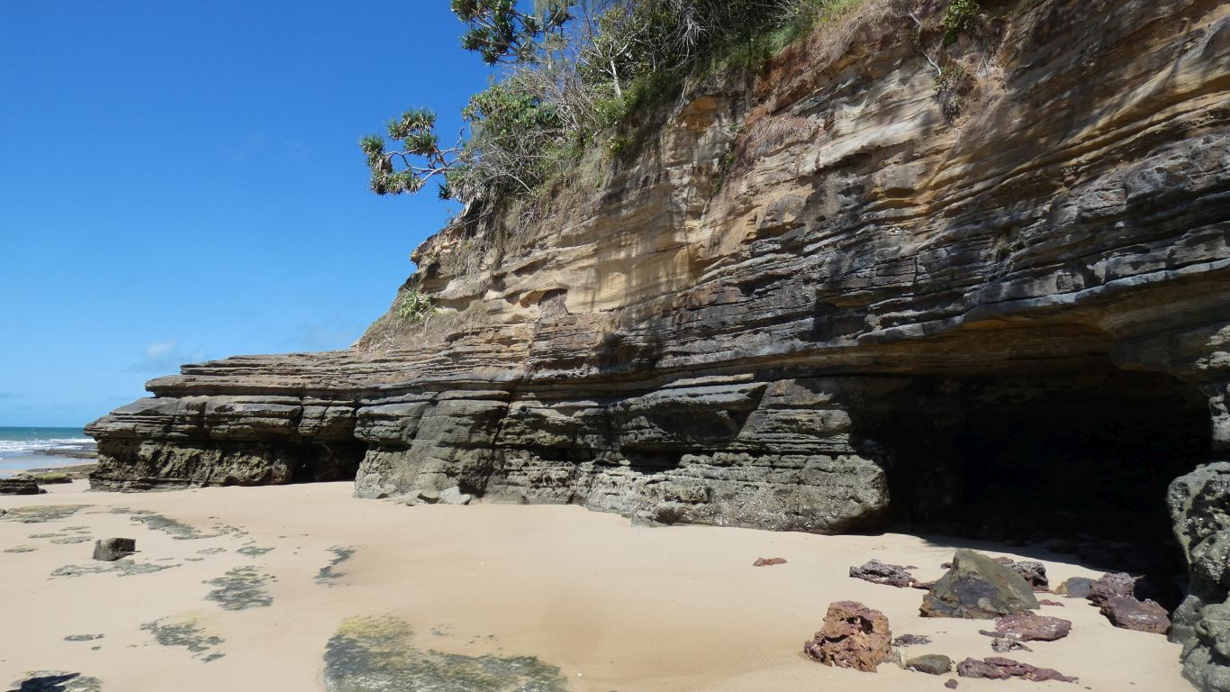
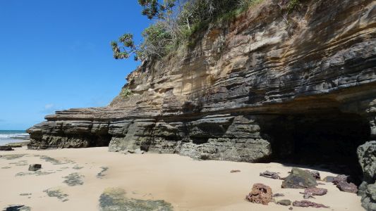
The rock strata are fascinating. Layers of different
coloured sandstone.
Further south, further than we can walk, is an area labeled "Red Cliffs"
on the maps. |
| | | |
 |
|
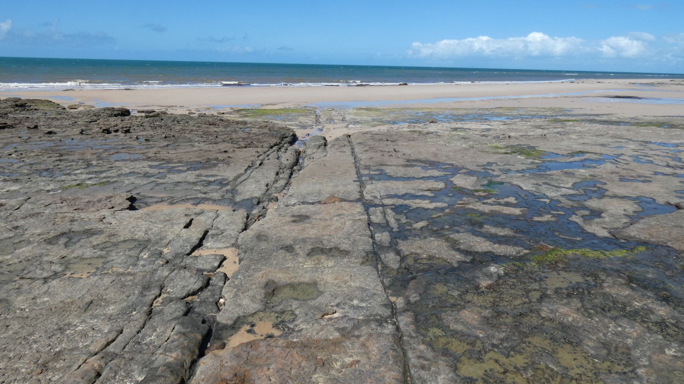
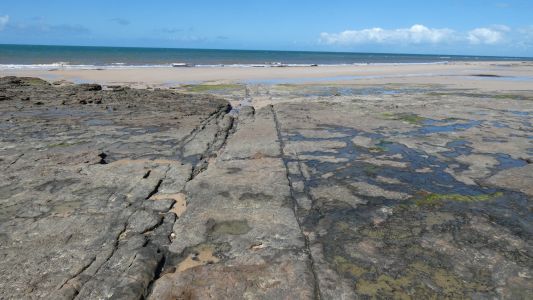
We find it strange what can pop out from our memories. This
reminded us of the ancient road in China. Wheel ruts in the rocks. Of
course its not, its just fault lines. But the memories are nice. |
| | | |
 |
|
Having rounded one major headland there's another. When we
reach it we will have walked a little more than 5km. |
| | | |
 |
|
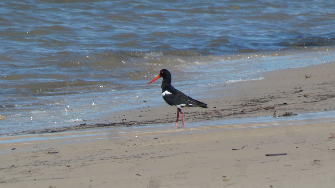
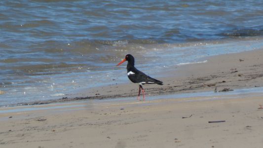
Not as pied as we think it ought to be for a pied
oystercatcher. |
| | | |
 |
|
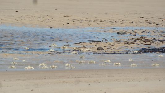
As well as the dark crabs on the rocks we surprise a mob of
light coloured crabs on the beach. They rush away to seek shelter in the
water and under rocks. |
| | | |
 |
|
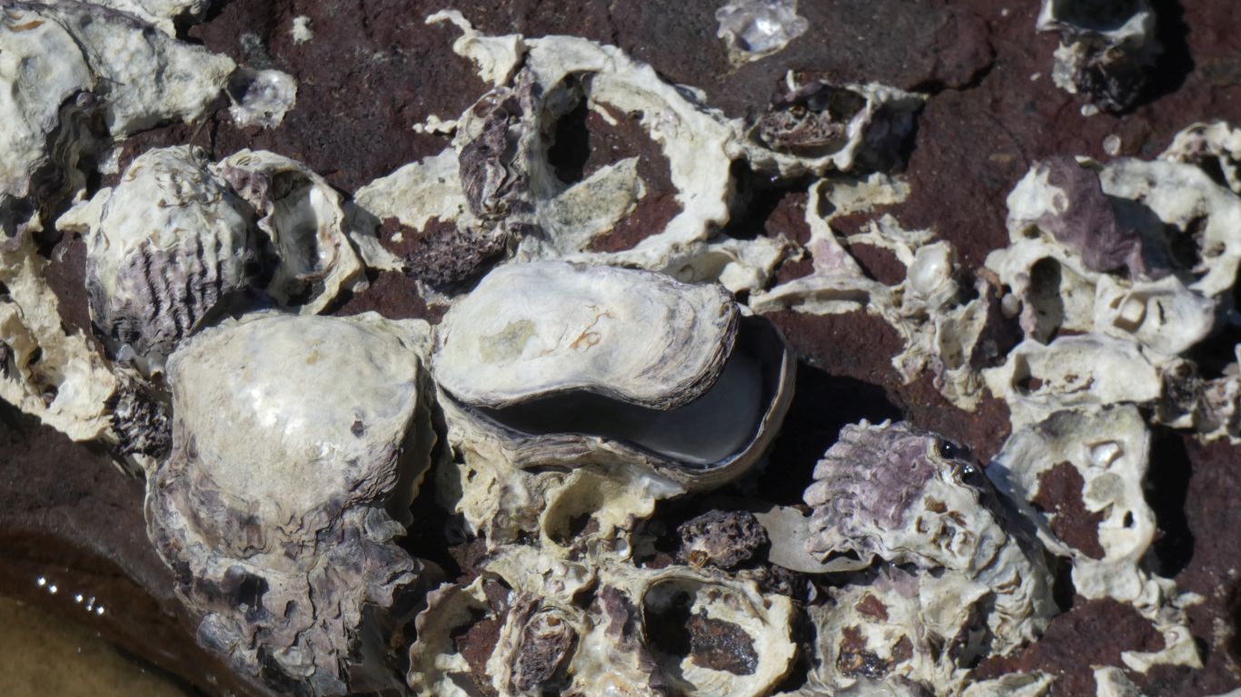
Most of the rock oysters we see have long ago been opened.
We doubt its human activity. We see some with the upper half of the shell
still attached. Perhaps starfish or sea urchins at work. |
| | | |
 |
|
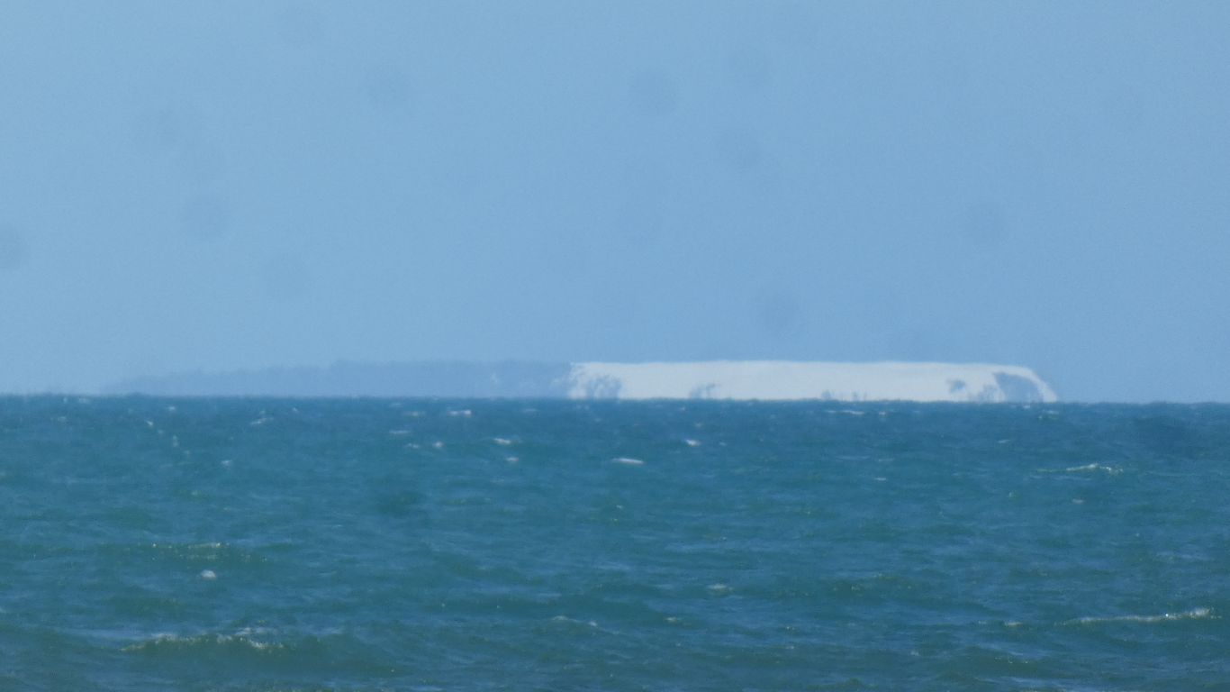
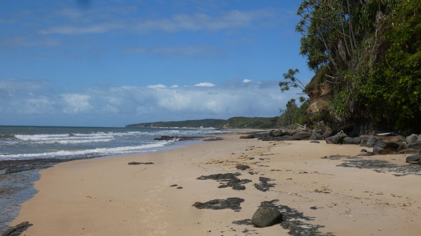
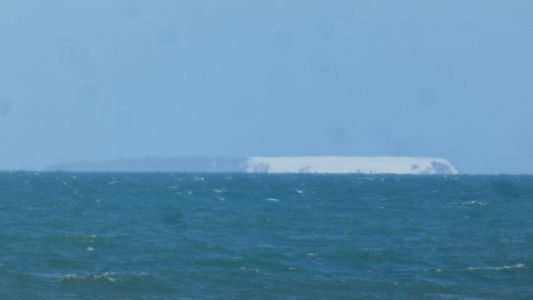
From the furthest point we reached we peaked around the
corner to see what is most likely Round Point in the distance. It looks like a
truncated sand dune, vegetation holding the east side together. Its the only
land in that direction, about 30km away. Its the southern end of Shelburne
Bay. With Cape Grenville just a little further south. The Queensland Coast
seems to be a succession of large "scallops". All the way from the NSW
border northwards. There's probably a consistent northwards current along
the coast carrying sand. In some places depositing it, in other places
picking up more.
Too far to walk today. We remember the days when we carried everything on
our backs and would quite happily have set off along the coast for a few
days. We notice on one of our maps there's a track to Red Cliffs marked
and several further south. Most are missing off the more general maps,
though Red Cliffs track appears on one and is labeled "private".. |
| | | |
 |
|
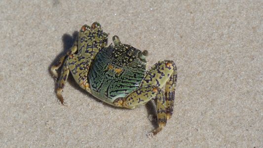
Gottcha. This crab decided to stay still on the sand long
enough to have its pic taken. Didn't bother doing the normal crab thing of
waving its claws at us. I can't see them, and there may be a leg missing. It
soon got bored with us and scurried off to the rocks to join the others. |
| | | |
 |
|
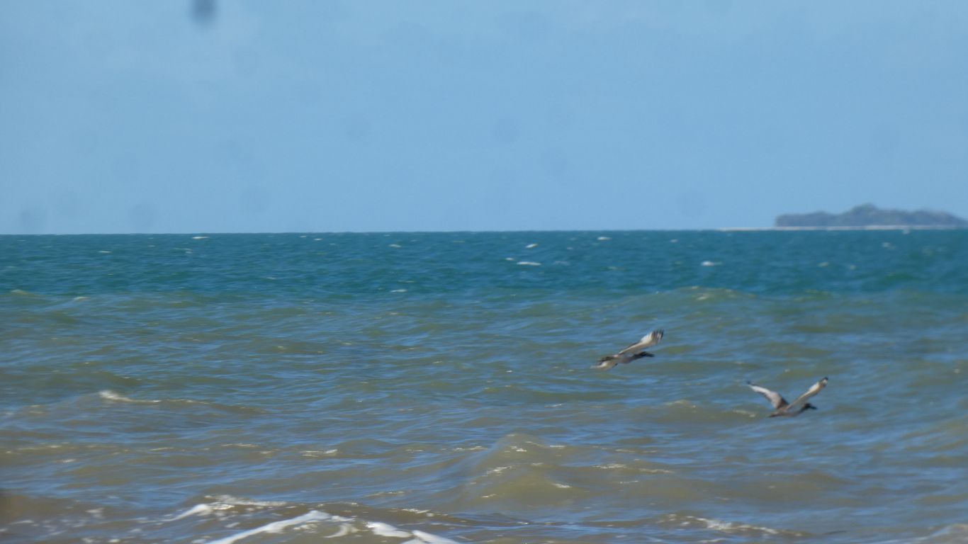
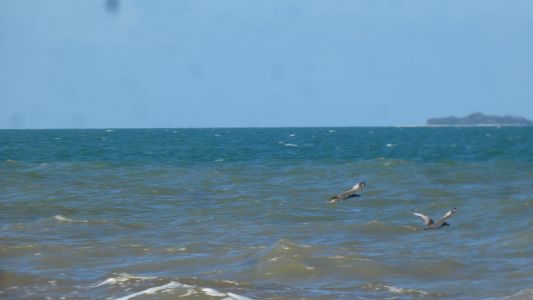
We haven't seen the curlew since the drone incident. We
catch a fleeting glimpse as two take flight. These two may always be shy, or
now just uncomfortable with people, or perhaps we are imagining. |
| | | |
 |
|
10km (there and back) isn't far. It took a bit less than 3
hours. The landing is "just around the corner". An enjoyable day at the
beach. Ali picked up a few shells, for drawing practice. They are such
beautiful shapes, and so very difficult to draw. |
| | | |
 |
|
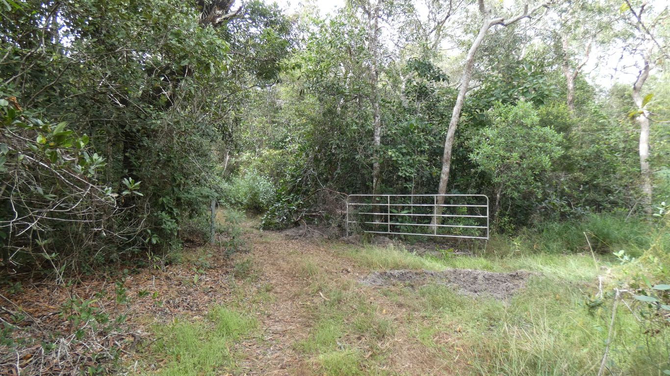
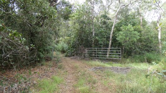
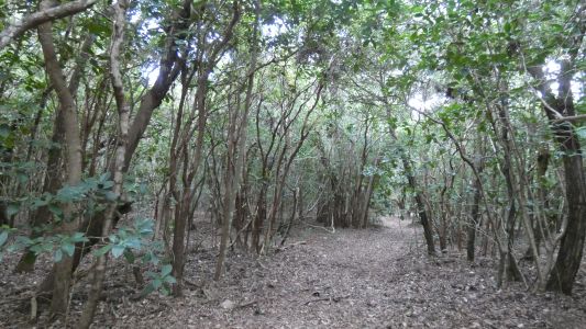
Next morning, while Ali drew shells I walked up the track
we drove in on. There were several normal looking drainage channels. But
near the bend, where the track began to level out, one looked subtly
different. Different enough to investigate. Through the foliage and follow a
rough track that becomes ever more obvious, and after about 150m there's an
open gate. No evidence of locks. No fence, just a wall of vegetation each
side. The track hasn't seen any vehicle in a long while. Lots of evidence of
pigs. |
| | | |
 |
|
The track leads along the cliff top. A better view of the
Hannibal Islets (to the right, about 10km away) and Pirie Islet (to the
left, about 6km away) than we get at sea level. North north east from the
truck. There's a light tower on the rightmost of the two Hannibal Islets
which we see flashing at night. Two flashes one second apart, repeated every
about 10 seconds. We don't have internet to check lighthouse signatures.
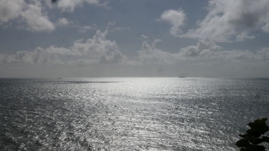
I'd looked at the cliff top a few times wondering if anyone had beaten a
walking track along the top. I didn't expect a vehicle track. At times only
3m from the edge, with a barrier of thick vegetation. Hang on with one hand,
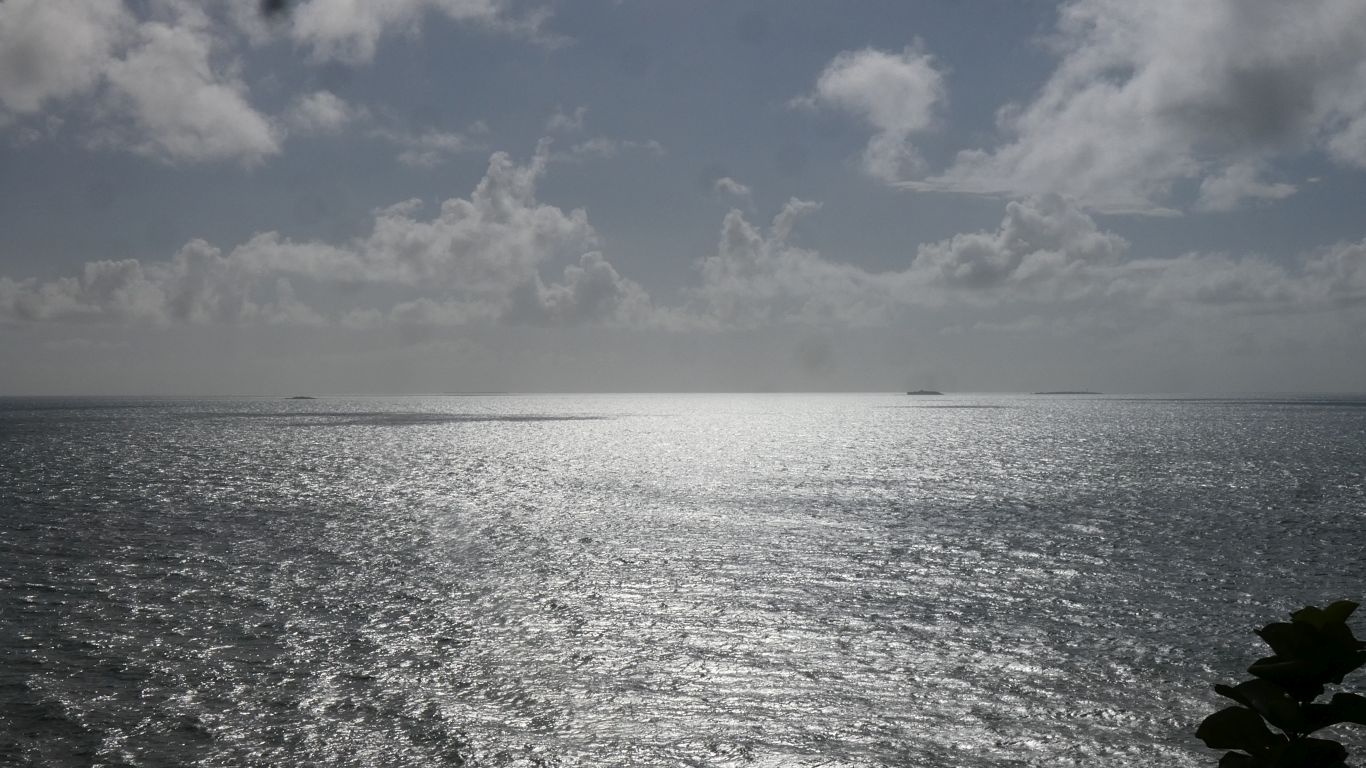
hold camera at arm's length with the other, click, and retreat.
The sun is high in the sky but the sea manages to reflect a silvery
light. |
| | | |
 |
|
The track leads down to the beach south of the headland. On
our first wander along the beach around the headland we thought there were
indistinct signs of a track, but not really distinctive enough to be
definitive. Here we are, there's what's left of the track. |
| | | |
 |
|
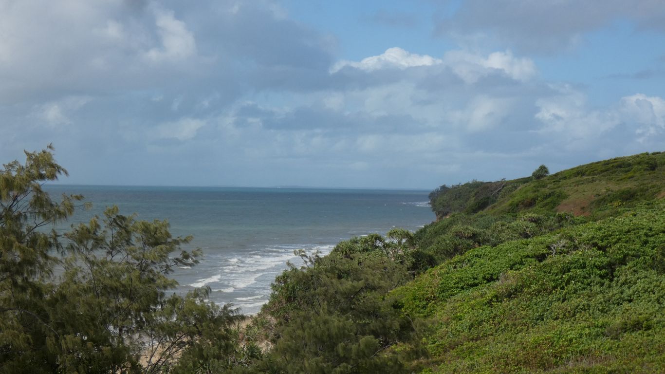
Looking south from higher up the track. A very obvious
change in vegetation. |
| | | |
 |
|
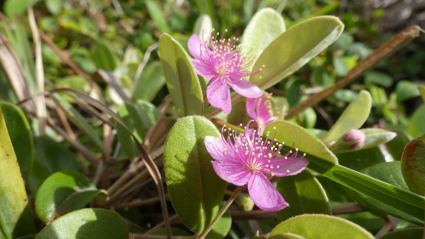
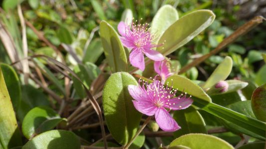
There are all sorts of plants sheltered just back from the
seaward edge of the vegetation. This is a small ground dwelling plant. |
| | | |
 |
|
This is part of a three meter high bush. I wonder what
pollinates and propagates the plants. The bush is eerily quiet, even so
close to the sea I don't hear the sea or feel the wind. I see a couple of
birds fleetingly as they take flight, but hear none. I also see few insects,
beyond the many ants. But it seems the bright colours and shapes of the
flowers have evolved to attract something.
I wonder what's edible. |
| | | |
 |
|
Looking north. Probably Hunter Point about 6km away, and
False Orford Ness on the horizon, about 28km away. |
| | | |
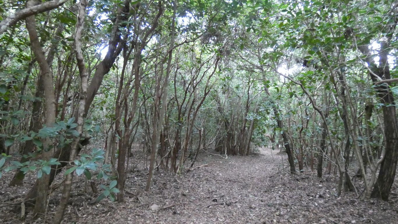
 |
|
The track is a bit overgrown, but still obviously a track.
Its not all like this, there's a huge variety, from bigger trees to thick
low bushes and "grass". |
| | | |
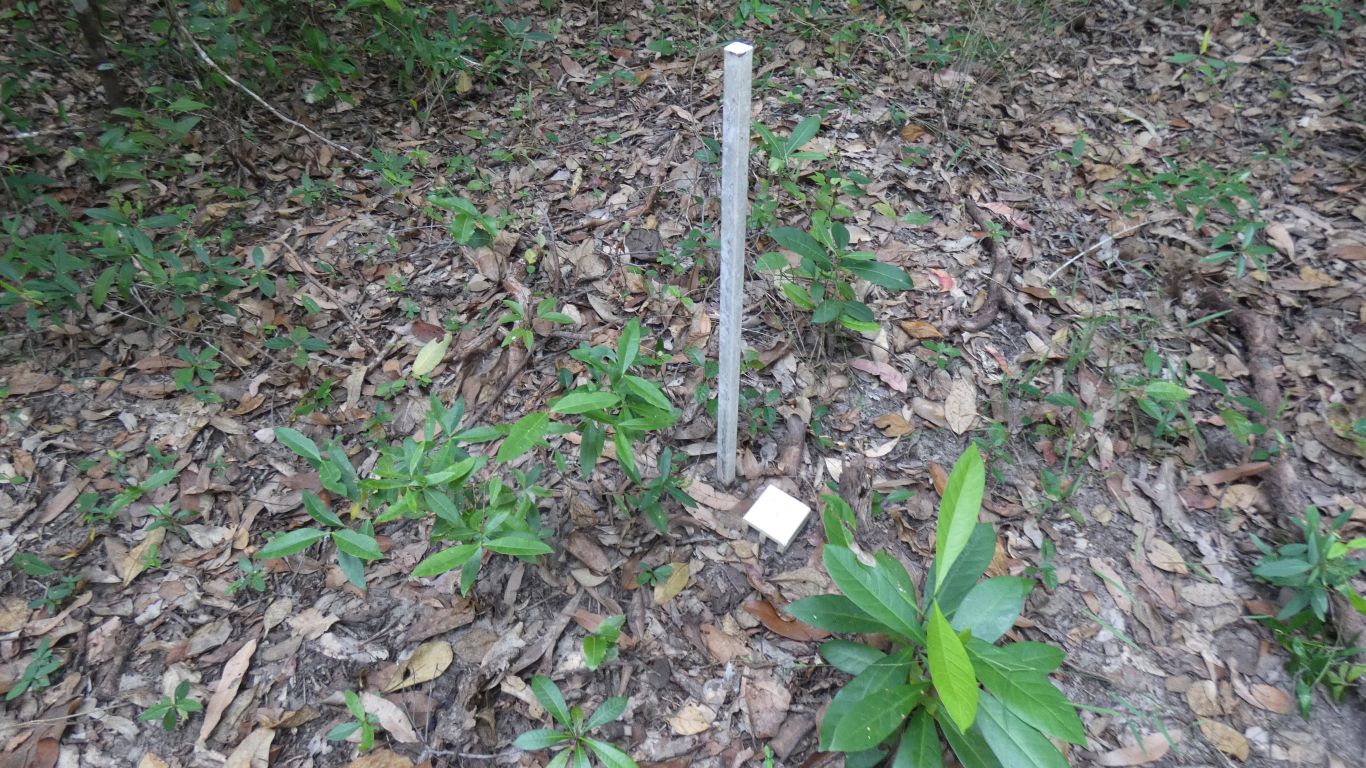
 |
|
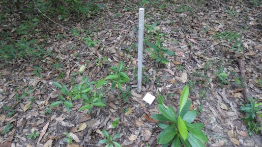
Mystery object number one. I later find a second next to
the main track. I have no idea. Someone went to a bit of trouble to put it
there. |
| | | |
 |
|
The deal with Ali was I would be back in ten minutes and we
would walk northwards until we tire. This is an unnamed point, the tide
was on its way out, just in time to allow us to pass.
We've spotted what may have been occasional campsites in dunes above the
high tide mark. But it would have been a long time ago. Few and far between.
The rock strata remind us a little of porcupine gorge. The finer, harder,
darker, lower strata drode more slowly and provide a defence against the
sea, just as it formed the base of the gorge. |
| | | |
 |
|
We think more sandpipers. If only they had yellow legs like
in the bird book. They were very difficult to see, well camouflaged. We
saw these land and disappear, until they moved. |
| | | |
 |
|
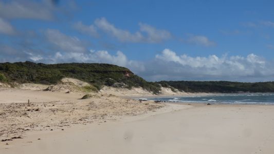
Our nemesis. The tide isn't out far enough. We are also
becoming tired - its about 5-6km from the truck. We think that's Hunter
Point, just around the corner. |
| | | |
 |
|
So we turn around and head home. An easy decision. The
truck is just below that far headland.
Have we really walked so far? |
| | | |
 |
|
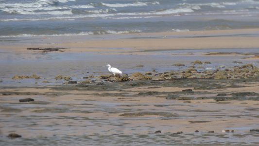
An uneventful walk back. Though legs getting a bit stiff
and tired. The egret insisted on flying further down the beach each time we
approached, then finally flew round us. We are used to that sort of bird
behaviour. They seem to take off when we point the camera at them. We also
saw a couple of pied oystercatchers, and a couple of very timid curlews that
repeated yesterday's fly away as we approach.
Home for lunch, and a sleep. |
| | | |
| Gills Moon Lagoon
to Chilli Beach |
|
July 4 - 5 2019 |
| | | |