But, as ever, we are looking forwards, not back.
Apart from, of course, when writing and reading the blog.
A diary. To remind us where we have been.
Whether eaten or burned we have no idea.
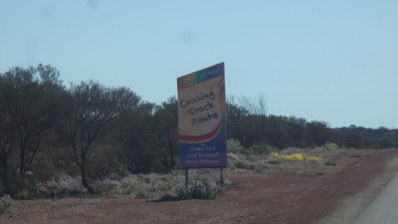
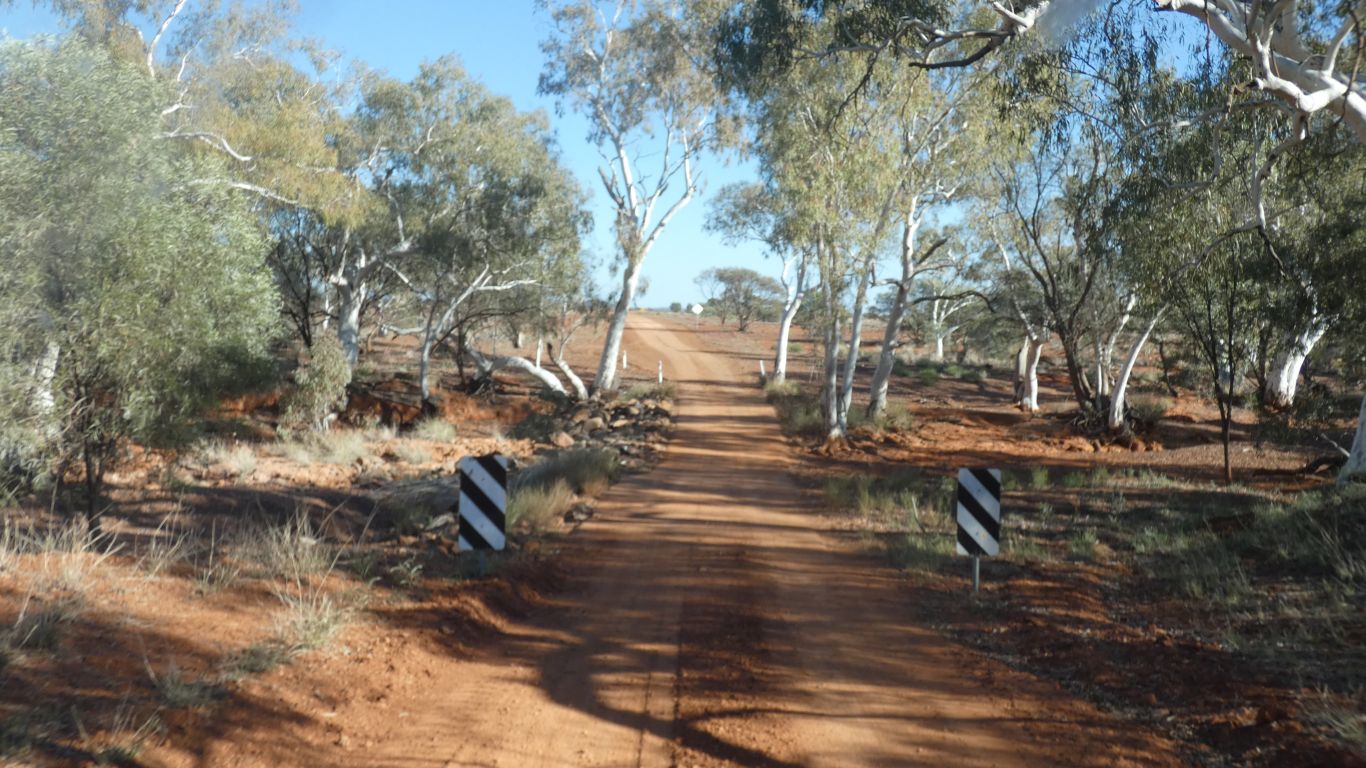
We hadn't quite expected this sign.
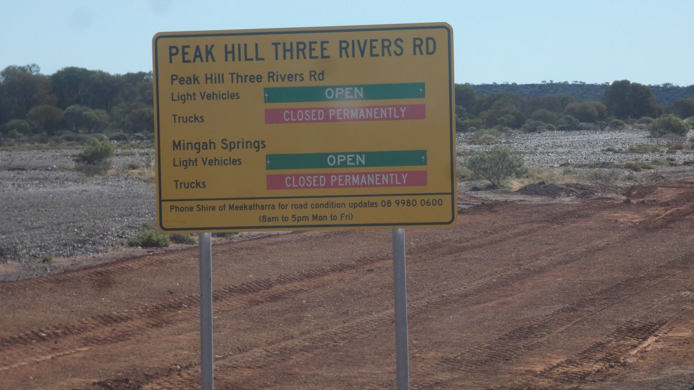
Are we a truck, or are we a light vehicle?
Should we take the sign literally, or as something so ambiguous it should be ignored?
Patently someone is trying to tell us something.
Whatever. We decide we are a light vehicle. We drive on a car licence.
WA seems to also have a simple approach to road use when wet. It requires the driver to exercise some judgement. With a hefty fine if damage is caused.
A consequence of the sign?
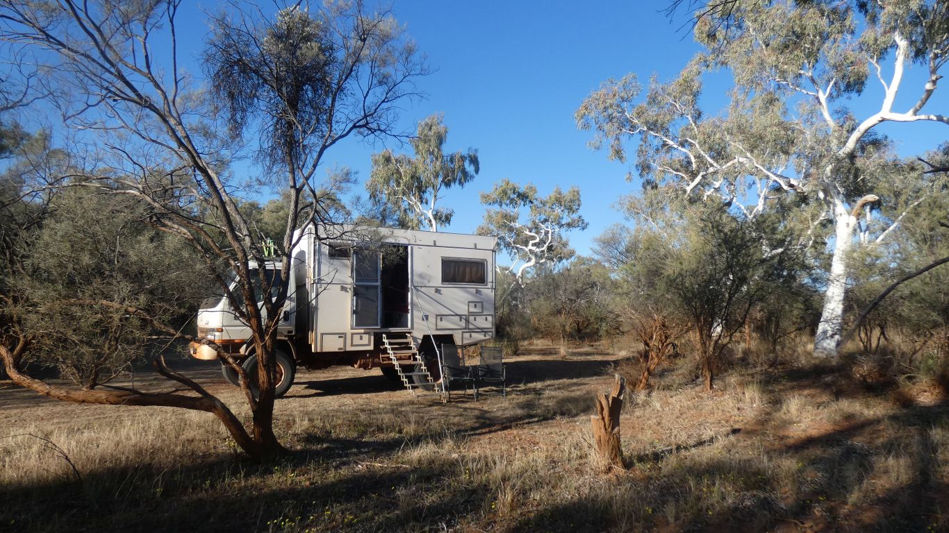
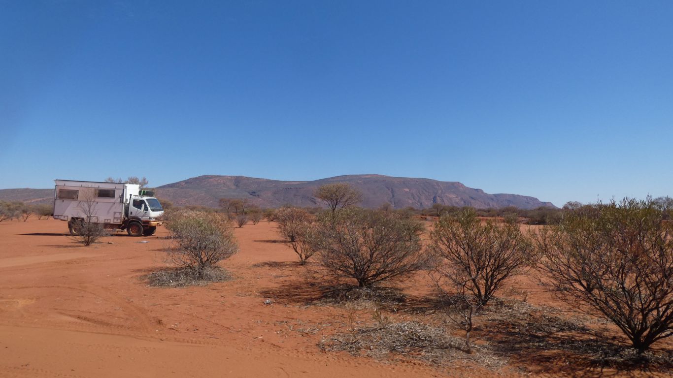
We camped at a Gascoyne River crossing. Well off the road in a pleasant clearing.
Three nights. We called it "recovering".
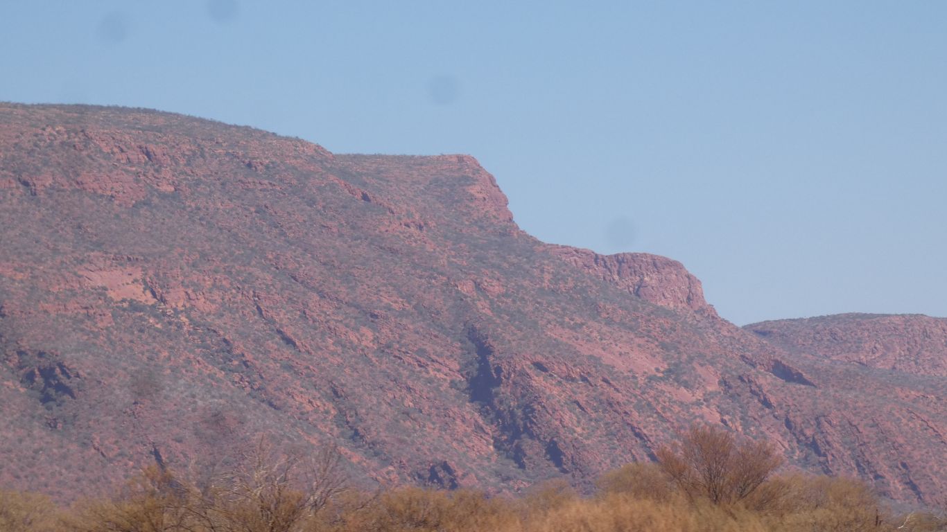
Hard not to notice really.
Perhaps "less arid" is a worthy description.
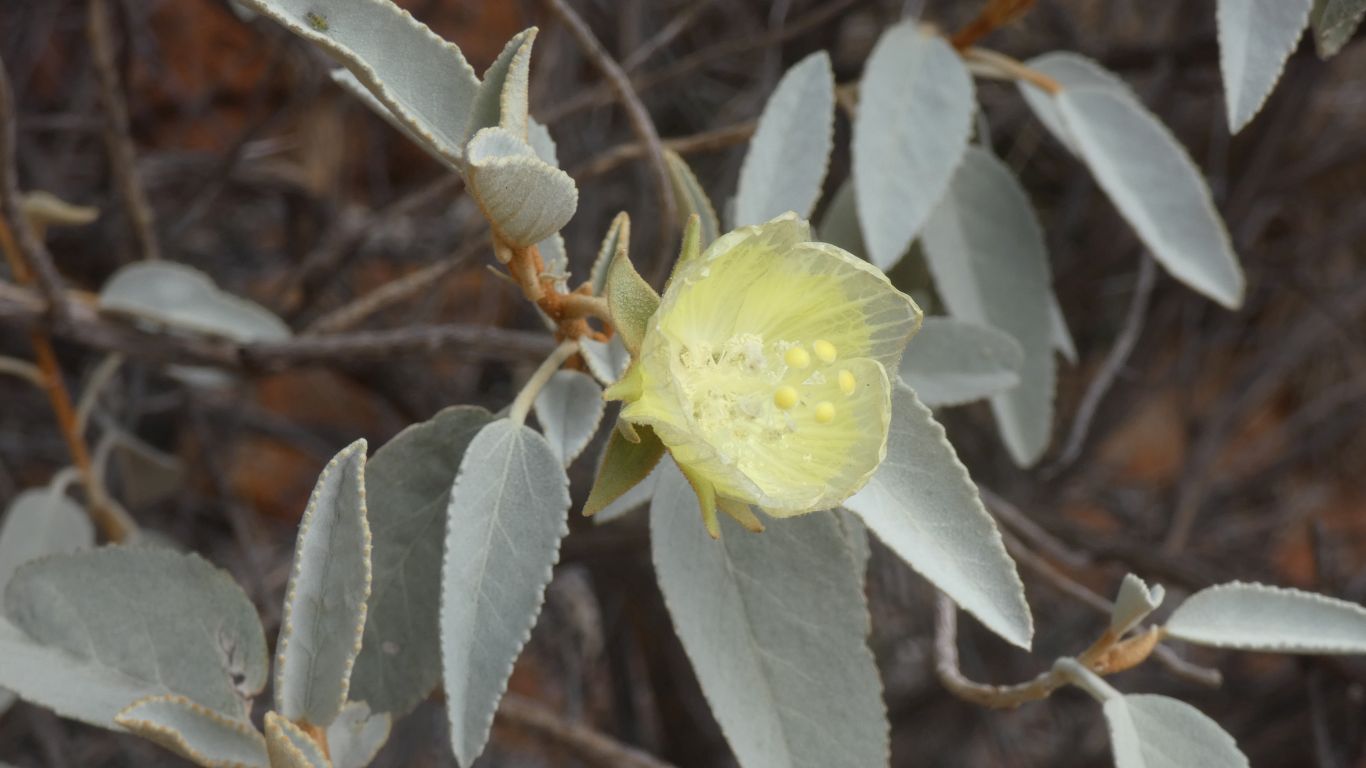
Though we have many more questions than can be answered by a name. How are they pollinated is but one.
A name would simply allow us to ask. Perhaps matching the picture can serve the same purpose.
It must be a light vehicle as trucks are not allowed ......
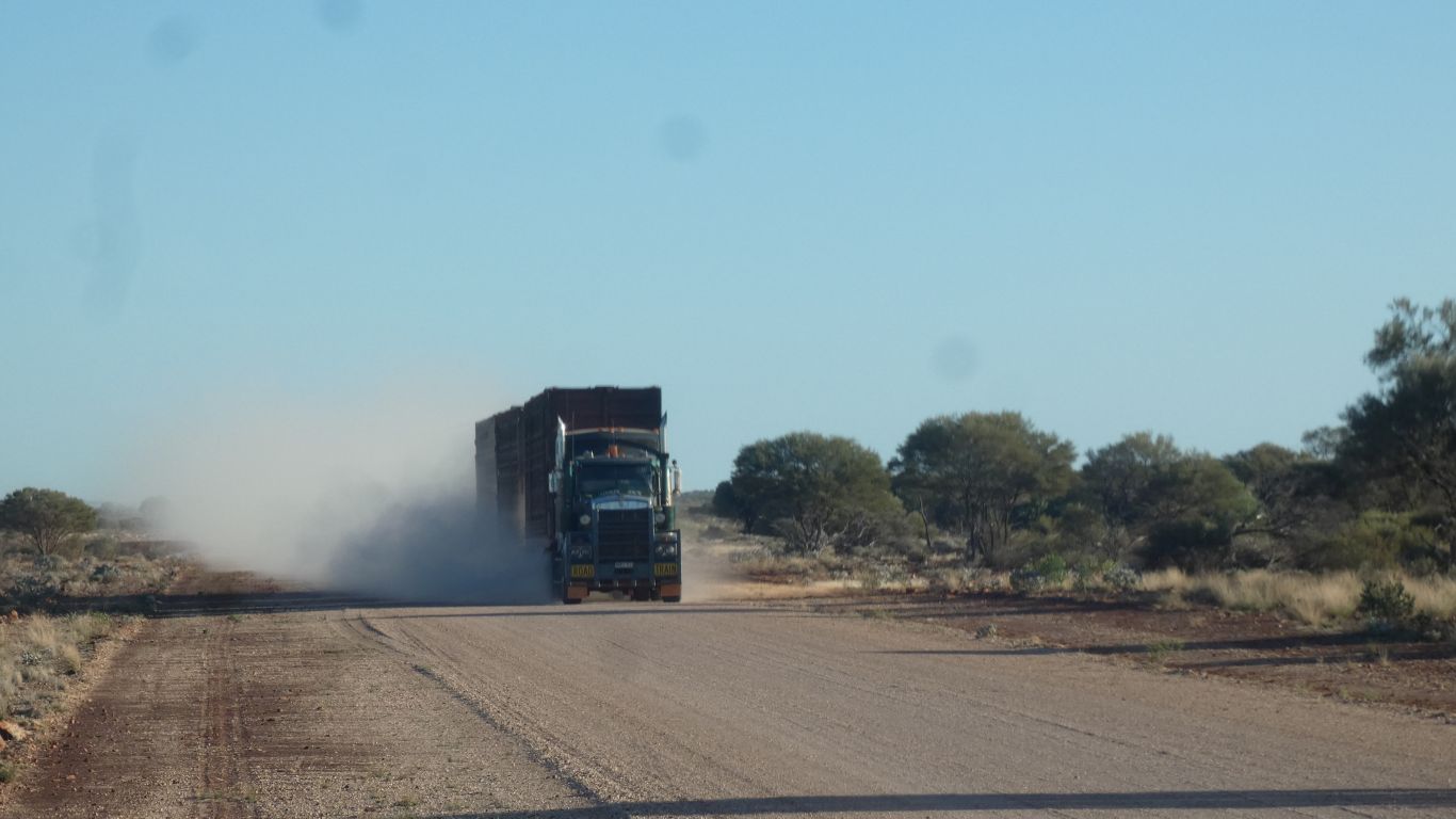
Its carrying cattle. Traveling slowly. The road serves several stations.
I should have mentioned the road is very dusty. We pull off and stop.
And mountains, which are anything over 2,000 ft. Or 600 m. Depending on choice of units.
I know this because the highest point on the island I was dragged up on is 2034 ft above sea level. Which meant it was a mountain. With a mountain railway to the top.
I slowed, but almost not enough. The concrete causeway was like a roller coaster.
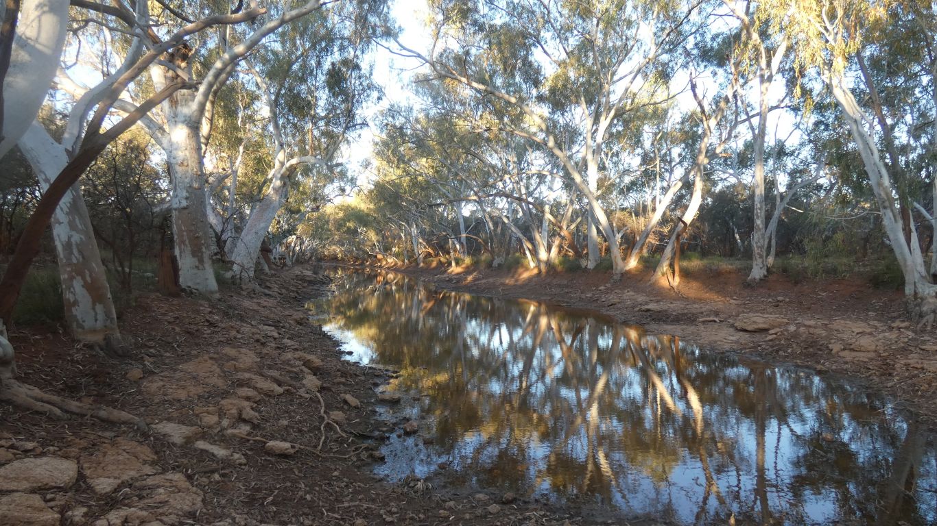
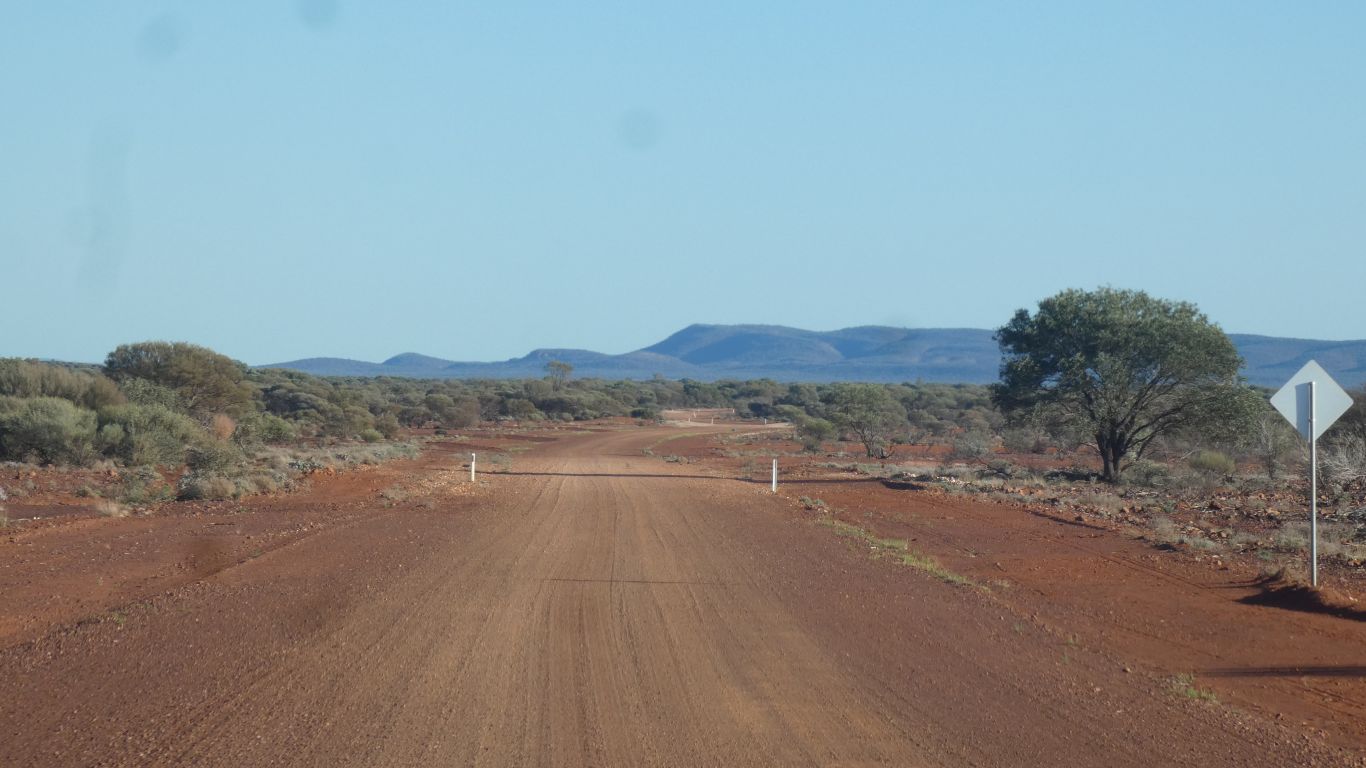
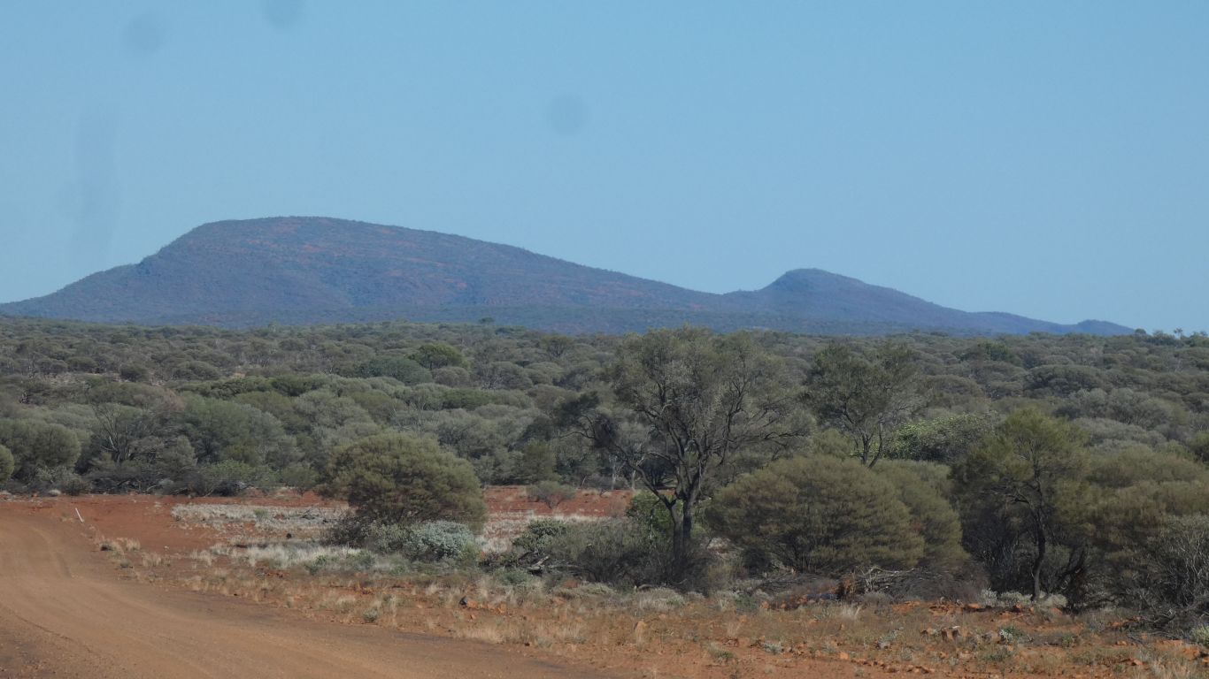
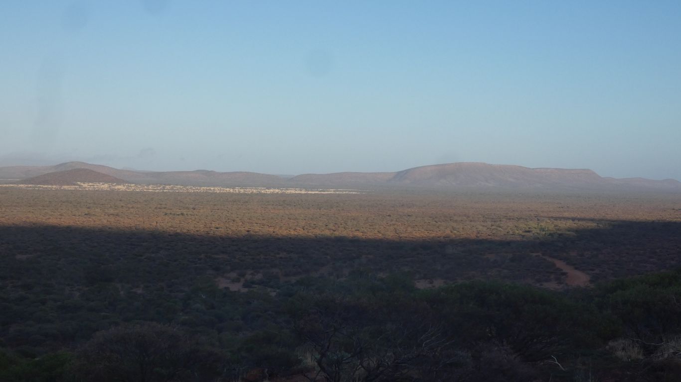
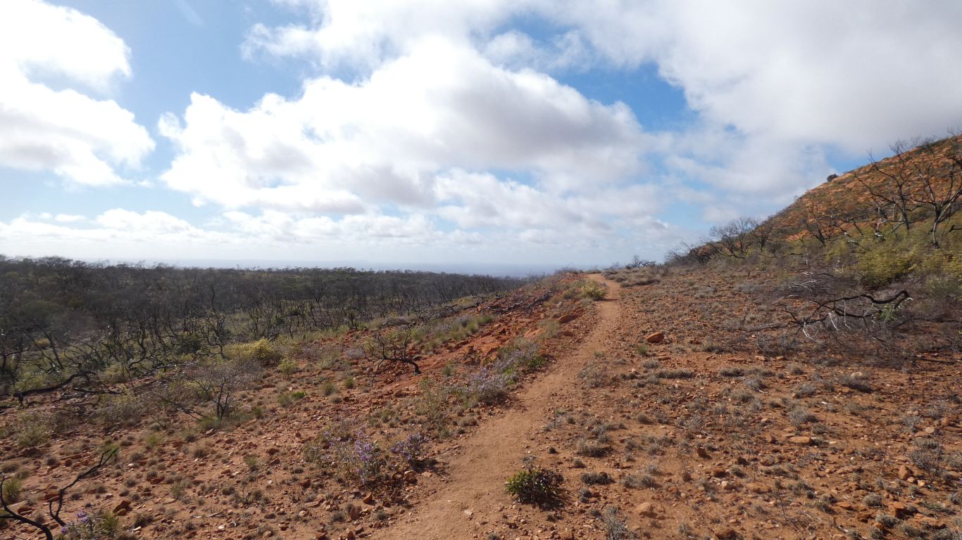
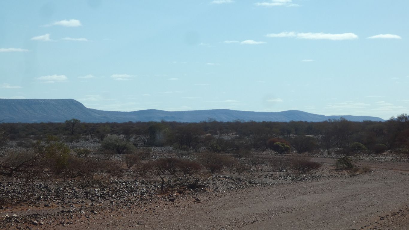
But we notice there are more rivers or creeks to cross, they have gum trees, and would be a good size if flowing.
Though still far apart.
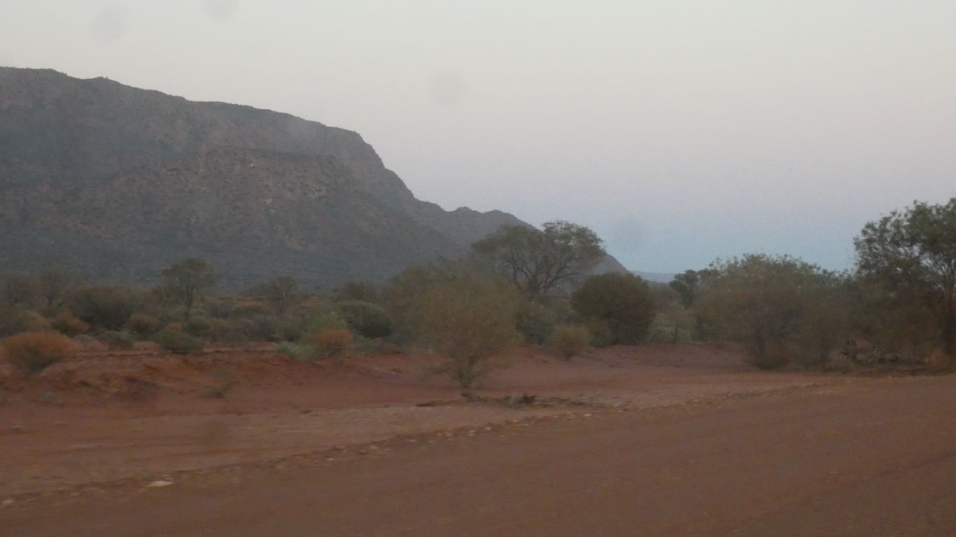
As we near Mt Augustus station, and "tourist park".
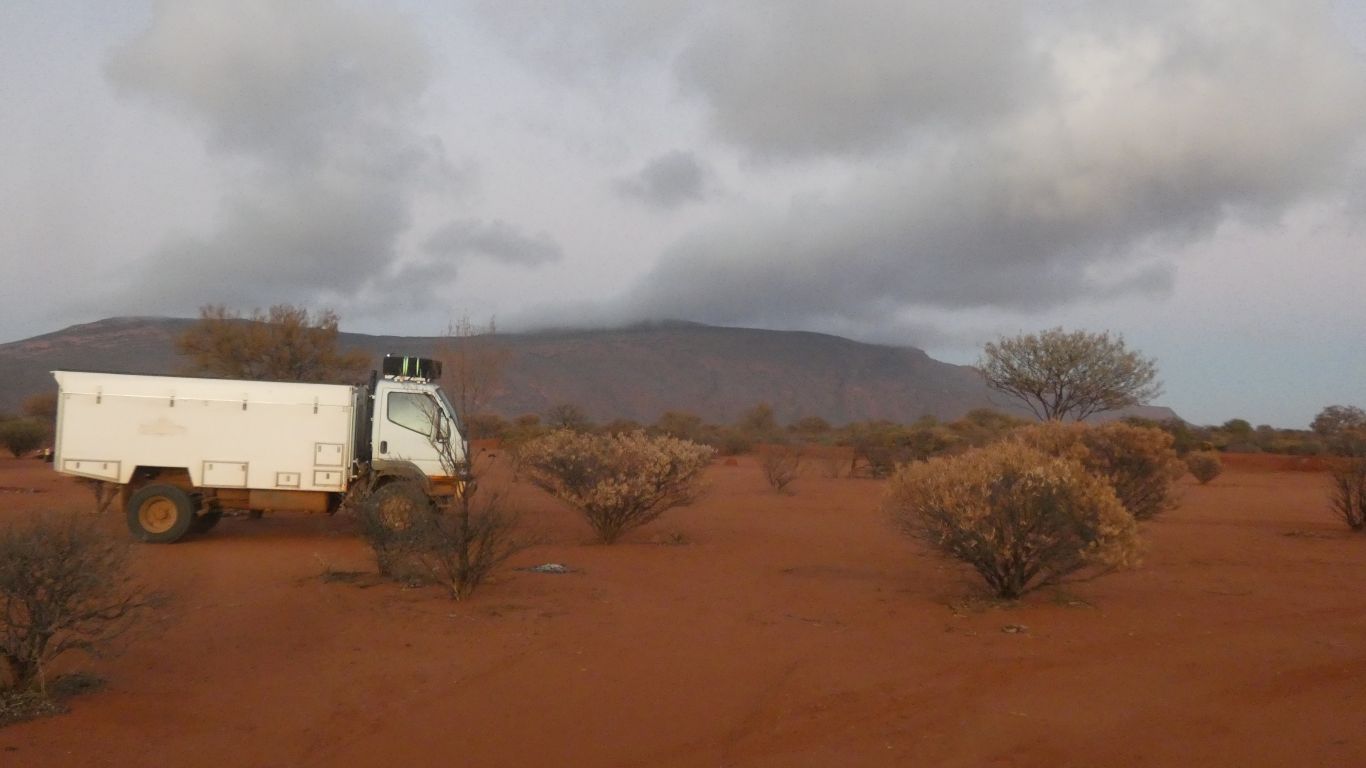
The washing dried in an hour due to the warm howling wind.
We hide inside.
Diesel was $2.60/litre. We'll wait until Gascoyne Junction at $2.15.
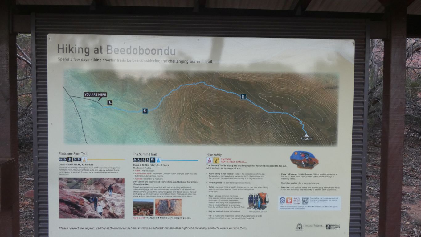
Its called hiking here. I don't know if its different to bush walking!
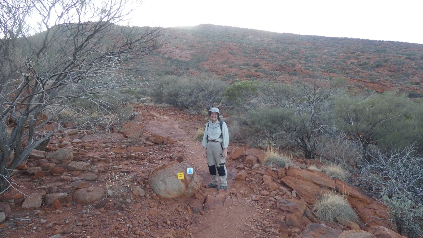
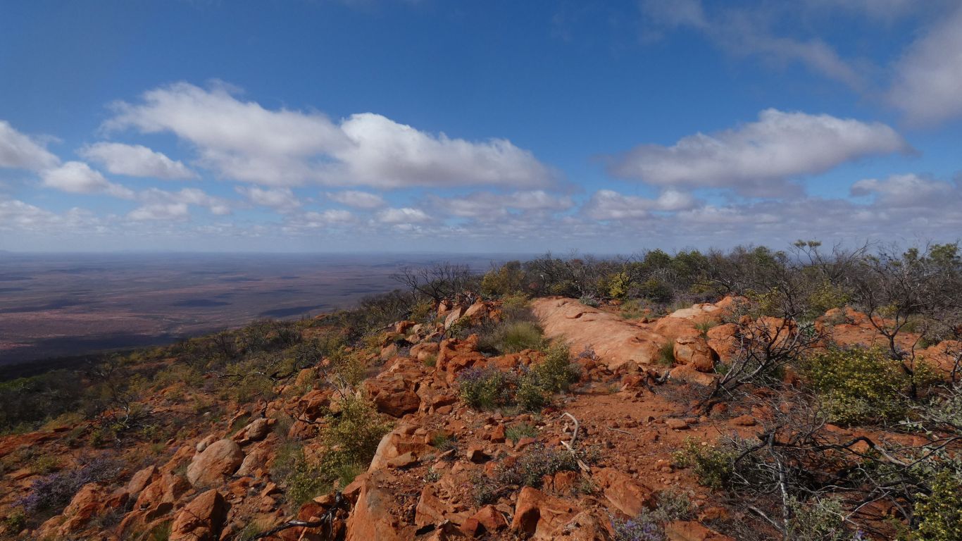
We got out of bed in the dark, at 5:30. Packed and are ready to walk to the summit.
Its elongated NW-SE.
Same as lots of other features in the larger area.
Though strangely, when we arrived yesterday the weather forecast outside the store didn't include today.
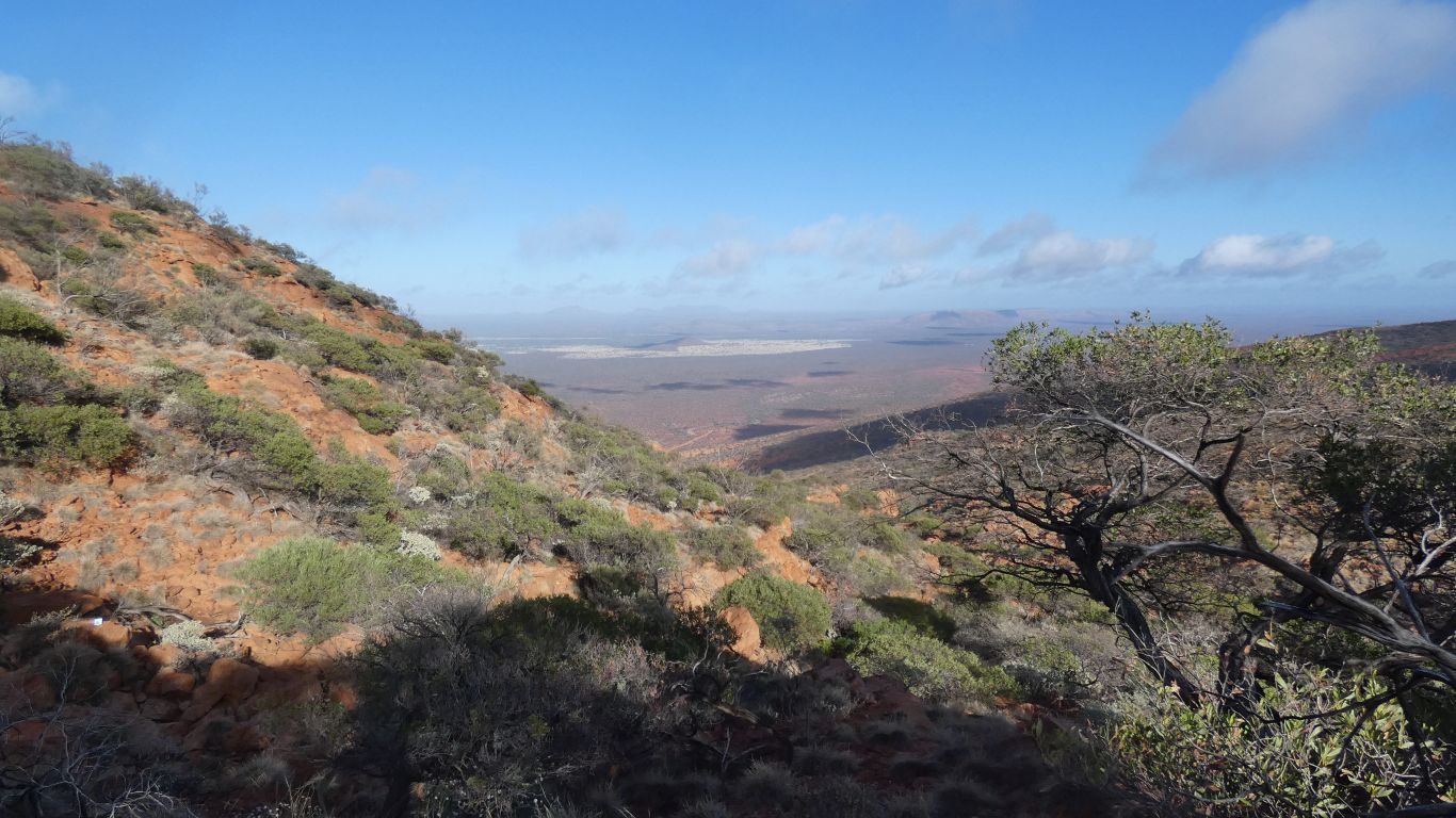
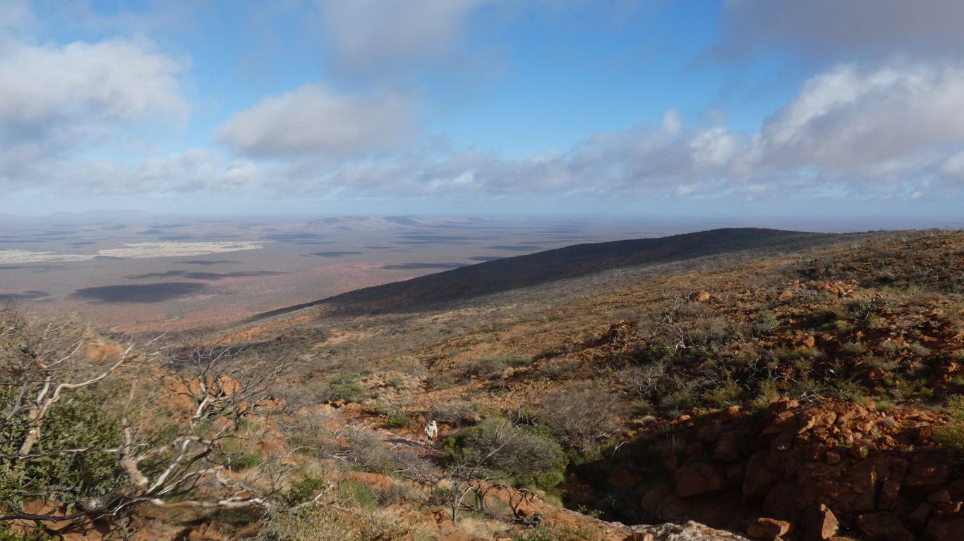
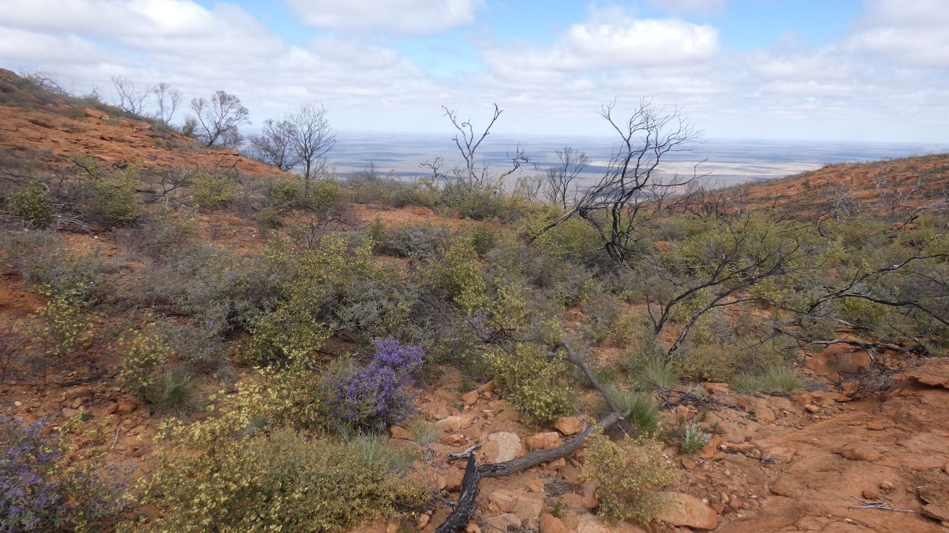
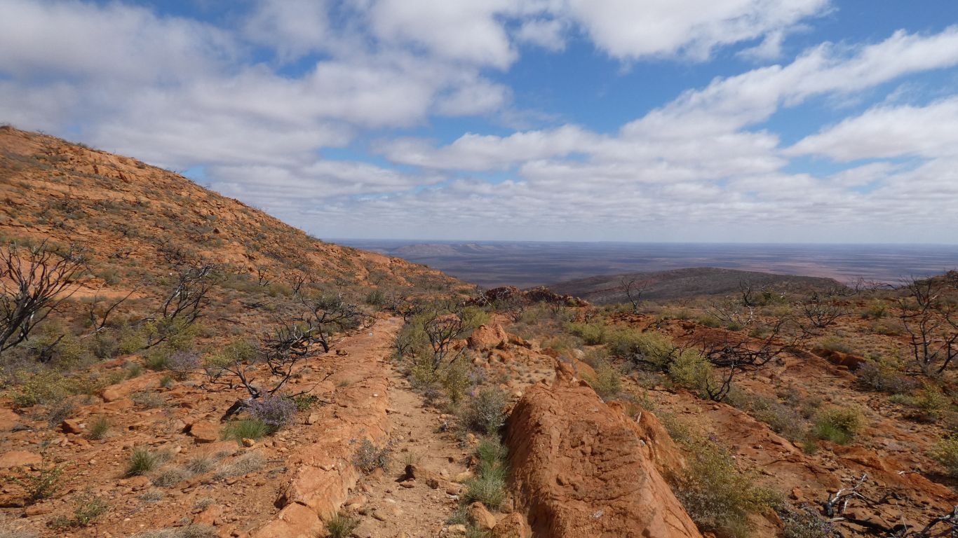
We are in shadow for most of the long steep climb to the ridge.
We know about inselbergs as we climbed up one, Stac Pollaidh, in Scotland.
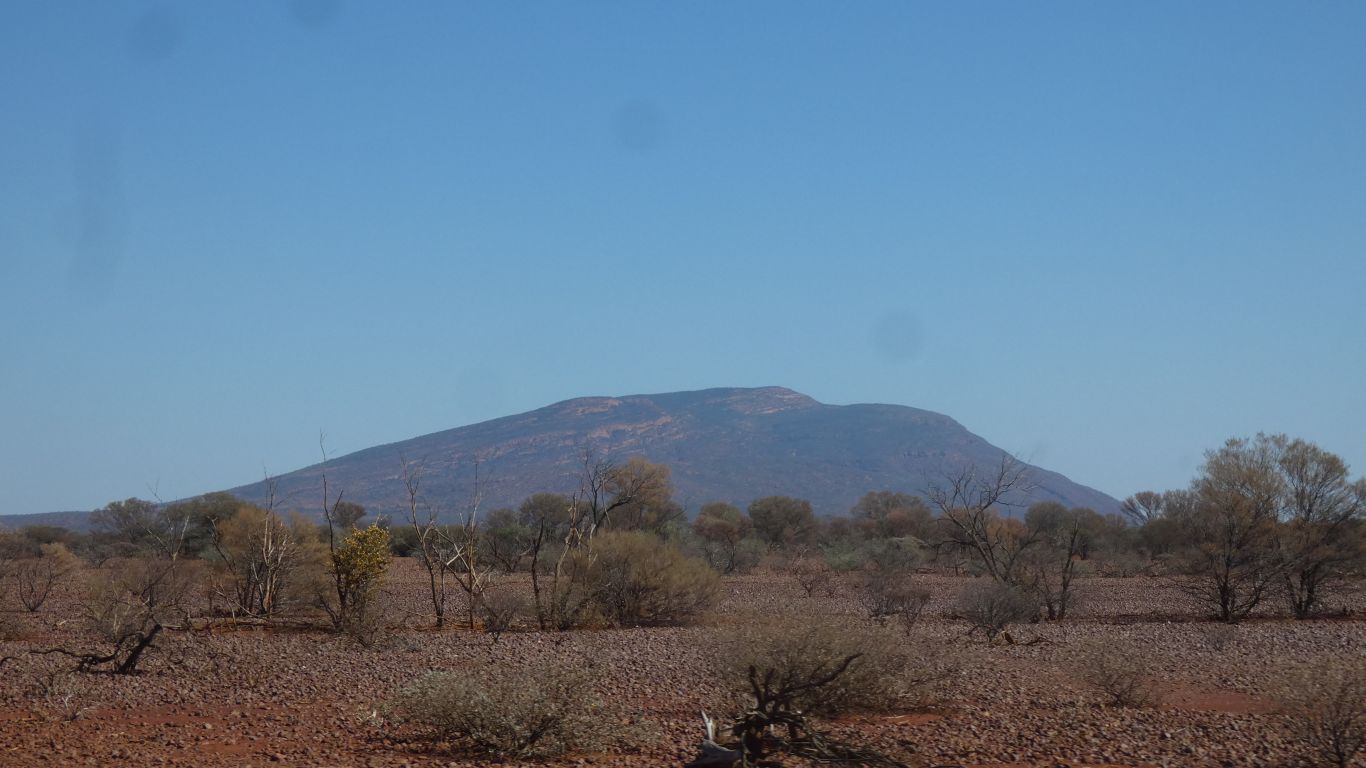
That was 610m, only just a mountain. Mt Augustus is 720m above the plain.
Inselbergs are simply isolated mountains. I guess no obvious rivers flowing through them.
How things change. And don't I wish people would add dates when such things are written.
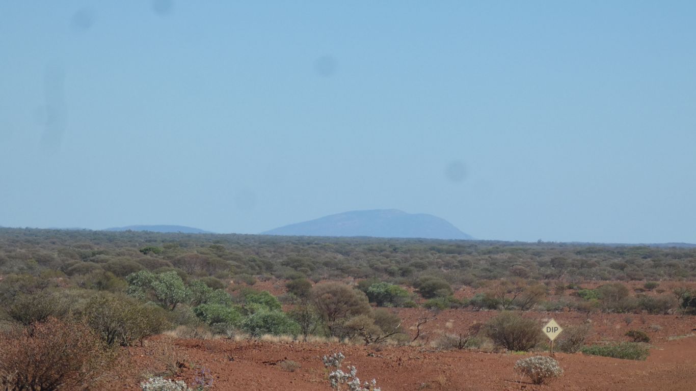
Not sure if we like the "milestones" every km.
We saw reference somewhere to a stash of water somewhere. Even a pic. For information, we didn't see one.
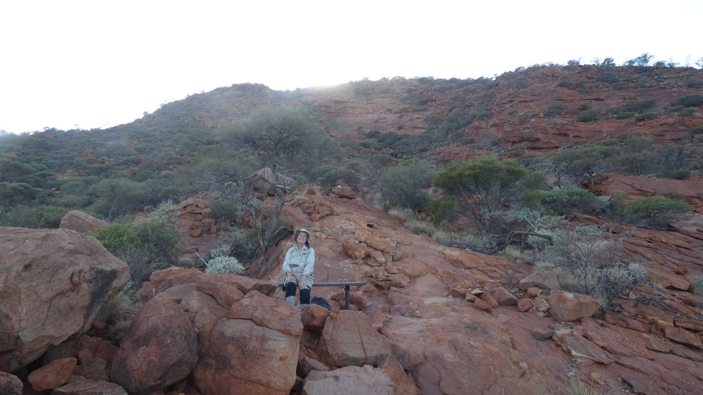
We sat on this same bench on the way down .... but we are getting ahead of ourselves.
Not quite a race against the sun, there is a cool breeze blowing.
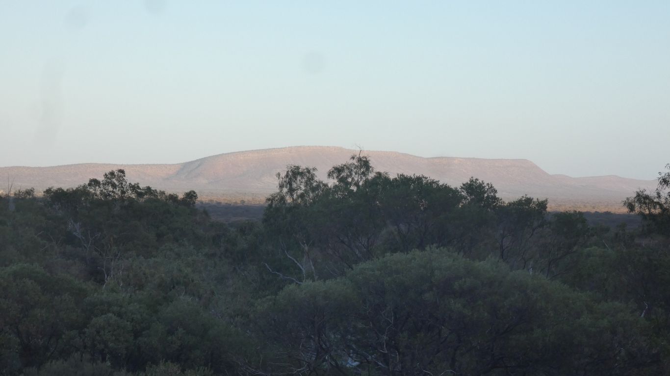
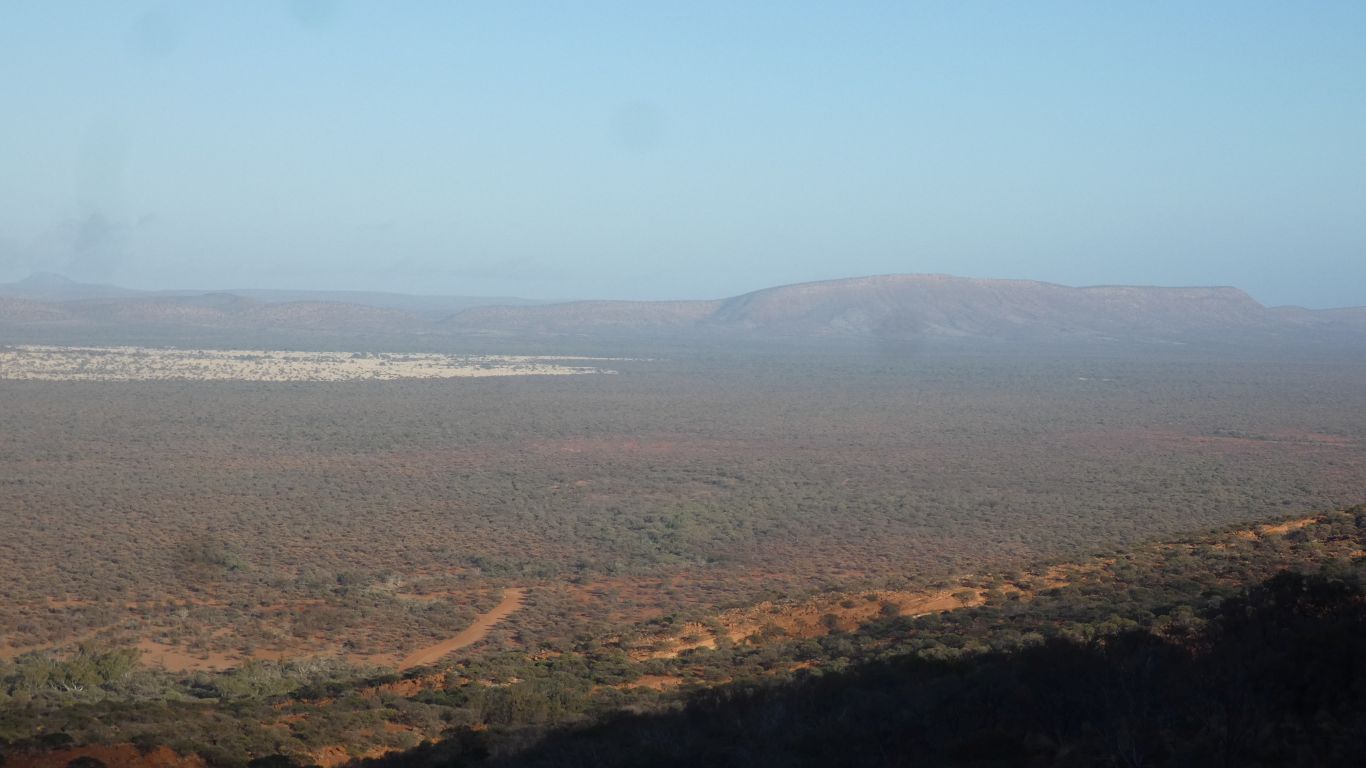
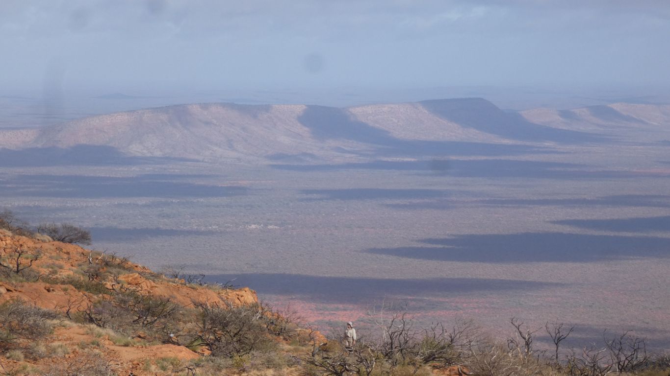
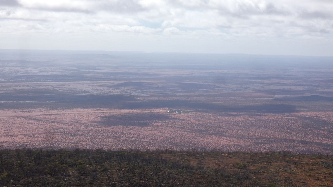
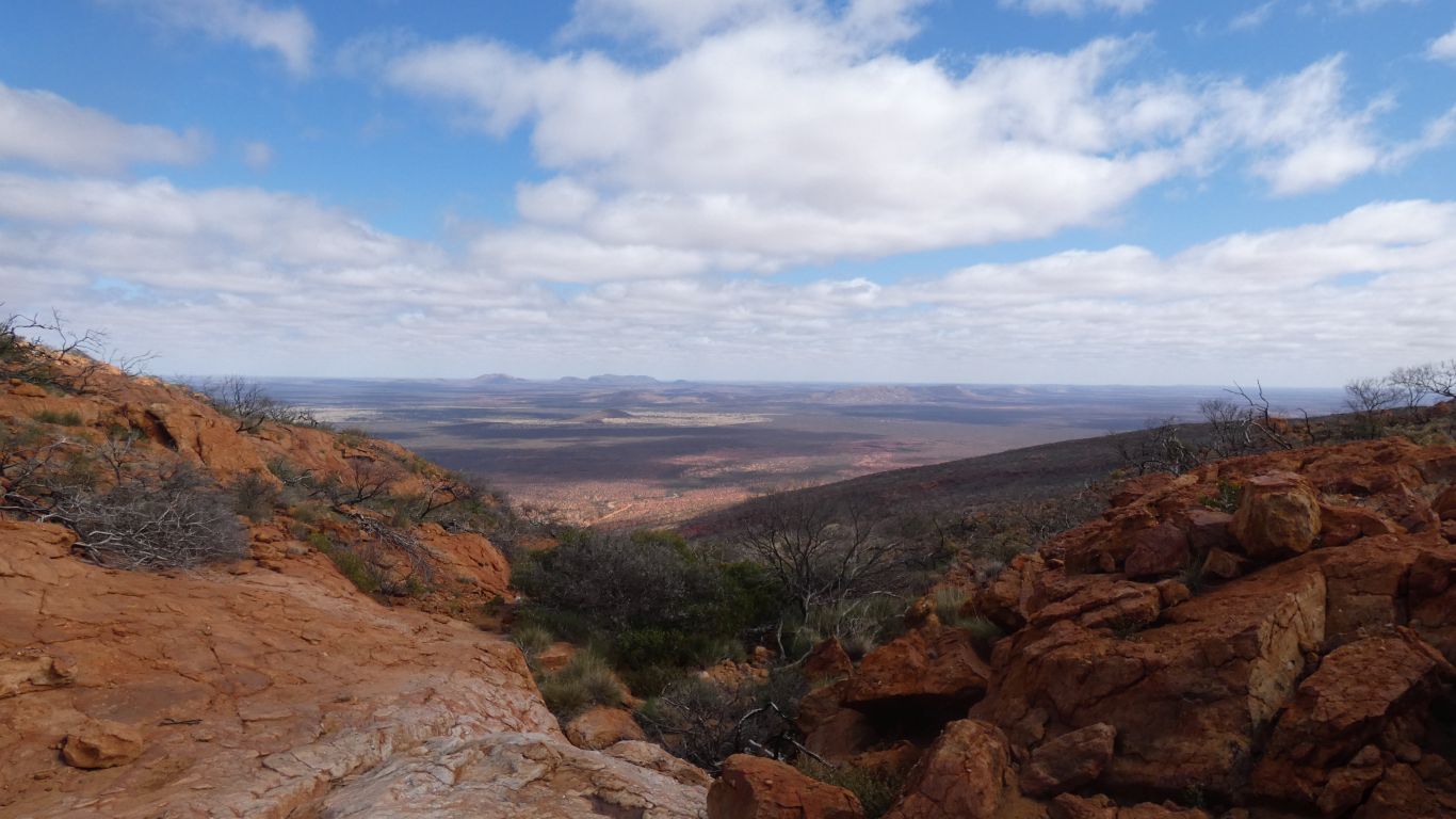
The mountain in the distance is 626m above sea level, the plain about 380m. Mt Augustus 1105m above sea level, 720m above the plain.
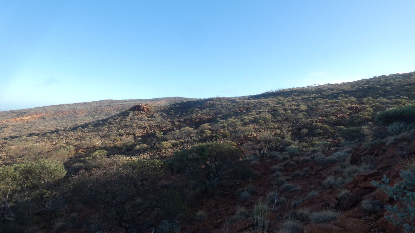
We see hints of a saddle. Slowly make our way up.
Its about now we feel our ages.
So obvious, they are shouting for our attention.
Impossible to ignore. Though we have no desire to do so. We are slowly drawn in.
One of many aspects of this mountain to enjoy.
Both are inselbergs.
They seem to come as clusters, or at least more than one.
There is a vehicle track between Mt Samuel and Mt Phillips, I guess an old station track, ex Mt Phillips station before it was national park.
I don't know about walking up either. Delta Lithium have their Yinnethara project at the base of Mt Samuel.
Ali somewhere in the middle.
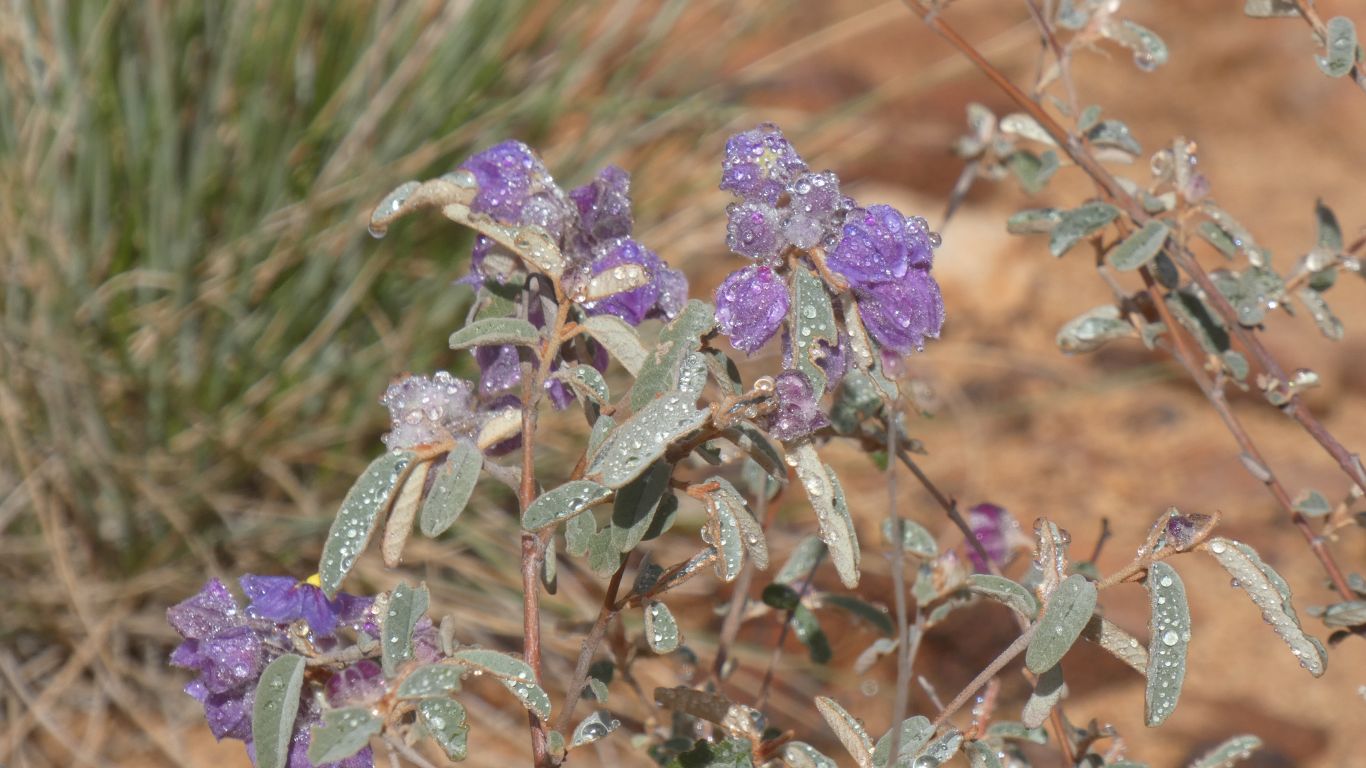
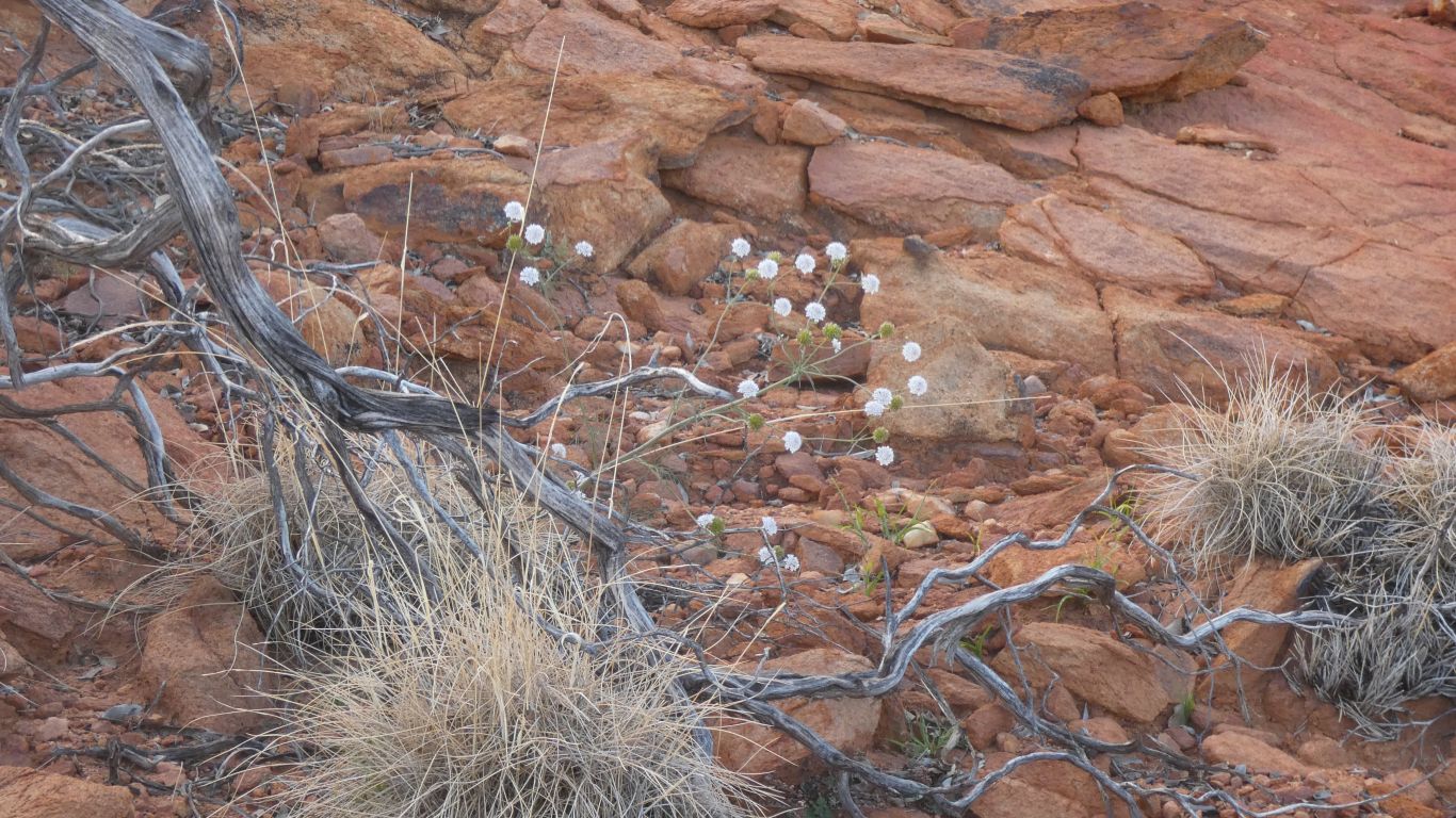
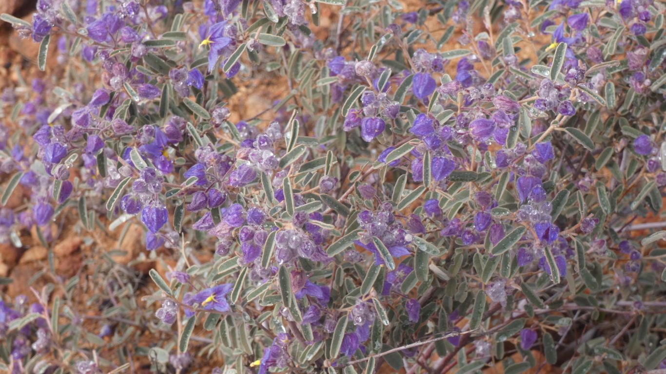
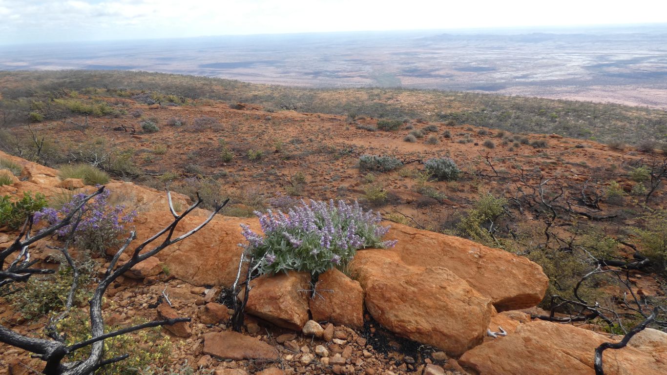
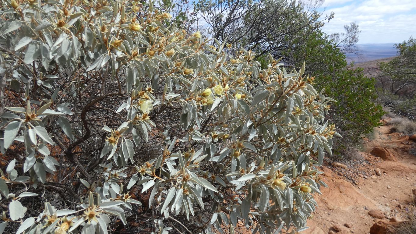
The heavy dew remains on the plant life.
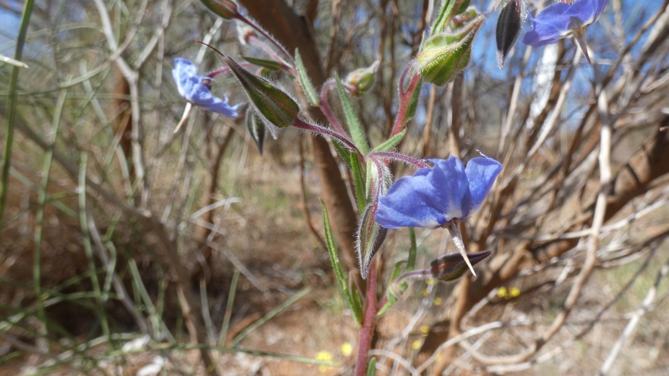
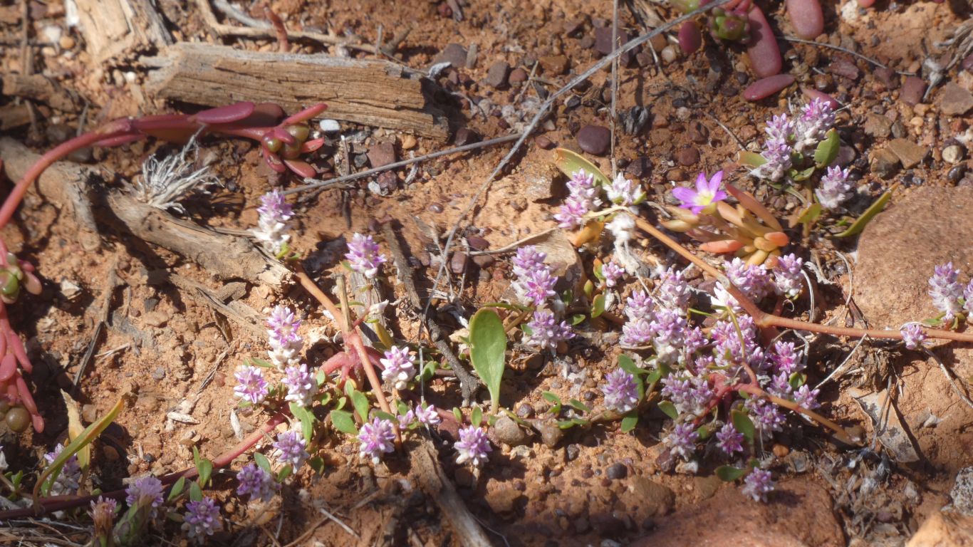
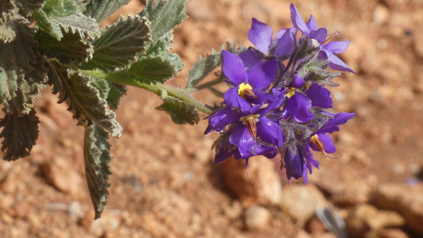
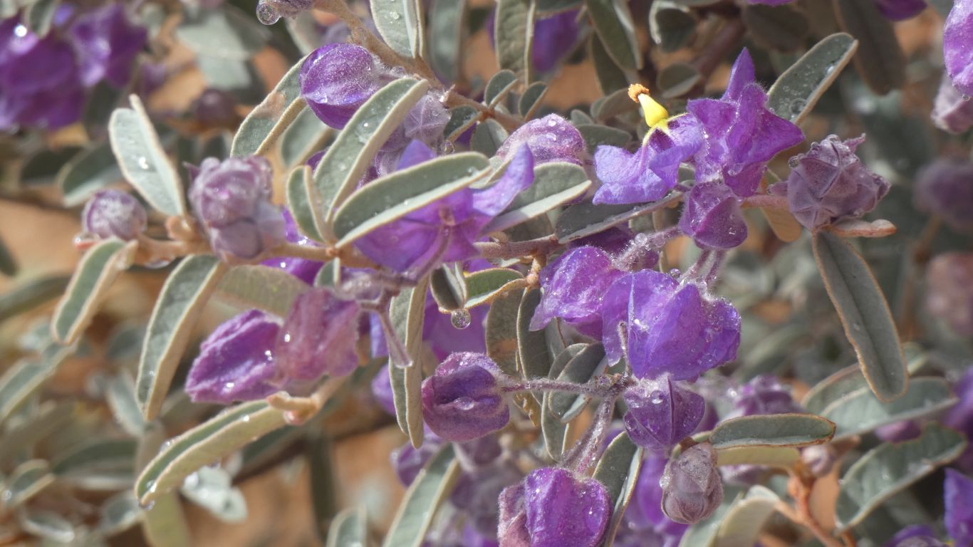
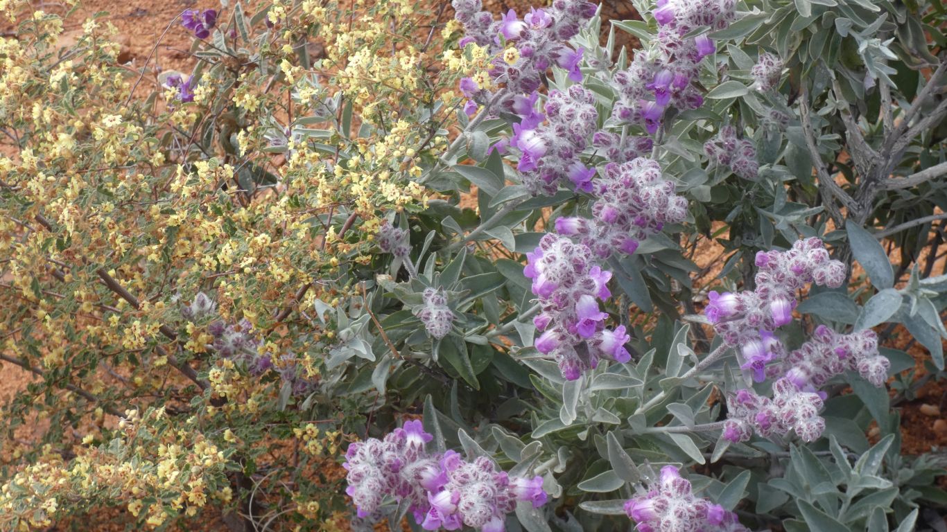
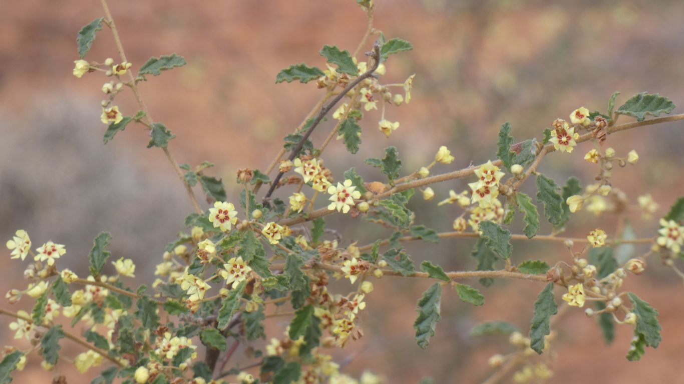
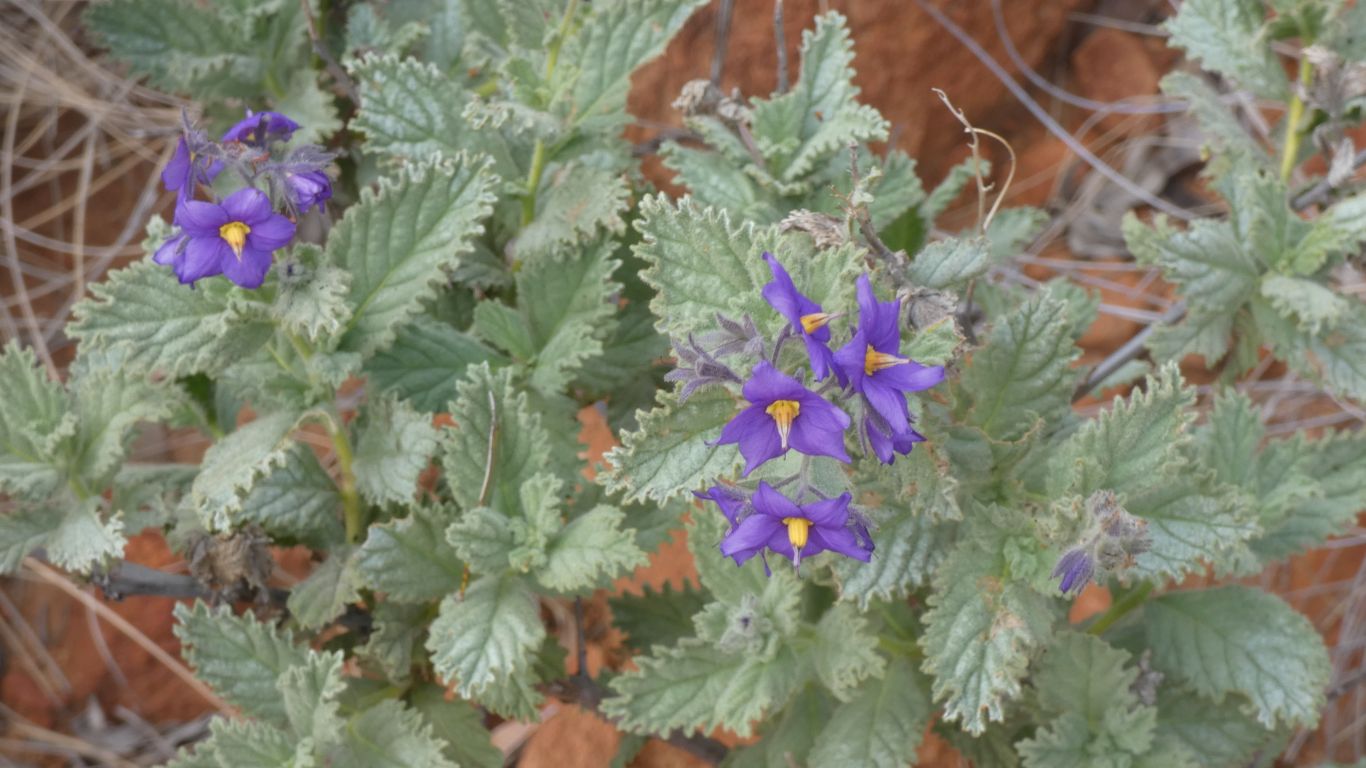
We begin to notice that all purple flowers with yellow centres are not the same.
With a note to the spell checker .... centre is my correct spelling ..... so there!
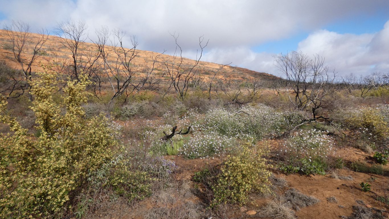
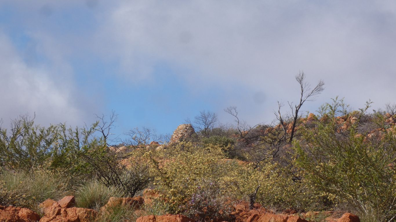
The mulga has been burned.
We also notice the lack of red flowers. That's if its possible to see an absence ...
I expected to be walking along a ridge. Instead we are in a broad gully leading to the top.
A slow mental dawning .....
We are not botanists, and not particularly observant. It takes us time to appreciate and digest our surroundings. And we are becoming tired as we near the summit.
The leaves look familiar.
I suspect if I ever cease being curious I will also cease lots of other activities.
I guess because he could.
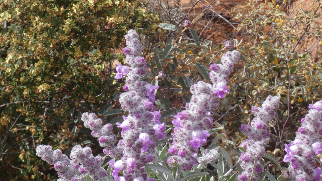
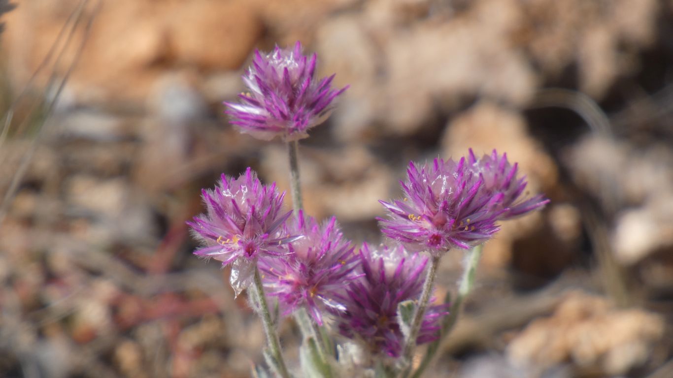
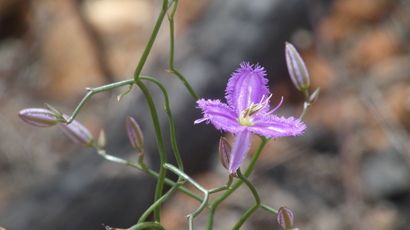
Ali had read the signs, and looked at our wildflower book. I hadn't, so my mind laboriously stepped through "that looks a bit different", is it spider webs holding the moisture, why are the flowers closed, to "its a different purple flower".
There are other foxgloves in WA. The ones pictured in the book, from further south, are red.
It seems we are on an interesting voyage of discovery.
About 3 hours from car park to summit. Half the 6 hours suggested we allow. We expect down to be slower. Its difficult to describe how slow walking over rocks can be. And how wearing of muscles and joints.
We have Telstra mobile signal at the top. Apparently there is also Optus. We make a couple of phone calls.
We eat a muesli bar each. Enjoying the surroundings.
Really quite different to our usual mountain experience. Almost alien.
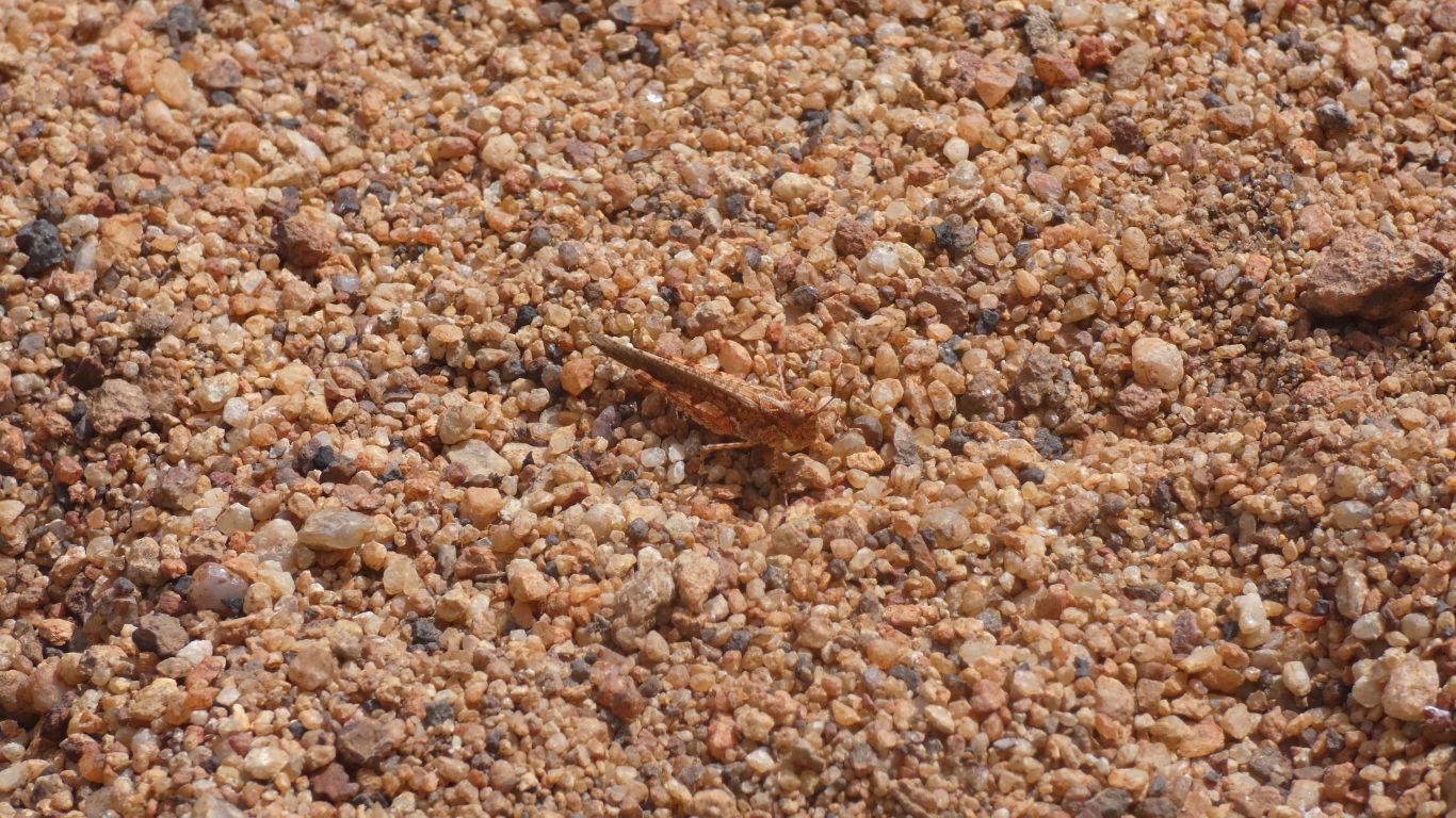
We see kangaroo/wallaby droppings but the animals are hiding. As they usually do.
But we aren't about to undertake a detailed analysis for which we are poorly equipped.

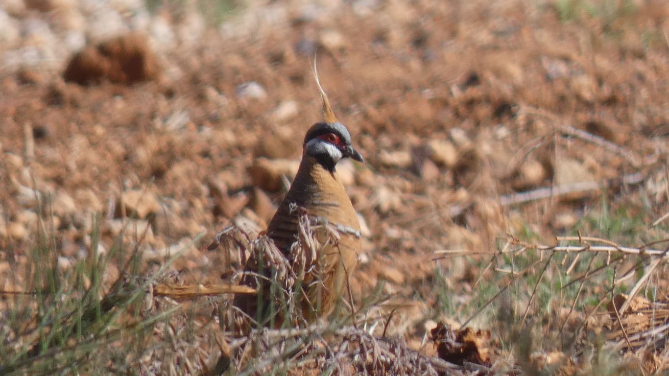
A grey headed honey eater posed for us.
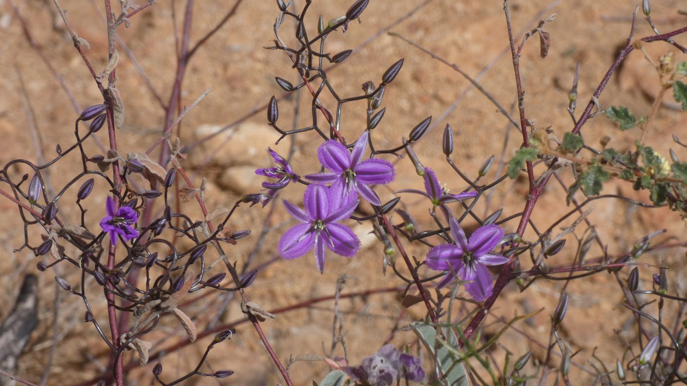
Perhaps a type of fringe lily. Though our pic in the book is from much further south.
They will remain an unresolved puzzle.
As we begin the descent our aches and pains are magnified. We become slower, more careful. The steps a little high for our sore knees and aching muscles.
Surprisingly our feet are still in good condition.
Some are early, others late, in the season.
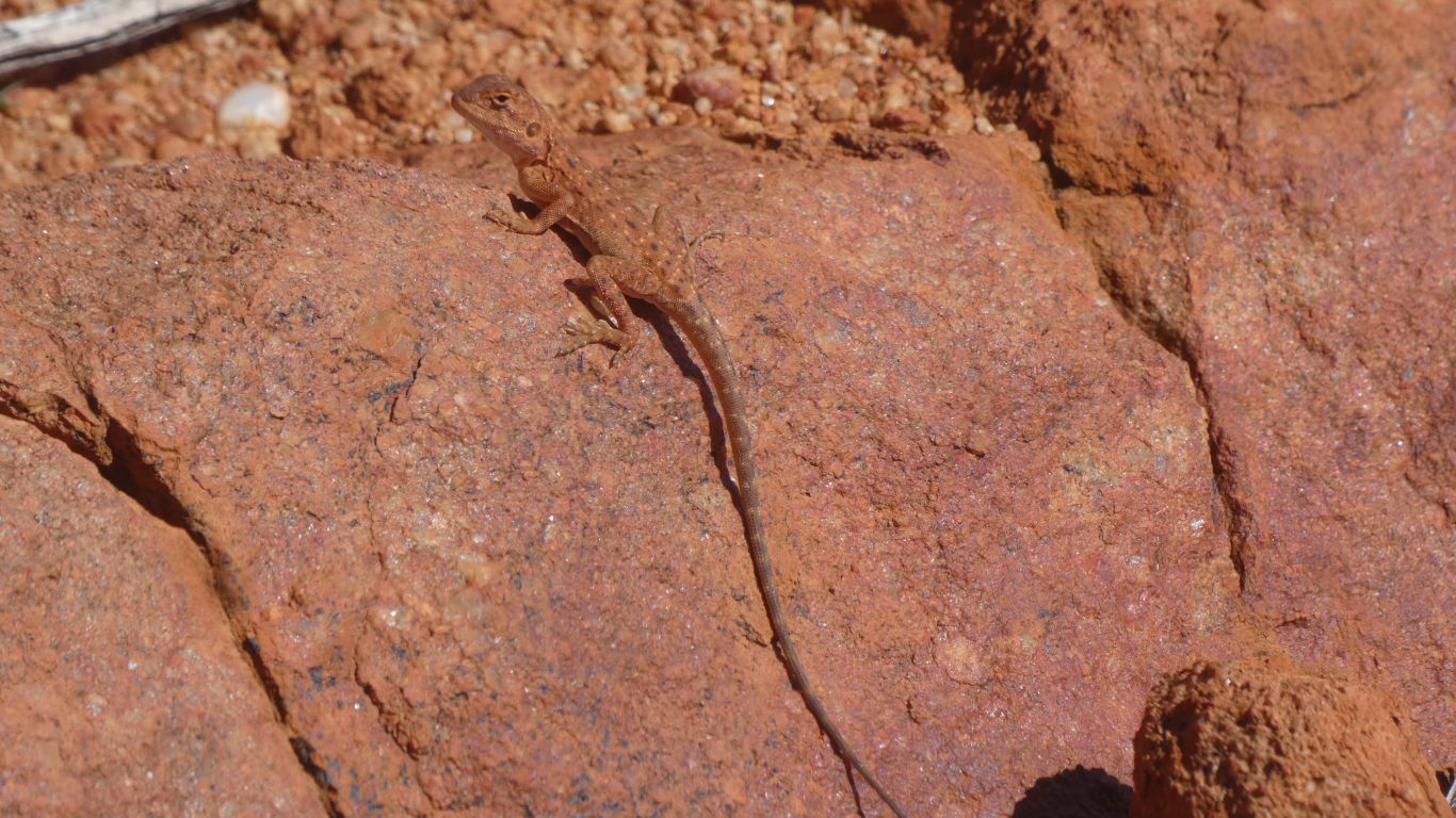
Just like the one that watched me near The Granite on the Canning Stock Route.
Was it really only a few days ago. We seem to be more aware of the passage of time as we age.
Not just slow. Painfully slow.
We wondered if we had almost bitten off more than we could chew. But chew it we obviously did. We should probably pay some future defference to our ages.
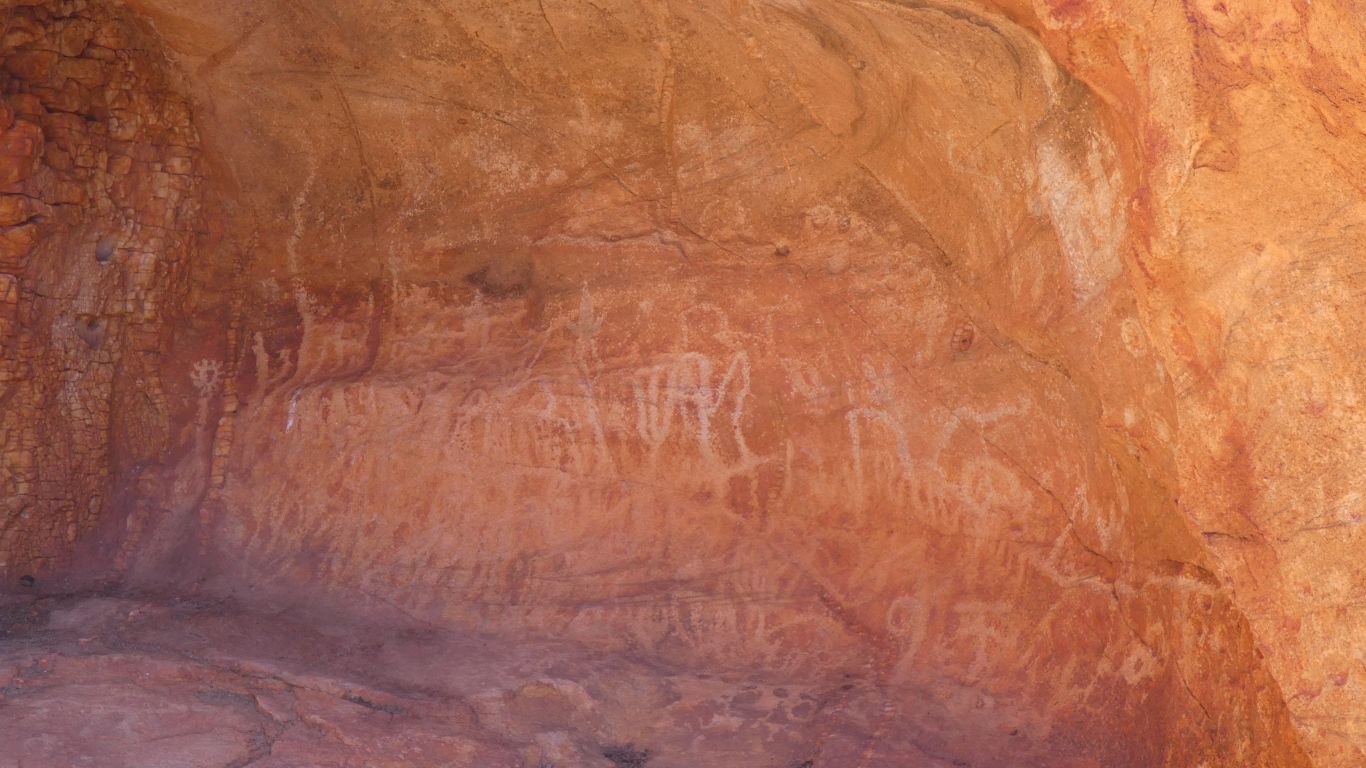
We drove further anti clockwise round the mountain to Mundee, the petroglyph trail. We thought we could manage another 100m of walking. Totally uninterpretable (to us) petroglyphs in two small caves near a water course.
If we had chosen to look we would have seen the granite base exposed in the Pound, at the northern end of the mountain.
There are comparisons with Uluru which I discount as "marketing". For me its like trying to compare chalk with cheese, or apples with oranges. Whichever euphemism for nonsense one chooses. The only similarity I can discern is that they are both inselbergs. Whether they are monoliths depends on one's choice of definition for monolith. Geologically neither are monolithic.
Suffice to say, for me, both are imposing. After that they are different. Marketing is writ with a purpose, the imaginings twisted towards that purpose. In this case it serves the purpose of someone somewhere to attract visitors to WA. I think that as I grow older I am more able to ignore and discount it.
Happy with my view of the world. No need for comparisons, or hyperbole (such as world's biggest or ...... insert whichever word you want). Enjoy the moment, it is what it is, and wherever I am is best.
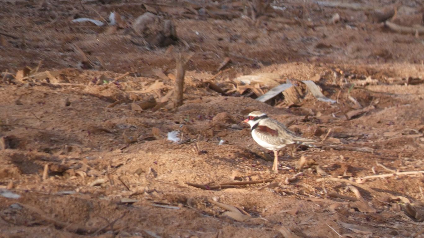
A black fronted dotterel. And a flock of corellas. The landscape slowly, almost imperceptibly, changing as we drive west towards the coast.
We are now adept at setting up the starlink antenna. Pointing a bit counterintuitively south. Not only communication wherever we are, but look at a satellite view of our surroundings, search for information, and as was important for our assault on Mt Augustus check the weather.
We chose well ..... ! We planned our arrival at Mt Augustus to give us good hiking weather.