They are formed as water exploits criss-crossing vertical fault lines to erode them, leaving islands of rock.
Specifically, the water dissolves the rock
The name is from the Kras region of Slovenia. Limestone country. Karst made its way first into German, then into English. The term is usually associated with limestone. Like many aspects of geology its more a description of a process than a definition of a result. Though the emphasis changes depending on who wrote what. I guess I don't care what its called (I have no reputation to lose) so I'm happy with a common process producing a variety of similar outcomes.
In limestone the erosion extends to caves, which don't form so readily in sandstone.
Quite different to how sediment laden rivers abrade gorges and form waterfalls, or how ice and glaciers grind away rock to form "U" shaped valleys and pyramid like mountains. Quite different to how granite forms tors (let's save that for another day...). Just one of many ways erosion occurs. And one that produces such varied results.
Just as not all karst is limestone, so, not all limestone is karst. In my mind, karst is about erosion not how the rock being eroded was formed.
My first recollection of what I now know is karst is in the limestone pavement areas of the Yorkshire Dales, part of the Pennines, in the UK. The rest, as they say, is history.
Below are the interesting (to us) karst areas we have visited in the last many years.
The pics are in chronological sequence. A sort of voyage of discovery we didn't know we were on. A voyage with no end. Forever curious.
The later images can be clicked on to enlarge. Clicking on the dates links to the blog page that contained the image.
The common thread is simply water dissolving rock.
What happens after that depends on the grain size within the rock and the matrix which binds the grains together. Modified during formation by temperature, pressure and perhaps some metamorphosis.
And we all know that finer grains are carried further by water and wind before being deposited than coarser grains and even rocks.
To confuse, even my favourite Dales were once covered by ice, which left behind erratics. Rocks which don't belong. Carried by rivers of ice.
Add how much distortion, how much the rock has been pushed up, has occurred to form the vertical faults, the joins, that the water exploits.
Then there is age. Erosion is a slow process. A longer time since the sedimentary rock was first exposed the greater the erosion. Helped by temperature, warmer water dissolves more.
How much water falls as rain is obviously key. Climate has changed many times during geological time. What was once wet, with rapid erosion, may be dry now.
Too much erosion, for too long a time, and the mountains disappear. The low hills of the Petermann Ranges have been estimated to be once higher than the Himalayas.
And of course the rock chemistry. Not just whether its limestone or sandstone, but the impurities within.
For example, iron oxide, and perhaps manganese oxide plus other minerals, are dissolved with silica and precipitated out in lower layers of sandstone. The result is lighter sandstone in upper layers and more coloured, reds and yellows, in lower layers. Though we are unsure of what mineral causes the yellow.
Perhaps also, the examples below all seem to have bedding planes, the layers in which the sediment is deposited, which are near horizontal. A minimum of tilting. A minimum of cross bedding (planes meeting at different angles).
It all adds up to a variety of "Goldilocks" conditions. Though even that creates a vast variety of results. We have, as always, only scratched the surface.
Apologies. A dome can be either the very large area that has been pushed upwards and cracked that is then eroded, or a small dome left between the cracks. Hopefully the context is clear.
Apart from calling them organ pipes - I've never seen them called that anywhere else, and think of organ pipes as the hexagonal basalt formations.
And drawing it as a square rather than a circle which would give rise (sic!) to a large dome when the centre is pushed up.
But what's in a name, and its a nice description.
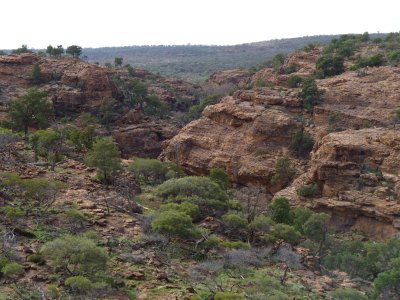
But on reflection the criss-cross of gorges fits the bill for karst.
Our excuse is we were figuring out how the truck worked. An early, shakedown if one must, trip. A bit distracted perhaps.
But remove the excuse and we were more inclined to "that's pretty", or "that's spectacular", or "that's exciting", or "that's challenging", rather than a slightly (only ever so slightly) deeper analysis.
| Mutawintji |
| Australia |
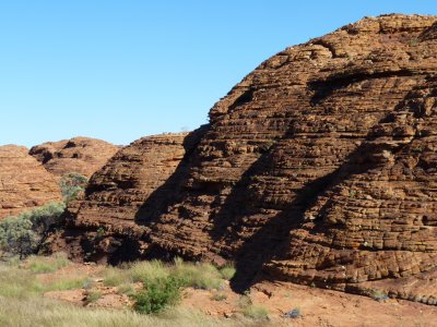
But around the edges, above the canyon, are sandstone domes.
| Kings Canyon |
| Australia |
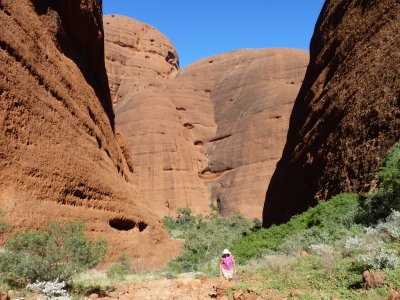
Presumably few faults, very little uplift and distortion.
| Katajuta (Olgas) |
| Australia |
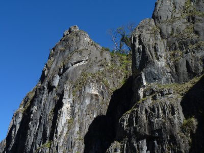
There are several areas of limestone near Mt. Koziuscko.
| Clark Gorge, Koziuscko National Park |
| Australia |
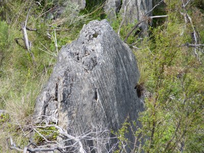
Small domes of fine grained limestone.
I suspect the finer the grain the more dome and pillar like the erosion. Certainly the more grooves in the vertical faces.
| Jersey Cave, Koziuscko National Park |
| Australia |

We met karst country almost as soon as we entered Thailand.
From a long ago trip I recall visiting "James Bond Island", though this isn't it.
| Ao Nang and Krabi, Phangna Bay |
| Thailand |
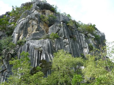
There were caves nearby.
| Khao Dang, Khao Sam Roy Yat National Park |
| Thailand |
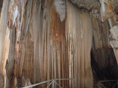
With a string of calcite cascades.
| Erawan National Park |
| Thailand |
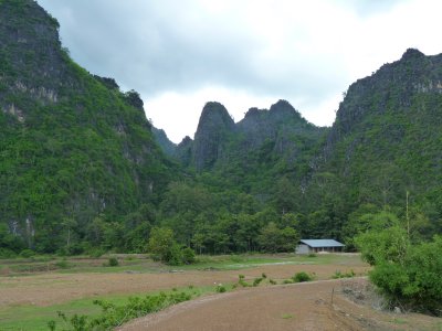
One day we'll visit the tourist drawcard of Halong Bay in Vietnam.
| Road to Vietnam |
| Laos |
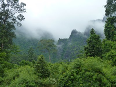
The surrounding hills covered in dense vegetation and shrouded in mist.
| Kong Lor Cave |
| Laos |
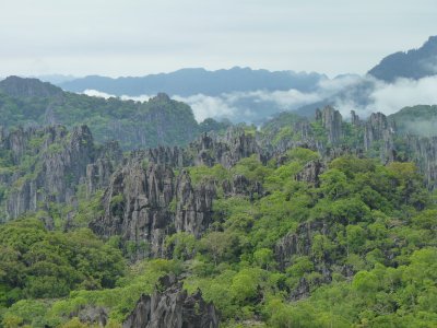
| Phou Pha Mane, near Laksao |
| Laos |
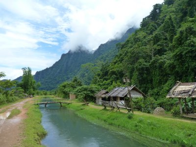
And walking.
The canal funnelled water from a cave we swam into. The beautiful deep green of water that's flowed over and through limestone.
| Village of Hmong, near Van Vieng |
| Laos |
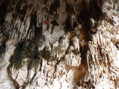
Birds nest soup.
| Swallow Cave |
| Yunnan, China |
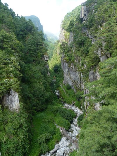
I wonder if he admired the geology?
| Cagshun Grand Canyon |
| Dali, China |
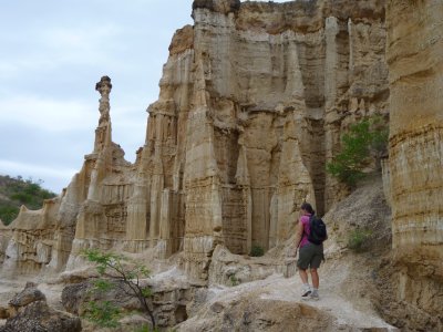
The hard cap protects the softer rock underneath, until finally the cap is eroded.
In Australia we seem to have harder silcrete caps and softer underlying rock, with drier current climate, which results in jump ups.
| Wumao Earth Forest |
| Yunnan, China |
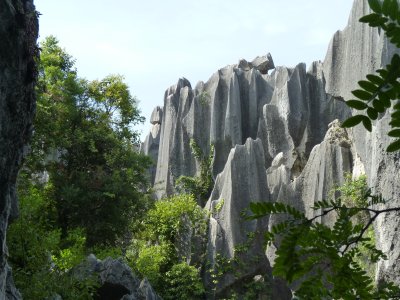
We walked through, between, the formations, in deep gorges.
A fun day.
Very fine limestone.
| Shilin (Stone Forest) |
| Yunnan, China |
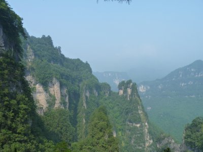
Granite, if I recall correctly. It erodes very differently.
| Guang Wu Shan |
| Sichuan, China |
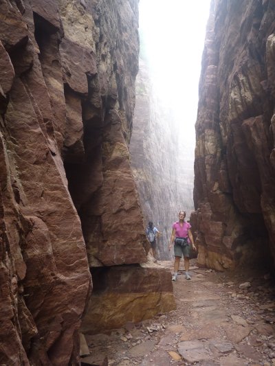
Gorges more than pillars and domes.
We didn't look close enough. Perhaps overwhelmed by the scale.
| Jin Shan |
| Hebei, China |
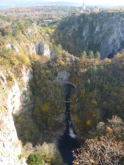
Weather and road closures prevented us visiting the Julian Alps.
| Skocjanske Cave |
| Skocjan, Slovenia |
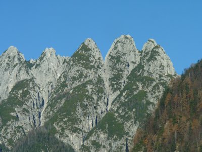
Some elements of karst. But also elements of ice.
Perhaps a sort of hybrid.
| Near Cortina |
| Italy |
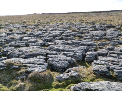
A part of the world I revisit when possible.
There are clynts (the cracks) and grykes (the sticky up bits).
| Ribblesdale, Yorkshire Dales |
| England |
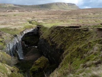
| Ribblesdale, Yorkshire Dales |
| England |
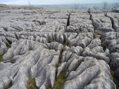
Another favourite place. One to take our children to. We camped there in 1997.
| Malham, Yorkshire Dales |
| England |
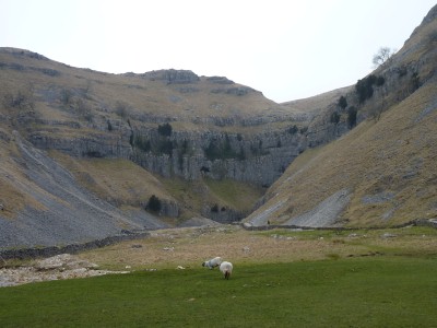
Goredale Scar.
A walk long remembered from early 1970's.
Including through the waterfall at the far end.
Up through Goredale, over a bit of moor to a dry, sunken, river bed, then down into Malham Cove. Where the water that would have been in the dry river flowed out of the bottom of the cove cliff.
| Malham, Yorkshire Dales |
| England |
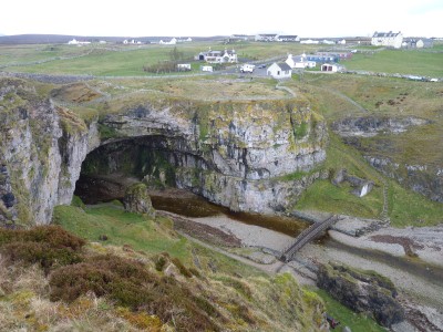
Lots of geology in Scotland. Just not karst.
| Smoo Cave, Durness |
| Scotland |
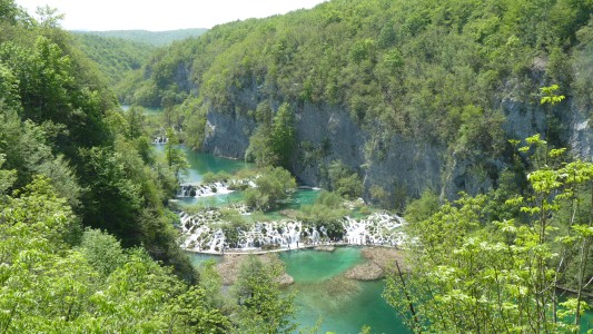
Tufa, calcite, call it what you like, it deposits as water evaporates, forming cascades.
The water retains its green colour from dissolved calcium carbonate.
| Plitvicka National Park |
| Croatia |
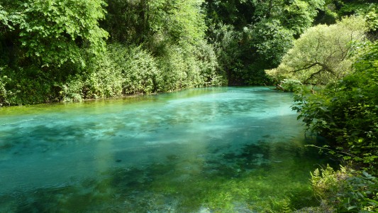
This is the outflow. The spring was an about 30m diameter sinkhole full of water.
Seemingly bottomless, the colour changed from the green of this pic near the edges to a transparent deep blue at the centre.
Lots of limestone in Albania. The bits we saw were shaped by ice.
| Blue Eye Spring, south of Gjirokastra |
| Albania |
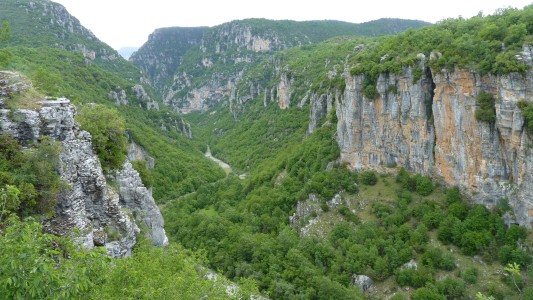
The river entering the gorge is muddy. In the middle is a spring of clear water that overwhelms the mud.
A long, steep, walk down.
| Vikos Gorge, Pindus Mountains |
| Greece |
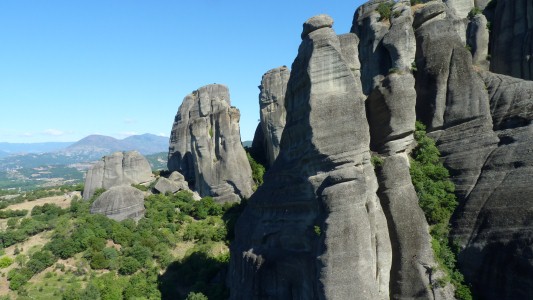
It was here I realised the interesting formations are often at the edge of plateaus. I recall thinking "limestone that looks like sandstone formations".
Tall and deep closest to the edge of the plateau, shorter further away. Slightly tilted.
A bit like many waterfalls working their way back through rock.
| Meteora |
| Greece |
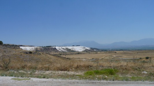
A bit of human intervention to allow tourist promotions. Roman ruins behind.
Only with limestone. Calcium carbonate dissolves in water and is later deposited as the water evaporates.
Silica from sandstone also dissolves, part of the similar erosion process, but doesn't precipitate in the same way.
| Pammukale |
| Turkey |

| Lake Acigol |
| Turkey |
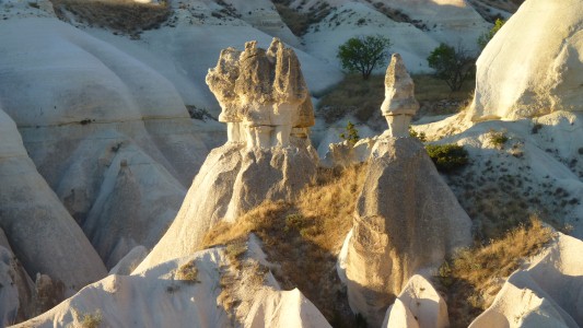
| Cappadocia |
| Turkey |
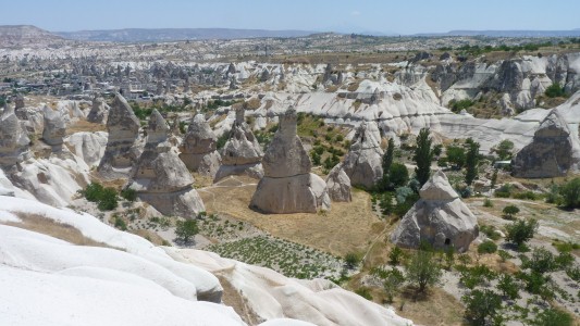
Soft sandstone. Soft enough for troglodites.
Forget the geology, it was fun exploring churches and abodes. Including underground towns that went down 7 storeys.
| Cappadocia |
| Turkey |
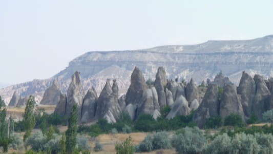
We missed the balloon ride by a gnat's whisker.
| Cappadocia |
| Turkey |
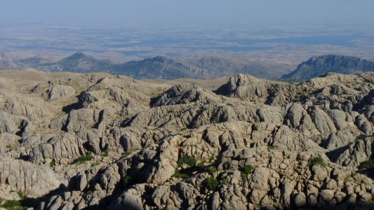
| Nemrut Dhagi |
| Turkey |
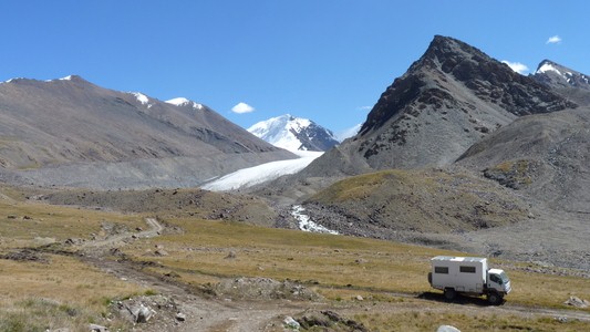
Ice forming "U"-shaped valleys and sharp mountains.
We enjoyed the day walking up the left hand (in the pic) lateral morraine of the glacier, to just past where we can see it in the pic.
One of many lasting memories from our trip.
I imagine the valley full of ice, before the glacier receded.
| South of Barskoon |
| Kyrgizstan |
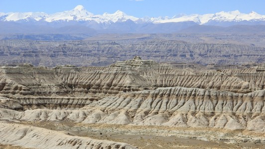
We thought the north side of the Himalayas was foothills, then just flat Tibetan plateau and more mountains.
In parts there's a deep valley. In this area soft and eroded.
We drove into the valley.
| North of Himalayas, near Zhada |
| Tibet |
The pillar is dark at the top and light at the bottom.
In dry times water evaporated at the surface drawing water up from below.
The iron rich minerals have been dissolved, carried upwards, and precipitated as water evaporated, with the resulting red colour towards the top.
| Chambers Pillar |
Australia
Revisit the Olgas.
Just in passing as we head to the north of Western Australia
| Kata Juta (Olgas) |
| Australia |
The very long reef from Geike Gorge, in a big loop northwards round to Kununurra via the ocean.
| Windjana Gorge and Tunnel Creek, Kimberley |
| Australia |
Exposed on the Leopold Downs road.
Walking through this, without a marked track, proved to be a bit of a challenge.
| Oscar Range, Kimberley |
| Australia |
| Geike Gorge, Kimberley |
| Australia |
Looking at the pics now I can be forgiven for thinking "karst".
| Cape Domett |
| Australia |
Such is the large scale we could easily see coarse conglomerate in the north and finer grains in the south. The iconic domes are in the south.
The sand and stones that formed the sandstone were washed there from a mountain range to the north. Part of the endless geological cycle of creation and destruction.
| Purnululu (Bungle Bungles) |
| Australia |
Lots of exercise.
The horizontal bands are the result of minerals, algae, and .... water.
Significant for this story is they are near horizontal.
| Purnululu (Bungle Bungles) |
| Australia |
| Purnululu (Bungle Bungles) |
| Australia |
We camped just to left of pic on a sandbar.
| Purnululu (Bungle Bungles) |
| Australia |
Its a long gorge ....
| Purnululu (Bungle Bungles) |
| Australia |
A very big pavement area.
A very different scale to the limestone of the Pennines.
Easy (I think) to see an early part of the erosion process.
| Purnululu (Bungle Bungles) |
| Australia |
Apparently the largest of the world's karst areas. The Nullarbor.
Who would have thunk?
Most of the features are underground.
In case one asks .... there is a slight decline towards the coast. According to the gps altimeter - not known for accuracy but sufficient to show the change.
| Nullarbor Plain |
| Australia |
In the background is Cambrian (older) limestone. Eroded and redeposited as tertiary (Cenozoic) limestone in caves and sink hole lakes.
Capturing many (gazillions) of fossils in the process.
| Riversleigh, Queensland |
| Australia |
A vast, but difficult to explore land.
Not sure if this is karst. But the pillars suggest it probably is.
| Nourlangie, Kakadu National Park |
| Australia |
| Jarnem, Keep River National Park |
| Australia |
| Goorrandalng, Keep River National Park |
| Australia |
| Western Lost City, Limmen National Park |
| Australia |
| Southern Lost City, Limmen National Park |
| Australia |
| Caranbirini Conservation Park, Borroloola |
| Australia |
An aboriginal cultural area.
| Dill Doll Rock, Hells Gate |
| Australia |